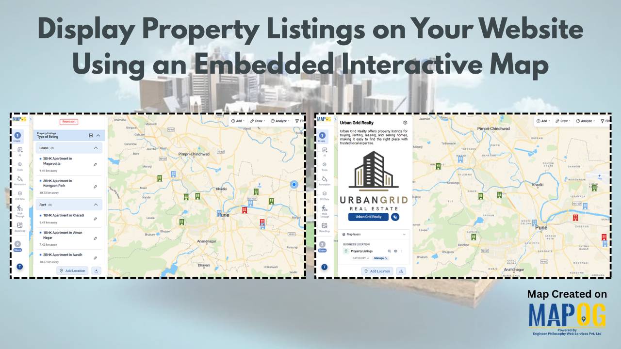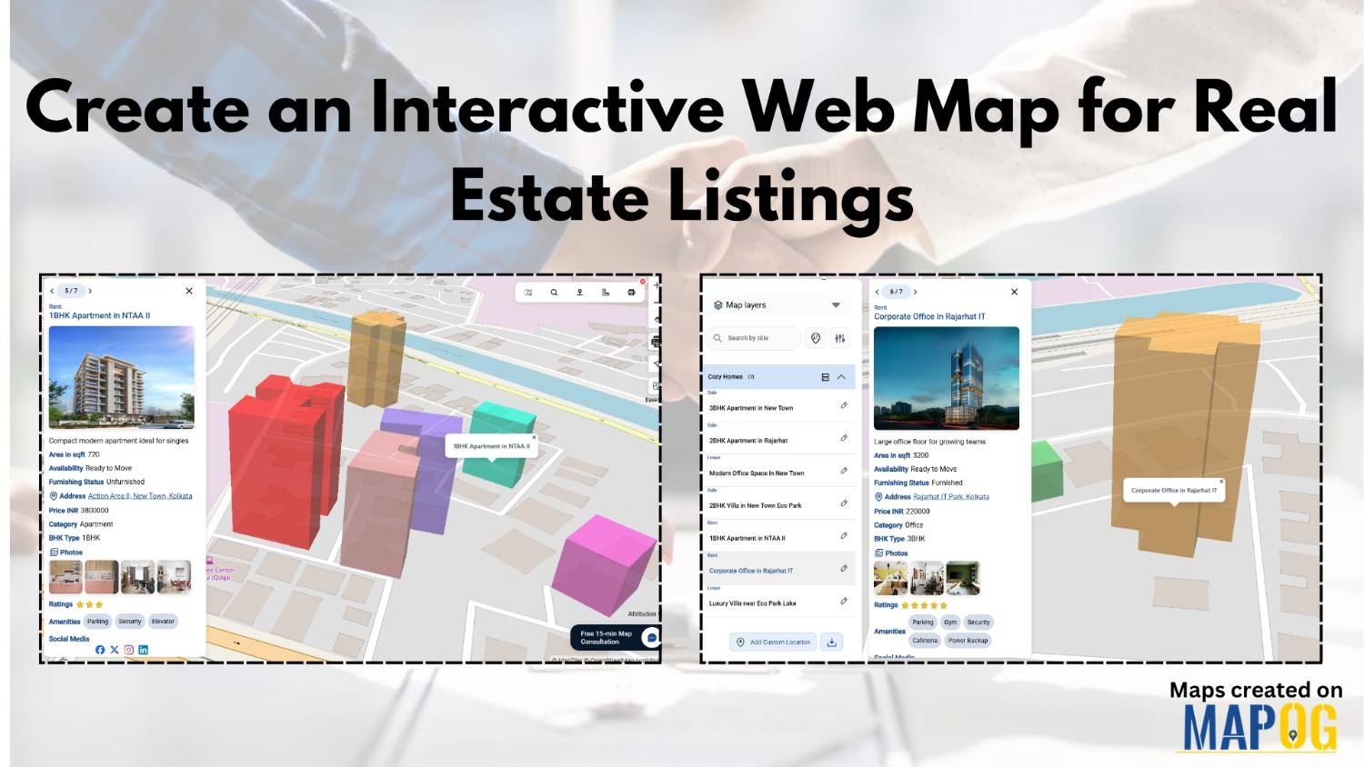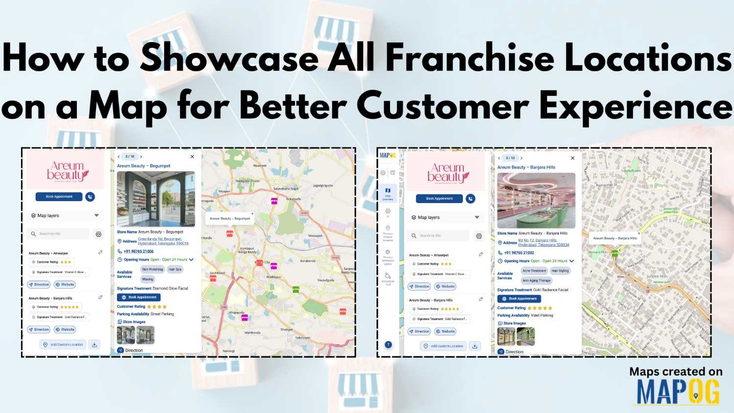
Make Your Property Listings Stand Out with Nearby Points on the Map
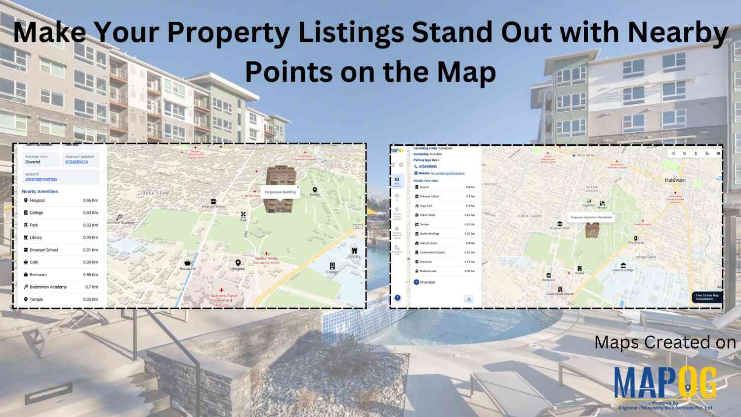
In real estate, property listings are often shared through images, spreadsheets, or basic portals. However, these methods only show partial information. While buyers can see the property, they rarely understand the surroundings. As a result, they spend extra time searching for nearby schools, buildings , and connectivity. With MAPOG , you can turn simple property … Read more