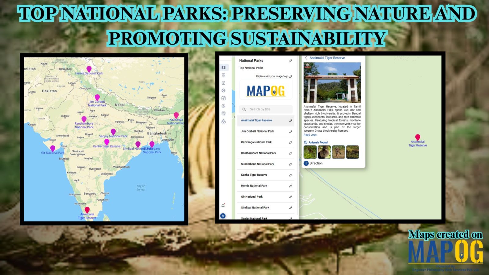
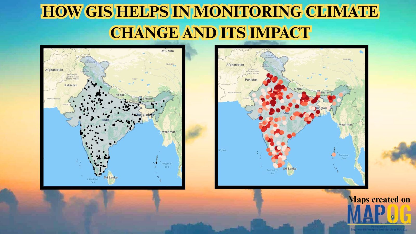
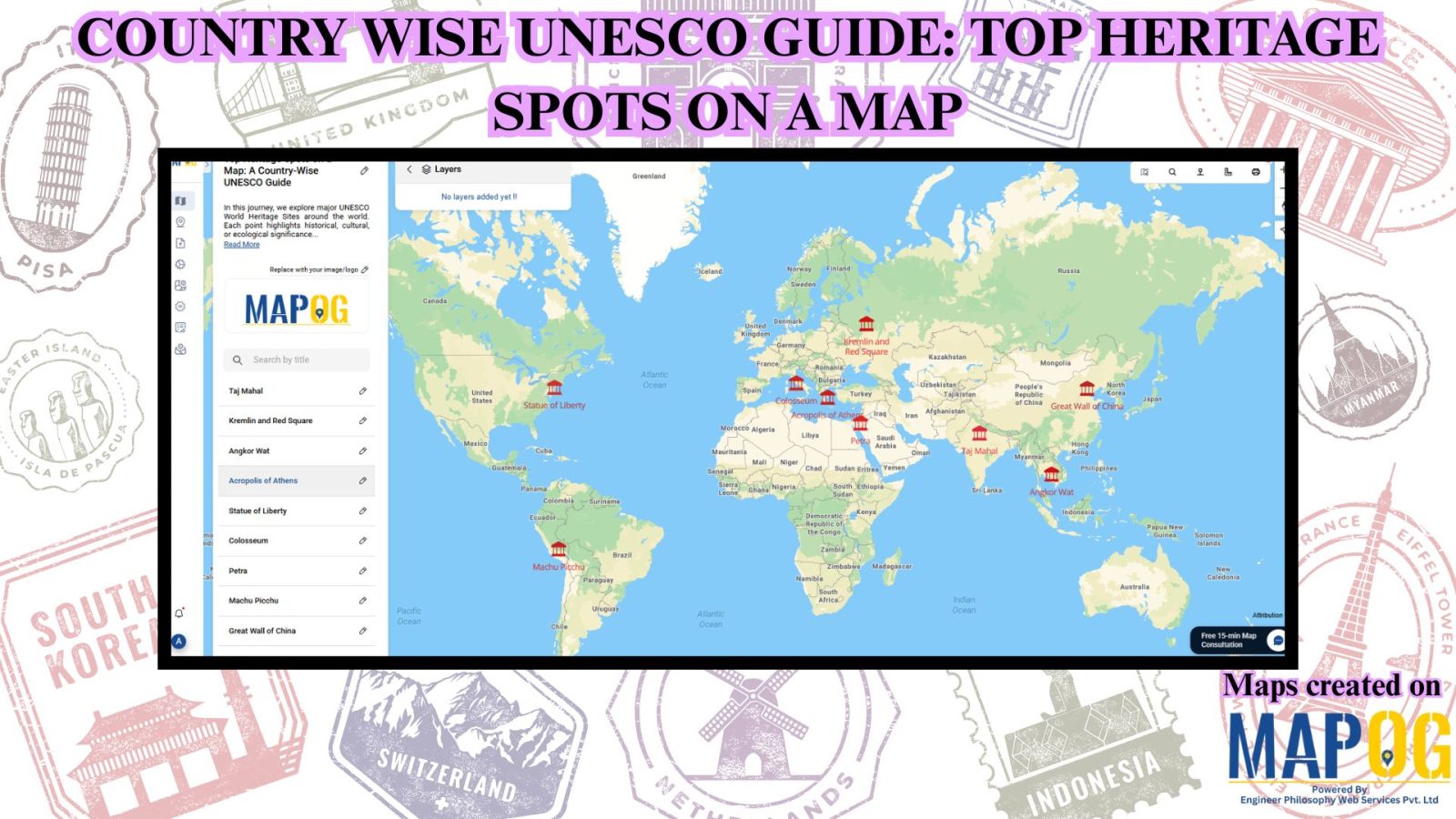
Uncategorized

Create Map :Join the Excel population data to the country polygons

Create Map :Join the Excel population data to the country polygons

In the present scenario of data-driven decision-making, understanding population demographics is paramount across various domains. One tool that stands out in this regard is the Excel attribute tool of MAPOG GIS Platform. This tool enables users to seamlessly integrate Excel population data with spatial data, providing valuable insights into demographic trends. The importance of this … Read more

Mapping and Coloring Regions of Country – Category Wise Style Your Map

Mapping and Coloring Regions of Country – Category Wise Style Your Map

In the realm of geographic information systems (GIS), effective color mapping plays a pivotal role in conveying complex data with clarity. One such tool that significantly enhances the color mapping process is the category styling option in MAPOG. This feature allows users to assign distinct colors to different categories, facilitating better understanding and interpretation of … Read more

Online GIS Data Map Viewers and Table Visualizations

Online GIS Data Map Viewers and Table Visualizations

Data tables serve as the backbone of Geographic Information Systems (GIS), housing crucial information about spatial features. In the realm of GIS, understanding and effectively manipulating these tables are essential for comprehensive data management and analysis. Enter MAPOG, a powerful platform that revolutionizes data table exploration and utilization. Explore the application of MAPOG in various … Read more

Mapping Petrol Pump Availability

Petrol Pump Accessibility: A Spatial Analysis Guide Using Buffer Zones

In the realm of ‘Petrol Pump Availability: Empowering Access’, MAPOG  stands as a powerful tool, offering insights that can redefine our understanding of spatial dynamics.  In a world constantly moving, access to petrol pumps is paramount. At MAPOG, we’re dedicated to providing a comprehensive solution for visualizing and analyzing Petrol Pump Accessibility: A Spatial Analysis. … Read more

Airport Shopping Isochrone: Find Stores Within Your Time Frame

Airport Shopping Isochrone: Find Stores Within Your Time Frame

In the realm of modern travel, airports not just serve as gateways to destinations but also operate as hubs for retail exploration. Nevertheless, maneuvering through shopping adventures in close proximity to airports can prove overwhelming. This is precisely where MAPOG steps in—a GIS platform that revolutionizes the exploration of premium shopping experiences near airports. This … Read more

Create a Map: Filter Camping Spots in a Region Within – Points in polygon

Create a Map: Filter Camping Spots in a Region Within – Points in polygon

In the dynamic world of outdoor recreation and tourism, finding ideal camping spots within a region can be challenging. Using shapefiles for the region and point files for camping locations, proximity analysis becomes a formidable tool. In this use case, we explore MAPOG Map Analysis for identifying optimal Camping Spots: Points in Polygon Analysis. Join … Read more

Create Map – DIGITIZING SOLAR, HYDROELECTRIC, WIND AND BIOMASS POWER PLANTS – RENEWABLE ENERGY  

“Digitizing renewable energy power plants” with MAPOG, in this exploration, we simplify the process of turning intricate data into a straightforward visual guide for a sustainable tomorrow. While our example focuses on the broader global context, these principles can be applied anywhere. Join us as we guide you through the steps, making green energy mapping … Read more