Navigating the quest for an ideal location to build your dream home can be a complex yet exciting endeavor. In this journey, MAPOG emerges as your trusted guide, offering a seamless and intuitive approach to pinpointing the most suitable house construction sites. Create a map to find suitable sites for constructing a new house by following our step-by-step guide. We will explore how to leverage MAPOG’s tools, starting from adding essential GIS data to identifying regions that perfectly align with your criteria. Let’s embark on this insightful journey to discover the ideal grounds for your future home. To know more about site suitability, read our latest blog on creating maps for real estate developers for the best site selection and petrol bunk accessibility using buffer tools.
Key Concept
The key concept lies in creating a map to find suitable sites for constructing a new house using MAPOG. By incorporating essential GIS data and leveraging the buffer tool, MAPOG ensures a meticulous approach to pinpointing optimal construction sites.
Steps to find suitable sites for constructing a new house
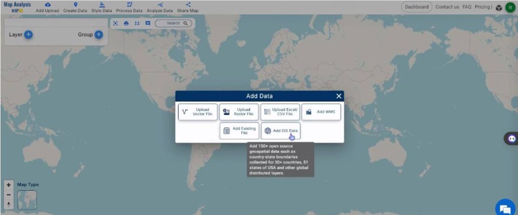
Step 1: Add Data
Open Map Analysis interface. Then click on the “Add Upload” button in the upper left corner. A dialogue box will open. Click on “Add GIS Data” to upload the data.
Rename the map to a suitable name by clicking on the pencil icon on the top right corner of the box present on the left-hand side. Once the layer name is typed, select Save Map to implement the changes.
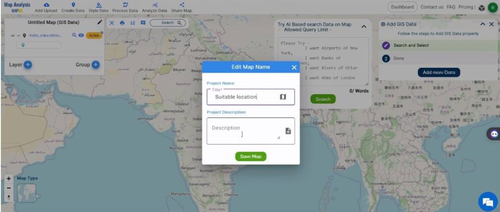
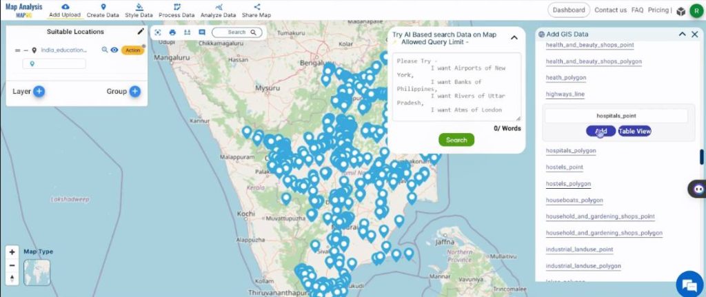
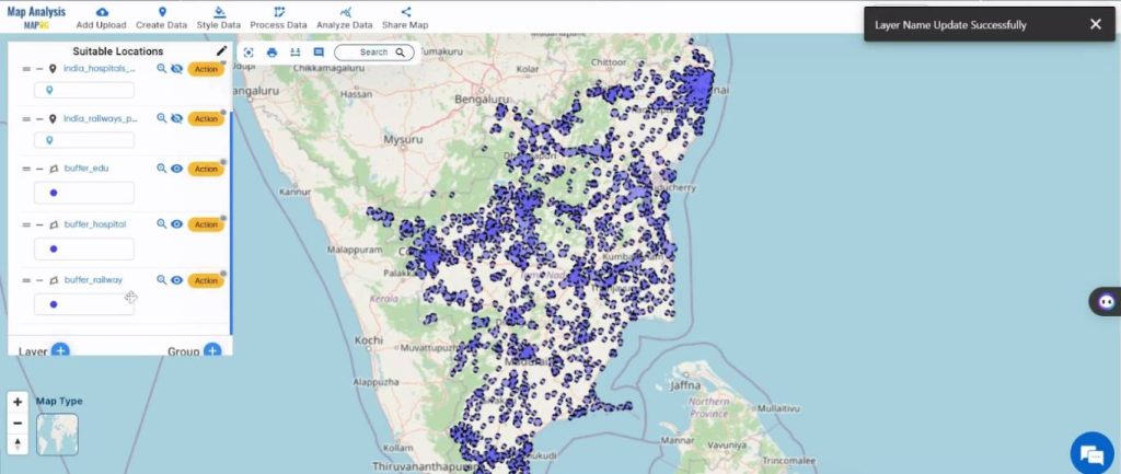
A box will open on the right side of the screen, enter the country name and the region of interest. Then search for the required data. Click on it and select Add. Then, the layer will be added to the map and the layer will be visible on the left side of the screen.
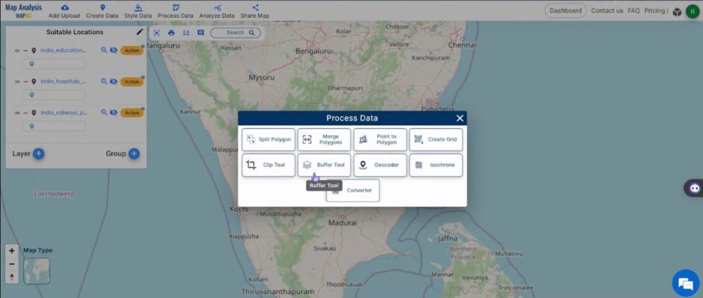
Step 2: Create Buffers
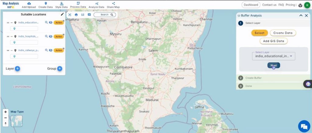
Select the Process Data option and select the Buffer Tool option.
Under the Select Layer tab, click on the Select option. In the drop-down box, select the required layer and click on Next.
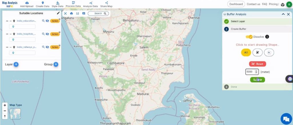
Next, under the Create Buffer tab, slide Dissolve and specify the range for which the buffer should be created. Then, click on Submit, to add the buffer layer to the map. The layer will be visible on the left side of the screen.
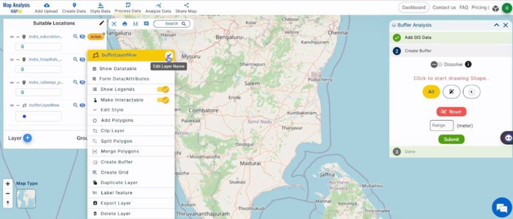
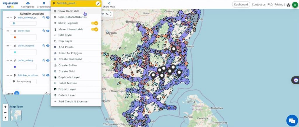
Next, click on the Action button next to the buffer layer and click on the pencil icon next to the name of the layer.
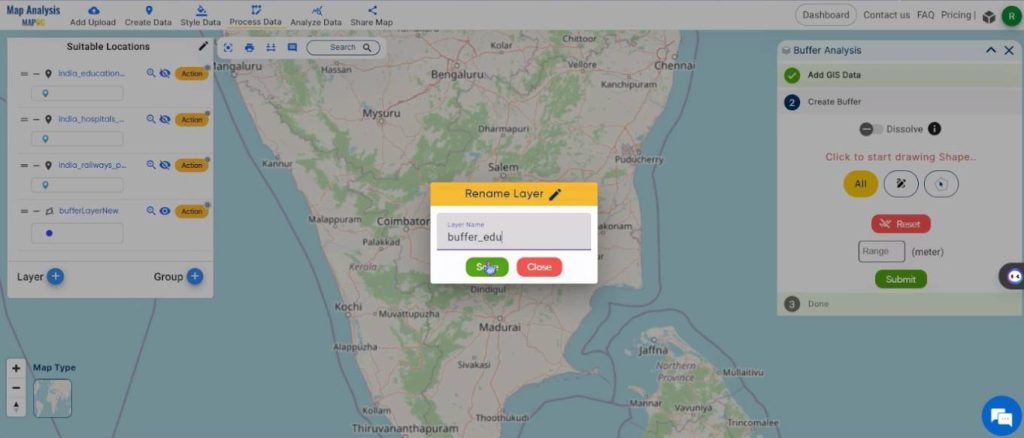
Rename the layer to a suitable name and click on Save.
Repeat this for all the required layers.
Step 3: Change the style of the buffers
Click on the Action button near any of the buffer layer names and select the Edit Style option.
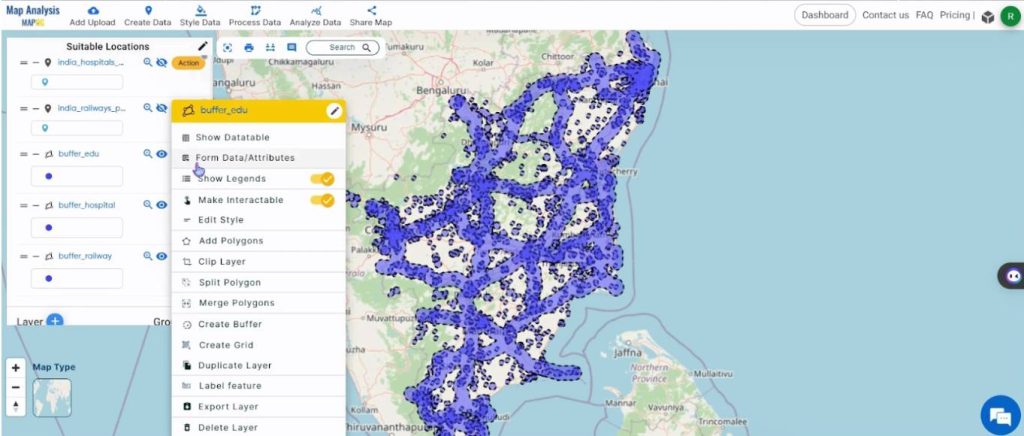
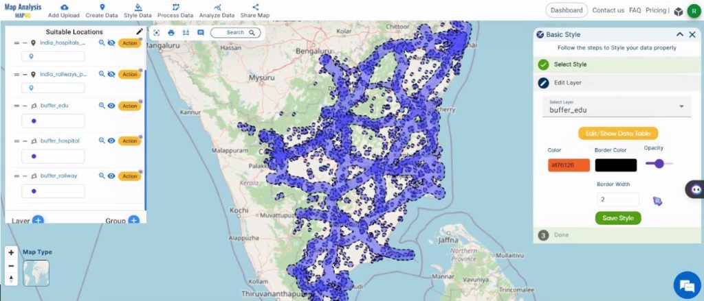
Out of the four options that appear, Select Basic Style.

Change the color as required in the Edit Layer tab.
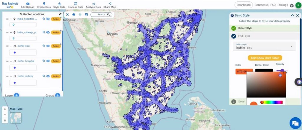
Once the color is chosen, click on Save Style to apply the changes.
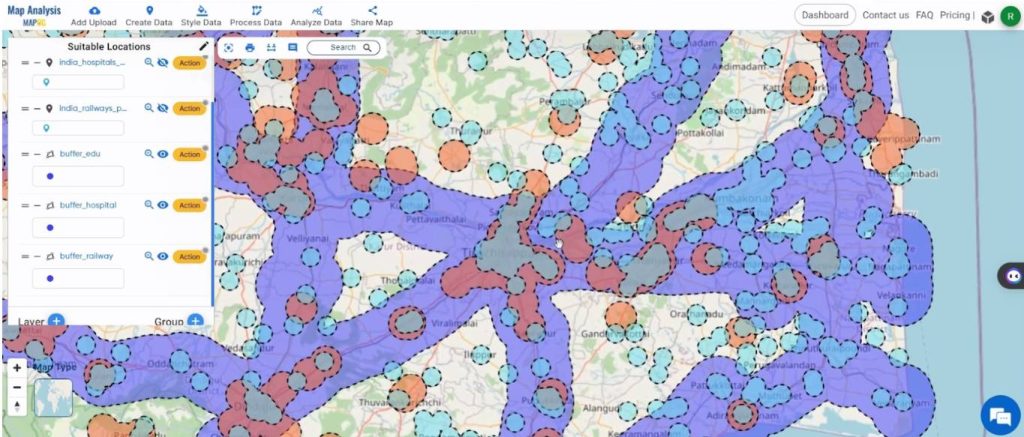
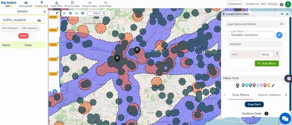
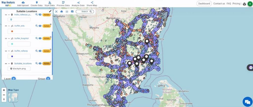
Step 4: Marking the sites suitable for the construction of a new house
The regions that contain all three buffers are the suitable regions. For better visualization, zoom into the map and see the regions that have all three buffers.
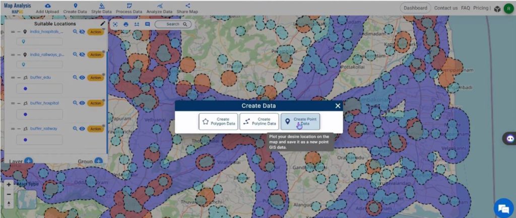
To mark these regions, click on Create Data and select Create Point Data.
Now change the name of the layer in the Layer Name text box.
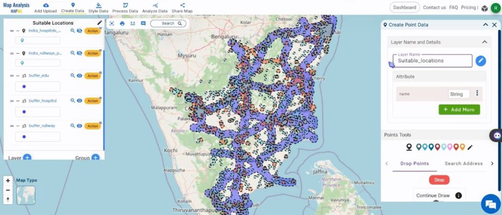
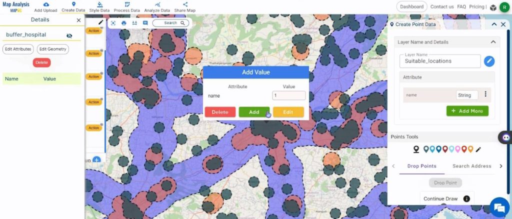
Zoom in and click on the required location. This will open a pop-up box. Give value as 1 and select Add, to add the point to the map.
Select the Drop Point to add another point in the map.
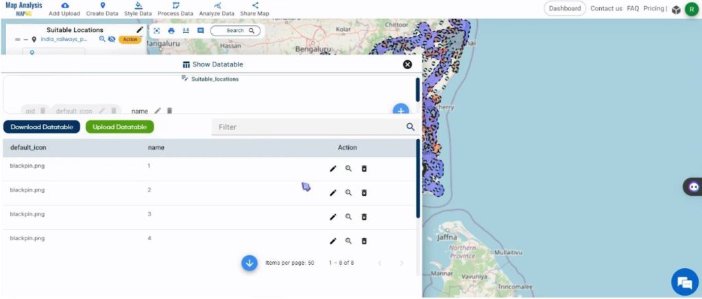
Continue until the required number of locations are marked. To view the data table, click on the Action button near the name of the point layer and select Show Datatable.
This will show the data table.
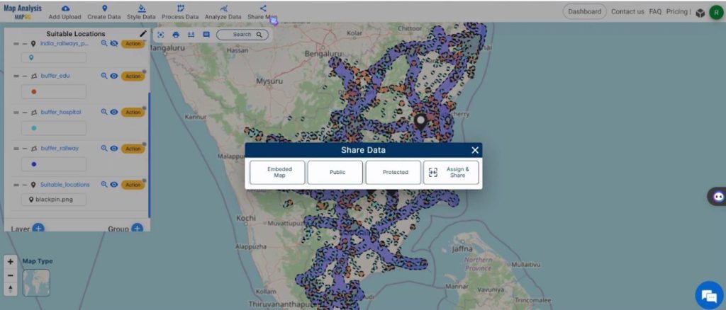
Step 5: Sharing the map
To share the map, click on the Share Map.
MAPOG transforms the intricate process of selecting house construction sites into an intuitive and visually engaging experience. The user-friendly interface and powerful tools provided by MAPOG make the journey efficient and insightful, laying the groundwork for a successful and well-informed house construction project.
Major Findings – Create a Map to find suitable sites for constructing a new house
The major findings of utilizing MAPOG for house construction site selection are:
- Precision in Site Identification: MAPOG enables precise identification of optimal house construction sites by incorporating essential GIS data and utilizing tools like the buffer tool. This precision is crucial for making informed decisions during the site selection process.
- Efficient Resource Allocation: The tool’s ability to define protective spatial areas around key data points, such as educational institutions and hospitals, aids in efficient resource allocation. This ensures that resources are directed towards the most suitable sites, minimizing unnecessary expenses for a cost-effective construction process.
- Geospatial Analysis for Informed Decisions: The geospatial analysis employed by MAPOG proves essential in understanding the physical characteristics and locations of structures in relation to the proposed house construction sites. This analytical capability contributes to making well-informed decisions throughout the construction process.
- Comprehensive Data Integration: MAPOG’s integration of diverse datasets, considering factors such as land use, topography, and infrastructure, provides a comprehensive understanding of the environment. This holistic approach ensures accurate identification of structures impacted by the house construction project.
Domain and Industry
The beneficiaries of this analysis encompass various stakeholders, including:
- Urban Planners: The precise identification of affected structures and optimized resource allocation provided by MAPOG assists urban planners in making well-informed decisions and ensuring sustainable road development.
- Construction and Engineering Professionals: Professionals in construction and engineering benefit from the streamlined road development process, minimizing disruptions and enhancing overall project efficiency.
- Real Estate Developers: MAPOG’s analysis aids real estate developers in identifying optimal locations for development, ensuring a strategic and well-informed approach to constructing new properties.
- Community Stakeholders: By fostering transparent communication and incorporating community input, MAPOG ensures that the concerns and preferences of community stakeholders are taken into account, contributing to a more inclusive and well-supported road development process.
Conclusion
In conclusion, the use of MAPOG for creating a map to find suitable sites for constructing a new house proves to be a pivotal and efficient approach. The analysis empowers decision-makers in urban planning, construction, engineering, and real estate development by providing a visually intuitive and precise method for site selection. MAPOG’s tools, particularly the buffer zones, contribute to a holistic understanding of the environment, promoting sustainable and well-informed decisions in the pursuit of building the ideal home.
Other Articles
- Protecting Wetlands: Guide to Create GIS Map for Nature
- GIS Analysis in Urban Planning: Reshaping Transportation Future Insights of state/city
- Fast Emergency Response: Using GIS and Isochrone Maps for 10-Minute Ambulance Arrival
- Mapping Tiger Attack Hotspots – Create an Online Map and Share
- Make Routes for Military Aerial Planning- Through Bearing angle and Distance calculation – Online Route Compass
- Mapping Healthcare Efficiency: GIS Buffer Analysis of Hospital Locations
- Add WMS- Two step online view of WMS layer on a map
- Plot ATM locations on a map and embed on your website
- Map habitat locations of endangered animals & keep track of their living
Admiring the time and energy you put into your website and in depth
information you provide. It’s great to come across a
blog every once in a while that isn’t the same unwanted rehashed information. Great read!
I’ve saved your site and I’m including your RSS feeds to my
Google account.
That is a great tip especially to those new to the blogosphere.
Brief but very accurate information… Thanks for sharing this one.
A must read post!