In the dynamic world of outdoor recreation and tourism, finding ideal camping spots within a region can be challenging. Using shapefiles for the region and point files for camping locations, proximity analysis becomes a formidable tool. In this use case, we explore MAPOG Map Analysis for identifying optimal Camping Spots: Points in Polygon Analysis. Join us to navigate GIS technology and discover how proximity analysis enhances outdoor adventures by finding perfect camping havens. Embark on a journey to create a map to find camping spots in a region. To create off-road routes, check out our blog on creating off-road hiking routes using bearing angles and distances.
Key Concept of Filter Camping Spots: Points in Polygon Analysis
Proximity analysis, is a GIS technique that allows for the identification of camping spots within a specified region based on their proximity to designated points of interest. By leveraging spatial relationships between geographic features, such as shapefiles representing the region and point files indicating camping locations, proximity analysis offers a systematic approach to locating suitable camping spots. This key concept underscores the transformative potential of GIS technology in outdoor recreation and tourism, enabling adventurers to make informed decisions about where to set up camp based on their desired proximity to amenities, natural attractions, or other points of interest within the region.
Steps to Create a Map to find Camping spots in a region
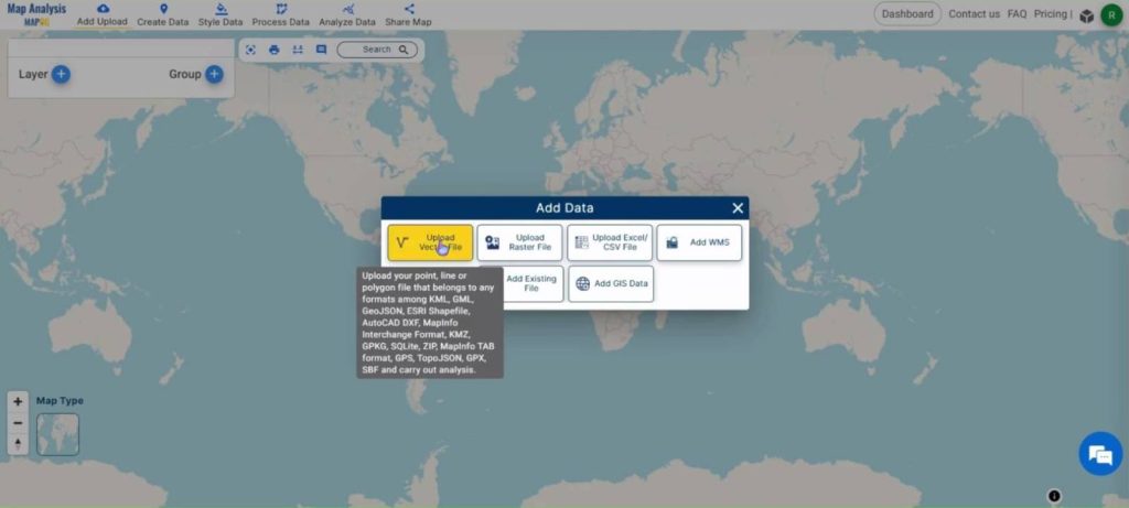
Step 1: Add Data
Open the MAPOG Map Analysis interface. Click on the ‘Add Upload’ button in the top ribbon. A dialog box will open. Select the ‘Upload Vector File‘ option.
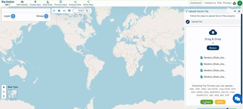
Click on Browse and select the required file. If a shapefile needs to be imported, then the supporting files also need to be selected. Then, click on Upload.
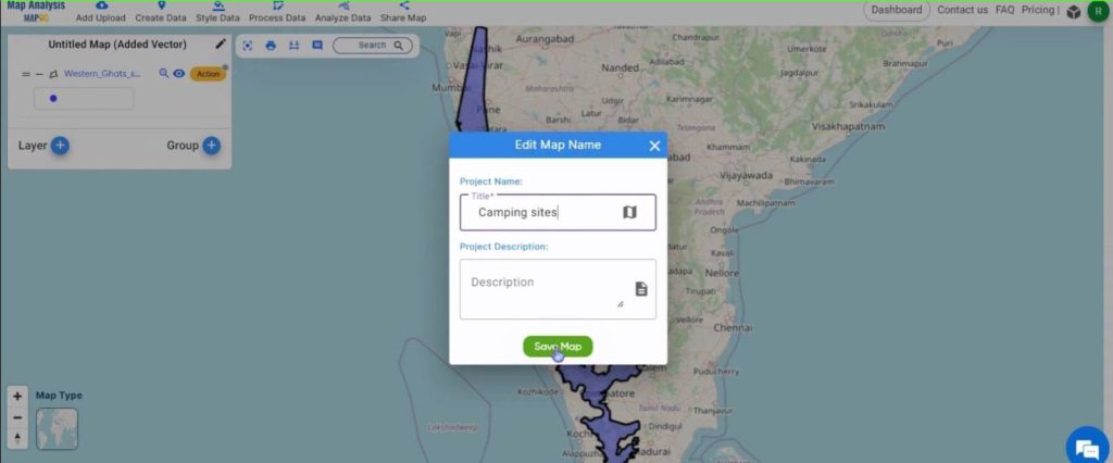
Click on the Pencil icon to rename the map. Give an appropriate title and click on Save Map.
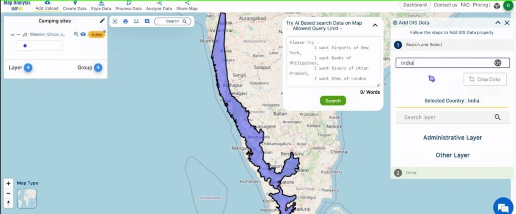
Next, click on ‘Add Upload’ and this time select the ‘Add GIS Data‘ option.
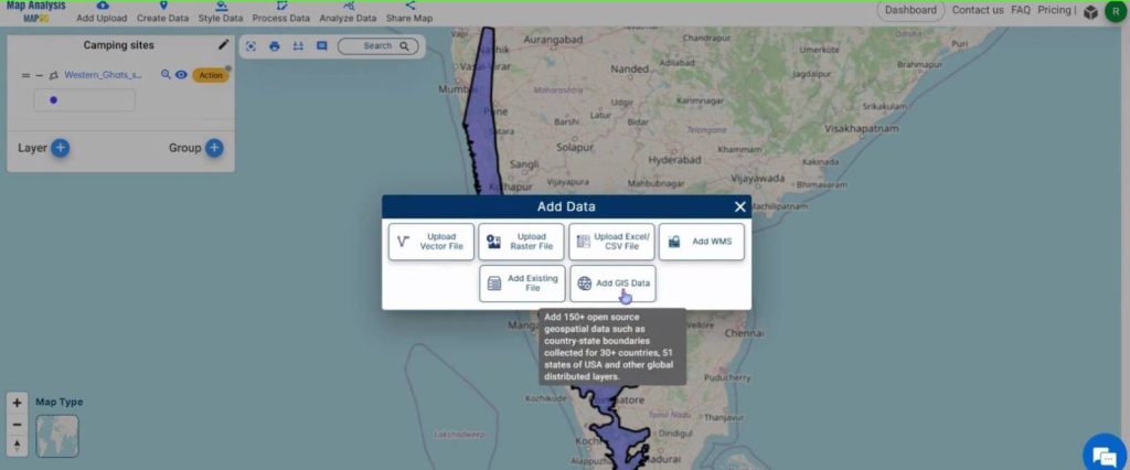
In the dialog box, give the country name.
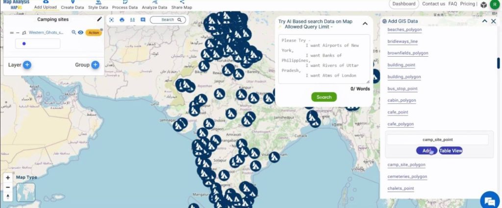
Then, add the campsite points layer.
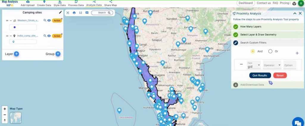
Step 2: Proximity Analysis
Click on the ‘Analyze Data‘ tool on the ribbon. In the dialog box, select 2 layers.
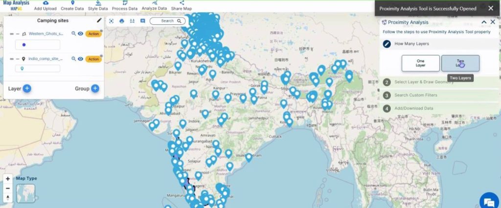
Choose the campsite and the shapefile in the first and last drop-down boxes respectively.
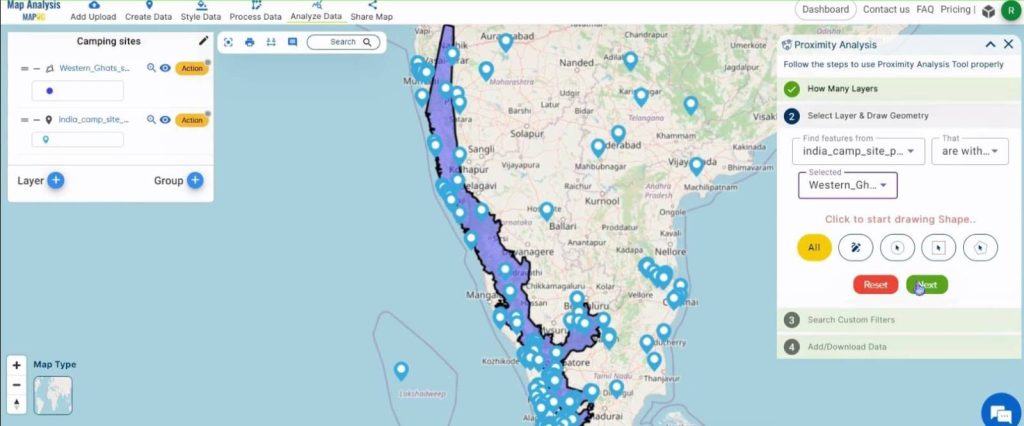
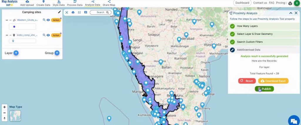
Next, click on Get Results.
Click on Publish once the analysis is completed.
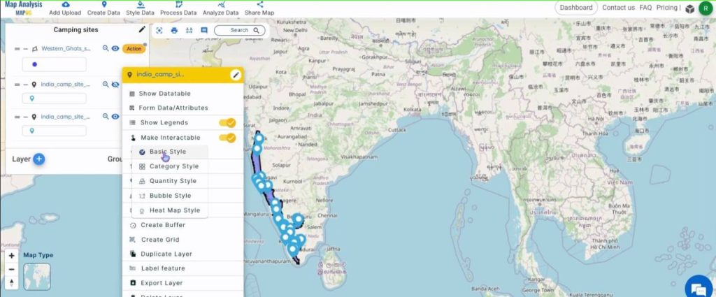
Step 3: Symbology
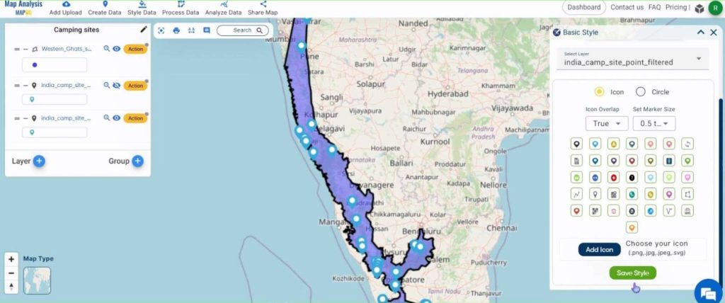
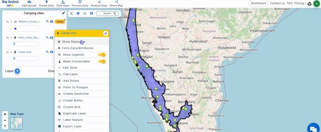
To change the symbology of the layer, click on the Action button and then on Basic Style in Edit Style.
Choose an appropriate marker size and icon style. Once selected, click on Save Style.
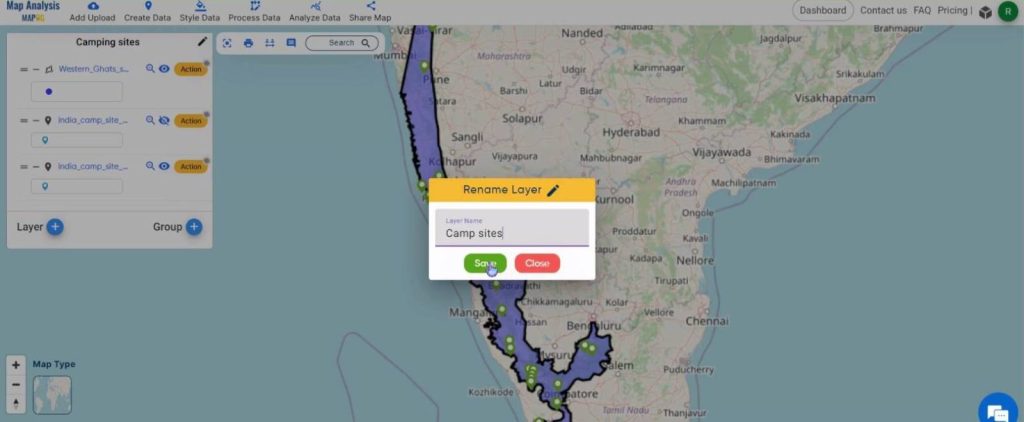
Change the name of the layer by clicking on the Action button and then on the pencil icon near the name of the layer.
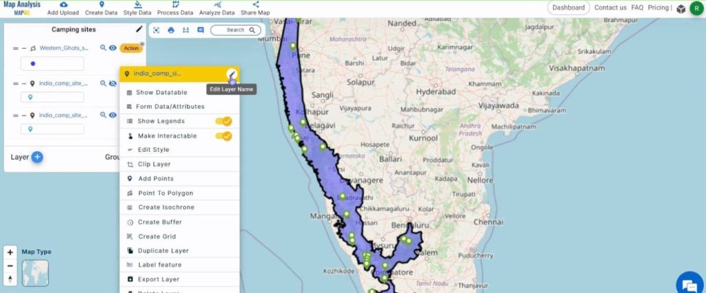
After giving a suitable name, click on Save.
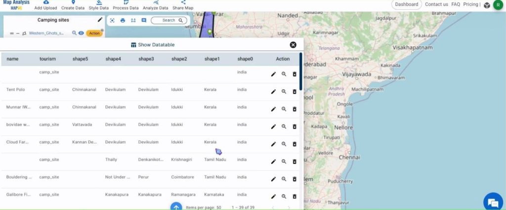
To view the details of the camping sites, click on the Action button and select the ‘Show Datatable’ option.
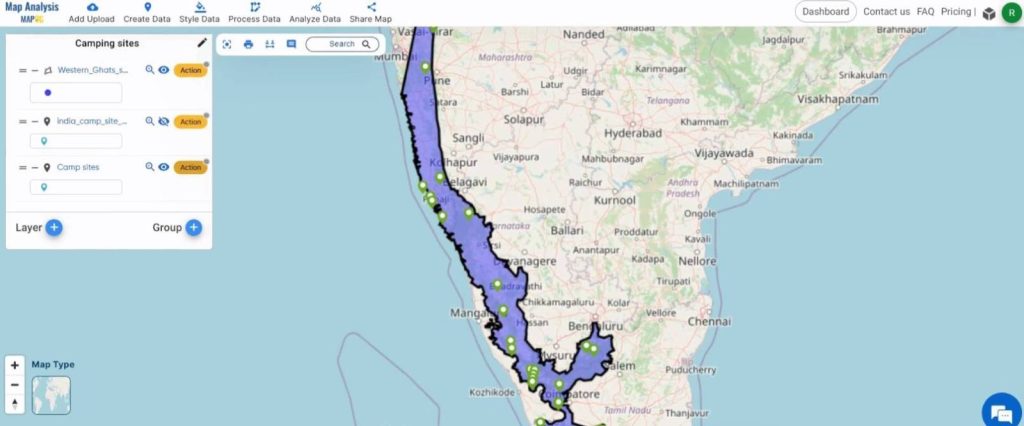
Shown below is a snippet of the details.
The final map is shown below.
Major Findings – Create a map to find Camping spots in a region
- Efficiency and Accuracy: Utilizing GIS technology for proximity analysis resulted in efficient and accurate identification of camping spots, streamlining the planning process for adventurers and tourists alike.
- Resource Optimization: By strategically locating camping spots using proximity analysis, resources such as time, fuel, and supplies were optimized, enhancing the overall camping experience while minimizing logistical challenges.
- Improved Tourism Development: Proximity analysis not only benefits individual campers but also contributes to tourism development by promoting lesser-known camping destinations and diversifying the outdoor recreation experience within the region.
Domain and Industry
- Tourists: Tourists visiting the region benefit from proximity analysis by discovering hidden gems and lesser-known camping locations, allowing them to explore and experience the area’s natural beauty while enjoying the comforts of camping.
- Local Businesses: Local businesses, such as campgrounds, outdoor gear shops, and restaurants, benefit from increased tourism and patronage resulting from proximity analysis, stimulating economic growth within the region.
- Government Agencies: Government agencies responsible for tourism development and land management benefit from proximity analysis by gaining insights into camping spot preferences and visitor patterns, enabling them to make informed decisions regarding resource allocation and infrastructure development.
Conclusion
In conclusion, proximity analysis proves invaluable in identifying ideal camping spots within a region, benefiting outdoor enthusiasts, tourists, businesses, government agencies, environmental organizations, residents, and the adventure industry. By facilitating optimal camping locations, enhancing decision-making, and promoting sustainable tourism, proximity analysis fosters memorable outdoor experiences and supports economic and environmental vitality. As we continue to leverage GIS technology, let us embrace the potential of proximity analysis to shape a future where outdoor adventures thrive and natural resources are preserved for generations to come.
Other articles:
- Protecting Wetlands: Guide to Create GIS Map for Nature
- GIS Analysis in Urban Planning: Reshaping Transportation Future Insights of state/city
- Fast Emergency Response: Using GIS and Isochrone Maps for 10-Minute Ambulance Arrival
- Mapping Tiger Attack Hotspots – Create an Online Map and Share
- Make Routes for Military Aerial Planning- Through Bearing angle and Distance calculation – Online Route Compass
- Mapping Healthcare Efficiency: GIS Buffer Analysis of Hospital Locations
- Add WMS- Two step online view of WMS layer on a map
- Plot ATM locations on a map and embed on your website
- Map habitat locations of endangered animals & keep track of their living
- Create a Map to find suitable sites for constructing a new house