In a groundbreaking move for public safety, the Ambulance Plotting System has been introduced in Great Britain. Integrated within the MAPOG framework, this innovative system guarantees a life-saving presence within a mere 10 minutes at fatal accident sites. By swiftly coordinating emergency responses, it aims to significantly reduce fatalities and enhance overall patient outcomes. This remarkable technology marks a crucial step forward in ensuring the well-being and safety of communities across the nation. Here in this we do isochrone analysis for ambulance services.
What is Isochrone Analysis ?
Isochrones in MAPOG refer to geographic areas reachable within a specified time frame. These enable efficient emergency response planning. The benefits include optimized resource allocation, ensuring swift arrival of medical assistance within the defined time limit. Isochrones enhance public safety by minimizing response times to fatal accidents, reducing critical delays. Overall, MAPOG‘s isochrones contribute to a more effective emergency response system, saving lives and improving the well-being of communities.
Benefit From Creating an Emergency Response Analysis In MAPOG
Exploring hospitals near accidental zones, integrated into MAPOG, transforms emergency response in Great Britain. The commitment to reaching fatal accident sites within 10 minutes ensures timely medical assistance, reducing fatalities, and improving outcomes. This system streamlines emergency care, minimizes delays, enhances public safety, and strengthens the efficiency of the response network. Ultimately, it contributes to the well-being and security of communities nationwide.
MAPOG Isochrone analysis for Ambulance Services
Go to MAPOG for isochrone analysis, ensuring a rapid emergency response: Utilizing GIS and Isochrone Maps to achieve a 10-minute arrival time for ambulances.
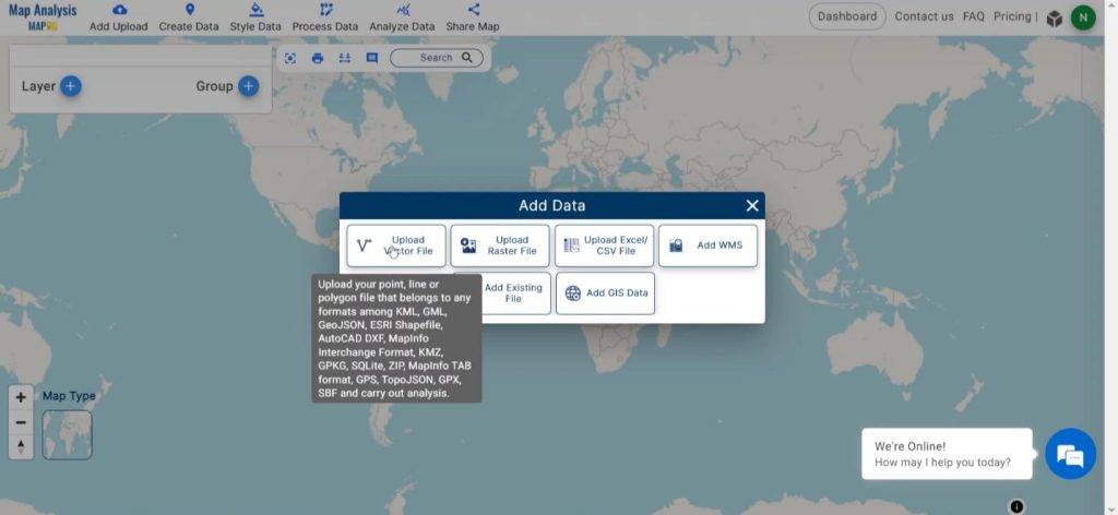
Step 1: Upload Vector Data
Click on add upload button on upper left corner. A dialogue box will open. Click on “Upload Vector file” to upload the data.
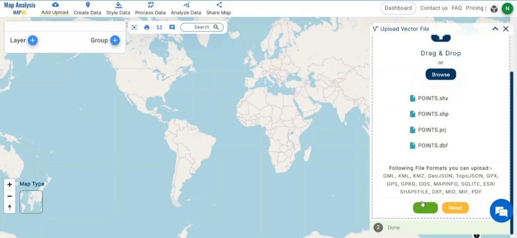
A box will open on the right side of the screen, select the Browse option to browse the data & click Upload to upload the data.
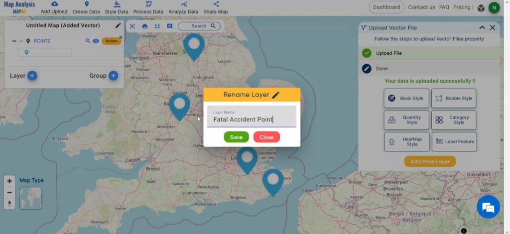
Rename the layer for better understanding. Click on Action and select Rename Layer. Edit the name and click on Save button.
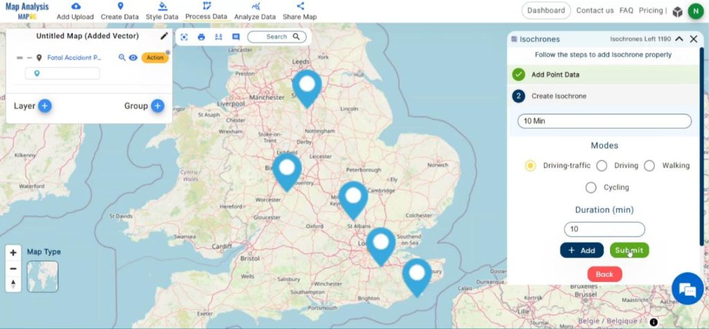
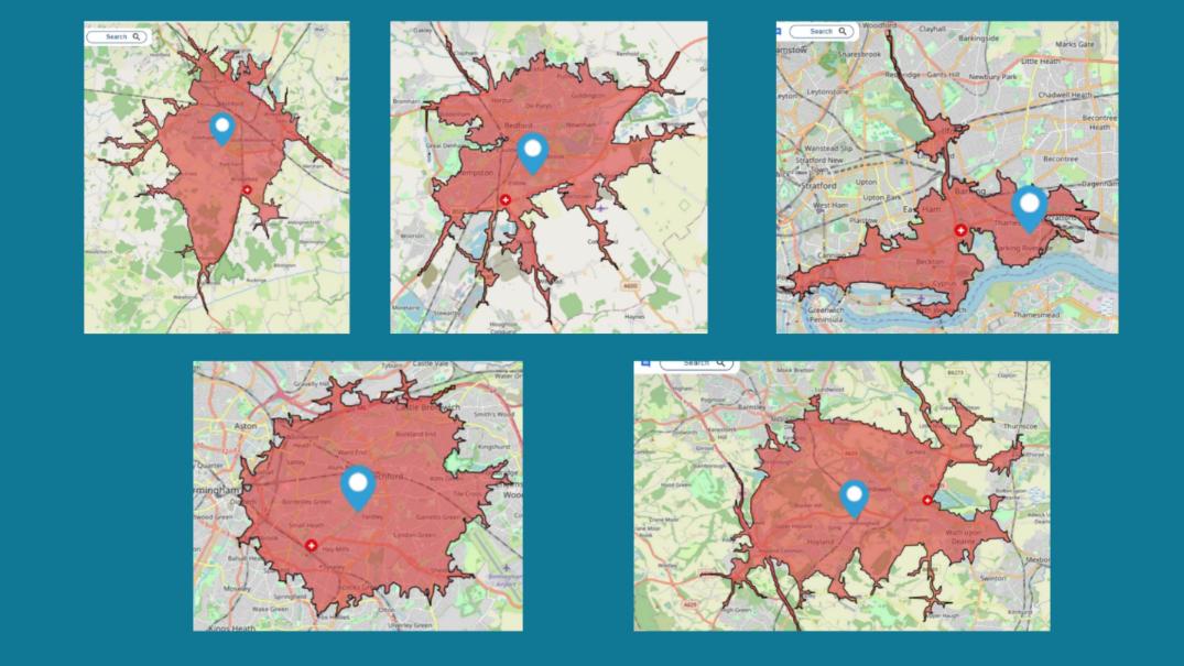
Step 2: Create Isochrones
Now go to the Process Data option to click on isochrones. Next in the select layer option select the accident point layer and after that select the duration time as 10 minutes and mode as drive-traffic and your isochrones will be prepared.
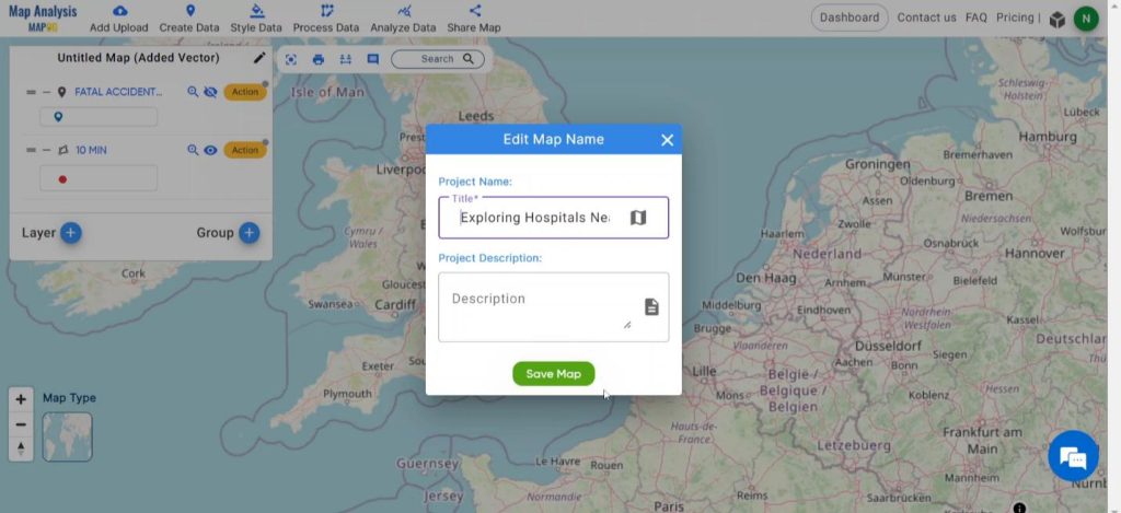
Step 3: Save Map
Now, click on the Edit icon situated right after the “Untitled Map” text to save the project. In the dialogue box write proper names and descriptions that describe the project accurately. And click on Save Map option. Your project will be saved.
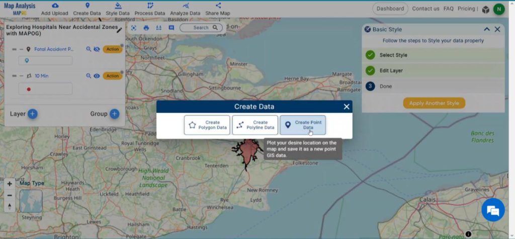
Step 4: Create Point Data
After saving the map click on Create Data option and select the Create Point Data option.
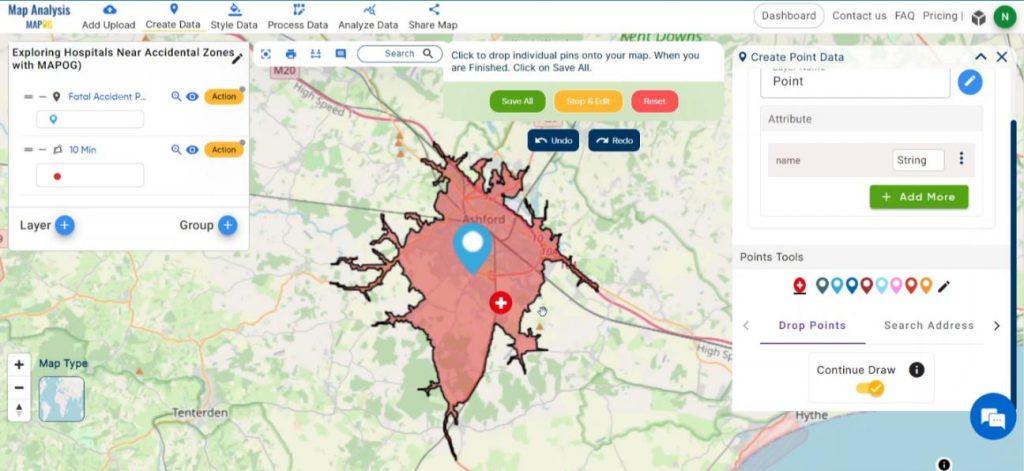
And start creating points in suitable locations besides the roads inside the isochrones.
Step 7: Results & Analysis
With our map now enriched with details, let’s make those final adjustments. This map is a powerful tool for Swift Response, Lives Saved, Efficient Emergency Care, Enhanced Emergency Response etc.
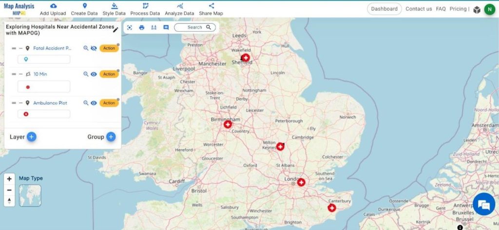
Now the map vividly illustrates the places where most of the accidents happen and where we should plot those ambulance for emergency purpose.
Findings and Factors to Consider
Swift Response Time: The Ambulance Plotting System within MAPOG consistently achieves its objective of ensuring a life-saving presence within 10 minutes of fatal accidents, showcasing its effectiveness in minimizing response times.
Improved Patient Outcomes: The implementation of this system correlates with improved patient outcomes, as the timely arrival of medical assistance significantly contributes to reducing fatalities and enhancing overall survival rates.
Enhanced Emergency Network Efficiency: The Ambulance Plotting System not only achieves its primary goal but also plays a key role in streamlining the emergency response network, showcasing increased efficiency and coordination in responding to critical incidents across Great Britain.
Geospatial Integration: The Ambulance Plotting System relies on advanced geospatial technology within the MAPOG framework, allowing precise mapping and real-time tracking of ambulances to ensure their timely arrival within 10 minutes of fatal accident locations.
Algorithmic Optimization: The system utilizes sophisticated algorithms to calculate optimal routes, considering various factors such as traffic patterns, road conditions, and geographical obstacles, ensuring the quickest and most efficient response to fatal accidents.
Collaborative Network: The success of the Ambulance Plotting System depends on collaboration within the MAPOG network, fostering seamless communication and coordination among emergency services, transportation authorities, and healthcare providers to enhance the overall effectiveness of the life-saving presence initiative.
I’ve found that utilizing MAPOG’s Isochrones has been pivotal in crafting an Emergency Response Analysis with flourishing details.
This map is a valuable asset for Healthcare and Emergency Services, Transportation and Traffic Management, Vulnerability Areas Identification, Insurance and Risk Management and beyond. This will help the Emergency Responders by ensuring timely and efficient response to fatal accidents, leading to improved patient outcomes and reduced fatalities.
You can also check for Route Compass Tool and Make Routes for Military Aerial Planning- Through Bearing angle and Distance calculation.
Other Articles
- Protecting Wetlands: Guide to Create GIS Map for Nature
- GIS Analysis in Urban Planning: Reshaping Transportation Future Insights of state/city
- Fast Emergency Response: Using GIS and Isochrone Maps for 10-Minute Ambulance Arrival
- Mapping Tiger Attack Hotspots – Create an Online Map and Share
- Make Routes for Military Aerial Planning- Through Bearing angle and Distance calculation – Online Route Compass
- Mapping Healthcare Efficiency: GIS Buffer Analysis of Hospital Locations
- Add WMS- Two step online view of WMS layer on a map
- Plot ATM locations on a map and embed on your website
- Map habitat locations of endangered animals & keep track of their living
8 thoughts on “Fast Emergency Response: Using GIS and Isochrone Maps for 10-Minute Ambulance Arrival”