Introduction
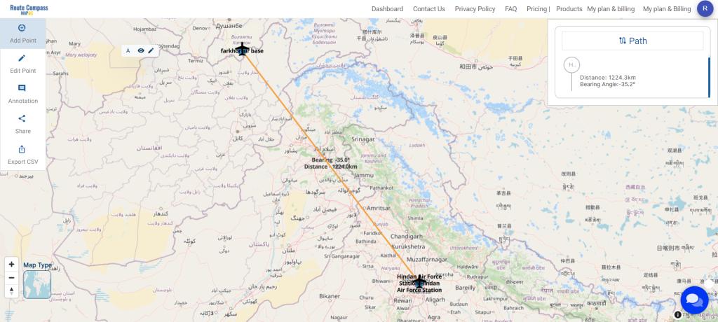
In this military aerial route planning analysis, we employ the MAPOG route compass to navigate the strategic journey from one Air Force Station to another Air Base. This tactical approach ensures efficient and effective planning for aerial movements in the specified region.

Key Concept
The key concept underlying this military aerial route planning analysis is the strategic utilization of the MAPOG route compass. By incorporating precise steps, including waypoint coordination, label customization, and icon annotations, the tool enhances the efficiency and effectiveness of military aerial route planning. This approach provides a visually intuitive representation of critical locations, contributing to informed decision-making and situational awareness during strategic military operations. The MAPOG route compass serves as a crucial asset, empowering users to navigate complex scenarios, optimize flight paths, and achieve mission success with precision and agility. Beyond its strategic employment in military operations, this tool finds practical use cases in civilian aviation, emergency response coordination, maritime navigation, and even in the realm of outdoor recreational activities such as hiking and mountaineering. Its adaptability stems from its ability to provide clear and concise visualization of routes, waypoints, and critical locations, facilitating efficient decision-making and navigation in diverse environments.
Steps for Military Aerial Route Planning with Route Compass
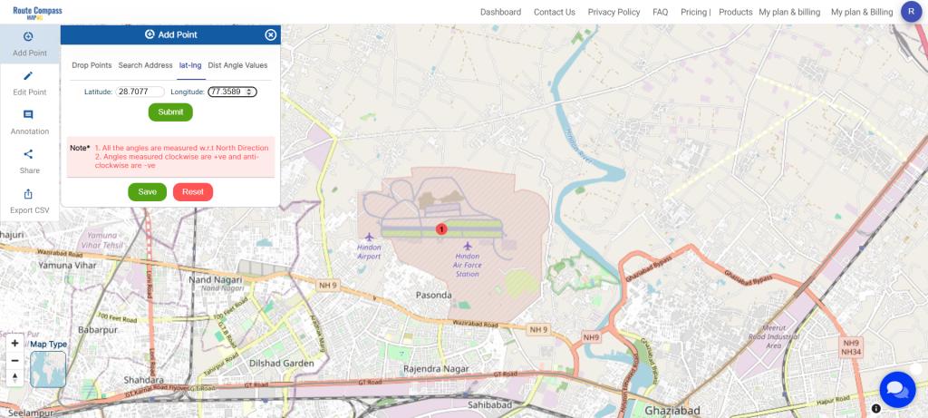
Step 1: Add Waypoints with Latitude and Longitude:
Begin by clicking on “Add Point” and select the “Lat Log” option in the tab. Input the coordinates of both air bases and submit the data.
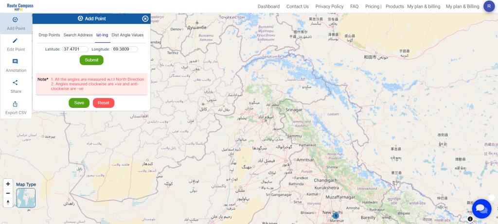
Step 2: Coordinate Input for Air Bases:
Specifically, add in the coordinates of the respective air bases and proceed to submit the information.
Step 3: Customize Point Labels:
Click on the point you’ve added to change the label name. After modifying the name, click “Change Label” to update the information.
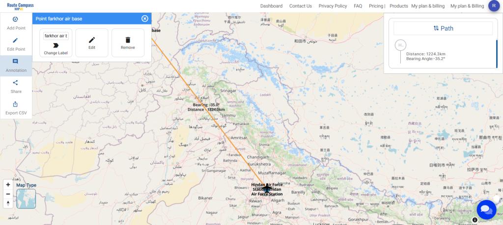
Step 4: Include Icons with Annotations:
To add icons, click on “Annotation,” select the desired shape, and save the style. This step enhances visual representation on the map.
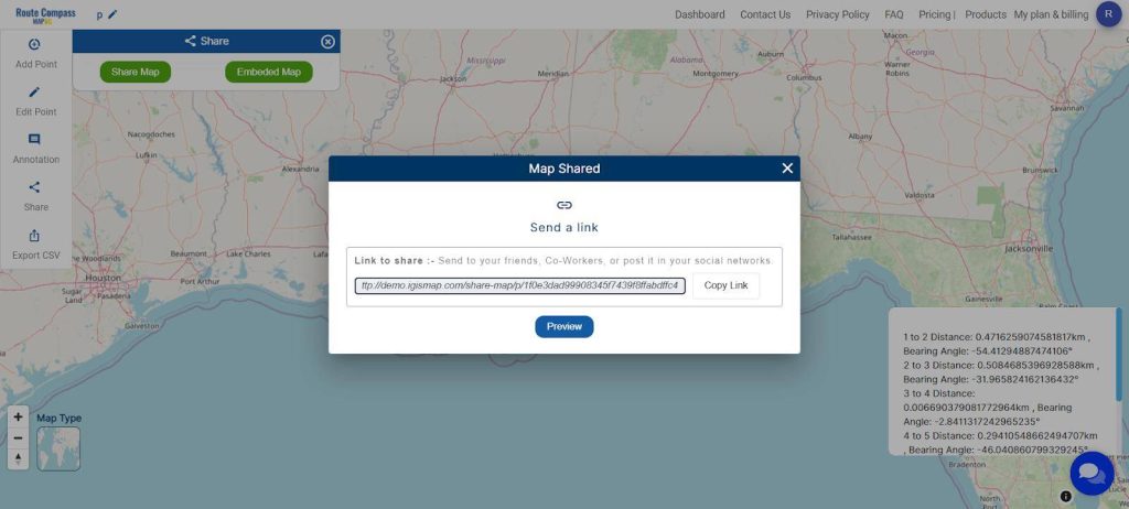
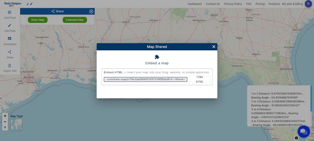
Step 5: Sharing and Embedding Options
Facilitate collaboration by sharing your project. Use the ‘Share Map’ option to send it to friends or post it on social media. For embedding into a blog or website, opt for ‘Embed HTML’ for seamless integration.
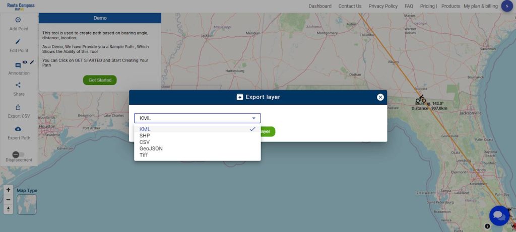
Step 6: Download Information in CSV Format or export path in other formats
For added convenience, MAPOG Route Compass allows the download of all information in a CSV file format. This feature ensures accessibility and easy sharing of project data. You can also use the export path tool for downloading the data.
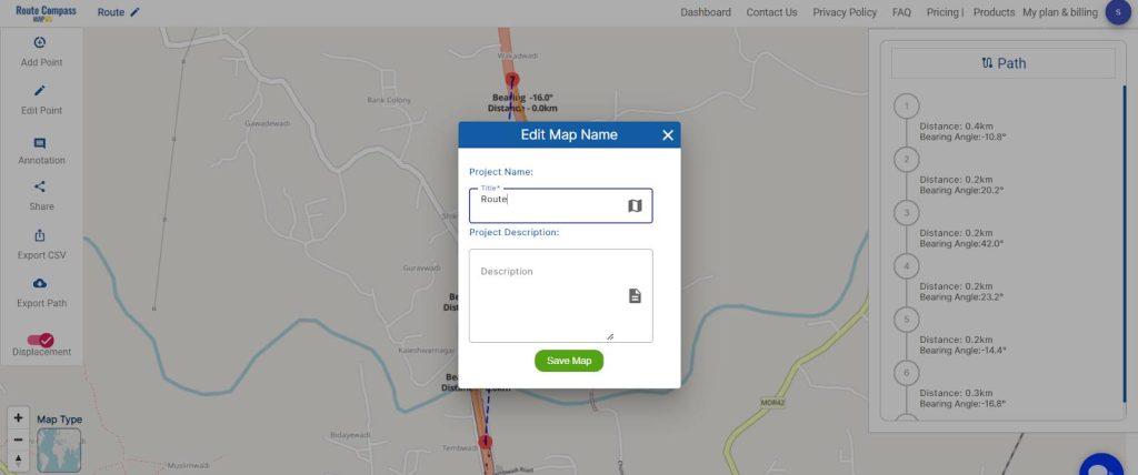
Step 7: Save and Rename Project
Save your project by clicking the pencil icon above, where you can also rename your project for better organization.
By following these steps within the MAPOG Route Compass tool, users can efficiently input coordinates, customize labels, and enhance visualization through icon annotations, contributing to effective military aerial route planning.
Major Findings
The use of MAPOG Route Compass facilitated precise and efficient military aerial route planning. By following the steps, including adding waypoints with exact coordinates and customizing labels, the tool enhanced situational awareness and provided a visually intuitive representation of critical locations on the map.
Domains and Industries Benefiting
Military Aerial Route Planning: Importance and Uses with Route Compass
Military aerial route planning is a critical aspect of strategic operations, involving the careful selection and optimization of flight paths for aircraft. The use of route compass tools, such as the MAPOG route compass, enhances the efficiency and effectiveness of these planning processes. Here are the importance and uses of military aerial route planning with a focus on utilizing a route compass:
1. Strategic Deployment:
- Importance: Aerial route planning ensures strategic deployment of military assets to specific locations.
- Route Compass Use: The route compass aids in determining the most direct and secure paths, considering geographical and tactical factors.
2. Tactical Maneuvering:
- Importance: Enables tactical maneuvering for mission success and adaptability in response to changing circumstances.
- Route Compass Use: Helps in real-time adjustments, considering factors like airspace restrictions and potential threats.
3. Time and Fuel Efficiency:
- Importance: Maximizes time and fuel efficiency, crucial for extended missions and conservation of resources.
- Route Compass Use: Calculates optimal routes, minimizing detours and reducing fuel consumption.
4. Minimizing Exposure to Threats:
- Importance: Reduces the exposure of aircraft to potential threats, enhancing overall mission safety.
- Route Compass Use: Identifies routes that avoid known high-risk areas, contributing to mission success and crew safety.
5. Coordination in Joint Operations:
- Importance: Facilitates coordination in joint military operations involving multiple branches and allied forces.
- Route Compass Use: Ensures seamless integration of aerial routes, promoting interoperability.
6. Mission Secrecy:
- Importance: Maintains mission secrecy and operational security by selecting routes away from unauthorized or prying eyes.
- Route Compass Use: Assists in designing discreet routes that minimize the risk of detection.
7. Rapid Response and Flexibility:
- Importance: Supports rapid response and adaptability to emerging situations.
- Route Compass Use: Allows for quick adjustments, ensuring flexibility in response to changing mission requirements.
8. Navigation in Complex Terrain:
- Importance: Facilitates navigation through complex terrains, such as mountainous regions or dense airspace.
- Route Compass Use: Helps in identifying the most navigable paths through challenging environments.
Conclusion
In summary, military aerial route planning, complemented by the precision of route compass tools, is indispensable for ensuring the success, safety, and efficiency of military aviation operations. This strategic approach serves as a key component in modern warfare strategies, empowering armed forces to navigate complex scenarios with optimal precision and agility.
For further information or assistance, please contact us at support@mapog.com. This robust combination of military strategy and advanced navigation tools exemplifies the commitment to excellence in ensuring the effectiveness of military aviation endeavours .
Other Articles
- Protecting Wetlands: Guide to Create GIS Map for Nature
- GIS Analysis in Urban Planning: Reshaping Transportation Future Insights of state/city
- Fast Emergency Response: Using GIS and Isochrone Maps for 10-Minute Ambulance Arrival
- Mapping Tiger Attack Hotspots – Create an Online Map and Share
- Make Routes for Military Aerial Planning- Through Bearing angle and Distance calculation – Online Route Compass
- Mapping Healthcare Efficiency: GIS Buffer Analysis of Hospital Locations
- Add WMS- Two step online view of WMS layer on a map
- Plot ATM locations on a map and embed on your website
- Map habitat locations of endangered animals & keep track of their living
14 thoughts on “Make Routes for Military Aerial Planning- Through Bearing angle and Distance calculation – Online Route Compass”