Welcome! In this guide, we’ll explore the straightforward process of merging polygons using MAPOG. Discover how this feature simplifies spatial data tasks, making boundaries clearer and visualization more effective. Join us as we learn about the benefits of polygon merging, illustrated by combining two panchayats to create a municipality. Let’s get started on streamlining spatial data management with MAPOG‘s user-friendly tools.
Key Concept
The key concept revolves around the functionality of polygon merging within MAPOG, a process that simplifies spatial data management by combining multiple polygons into a single entity. This feature enhances clarity in boundary delineation and improves visualization, thereby facilitating more effective analysis and decision-making. Moreover, MAPOG extends its versatility various use cases such as agriculture, route compass, urban planning, and buffer tools. This comprehensive approach underscores MAPOG‘s role as a multifaceted solution provider, driving innovation across diverse industries and applications.
Step-by-Step Process: Merging Polygons
Upload Data:
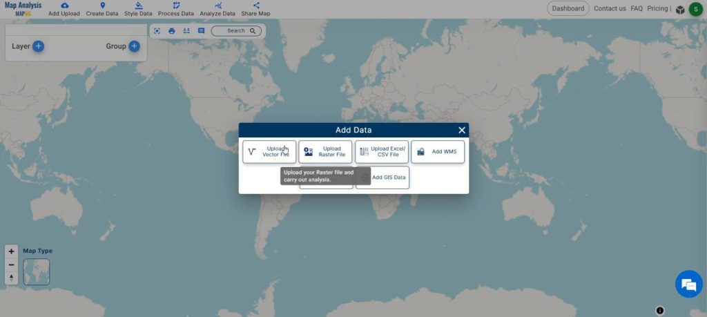
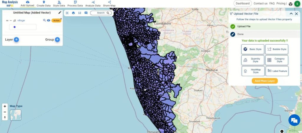
Open MAPOG’s map analysis tool and click on “Add upload.” Select “Upload Vector File” and choose the file containing the polygons you want to merge. Upload the file.
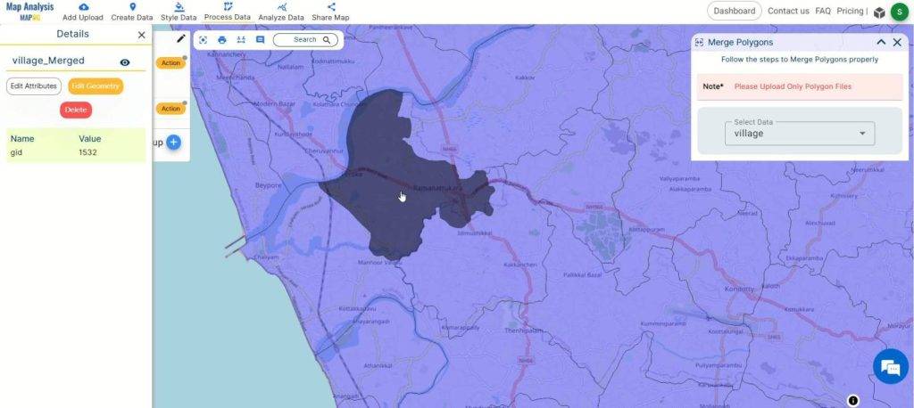
Access Merge Tool:
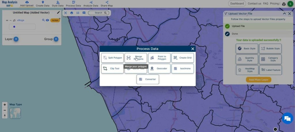
Go to the “Process Data” section and select the “Merge Tool” option.
Select Polygons:
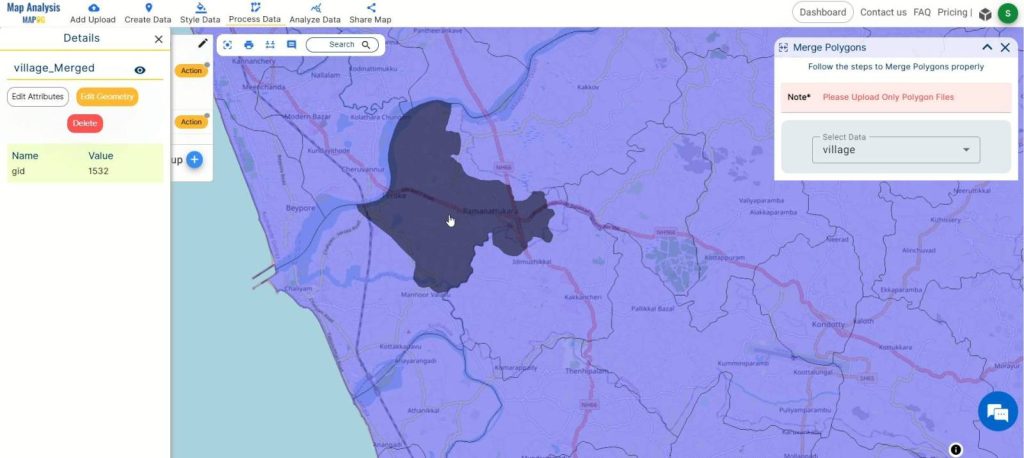
In the “Merge Polygon” tool, choose the dataset containing the polygons you wish to merge. Use the lasso tool or select manually to choose the specific polygons.
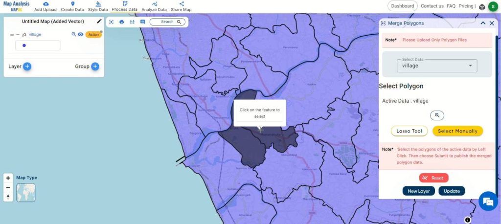
Decide whether you want to create a new layer with the merged polygons or update an existing layer. Select the appropriate option.
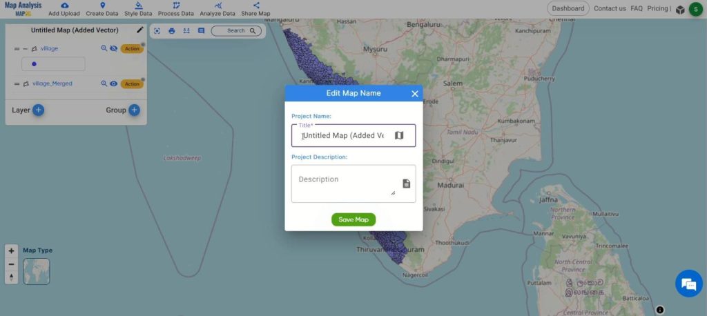
Finalize and Save:
Click on the pencil icon to rename the map if desired. Then, click “Save Map” to apply the changes and keep your data organized.
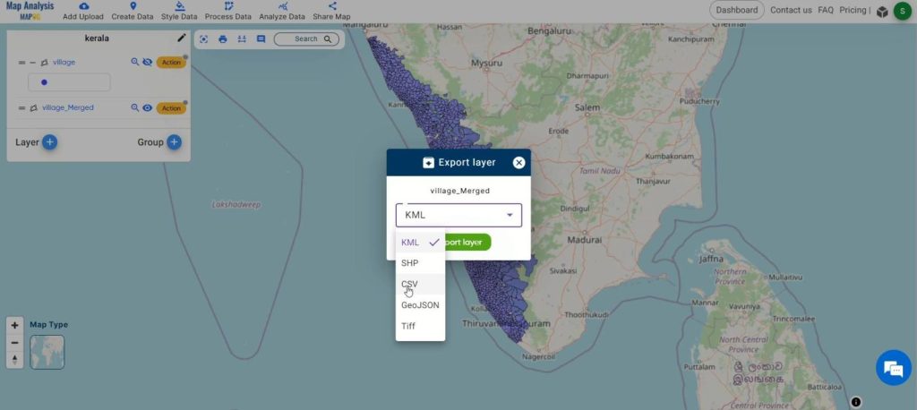
Export Data:
Optionally, click the action button to export the merged polygon layer in various formats for further analysis or sharing.
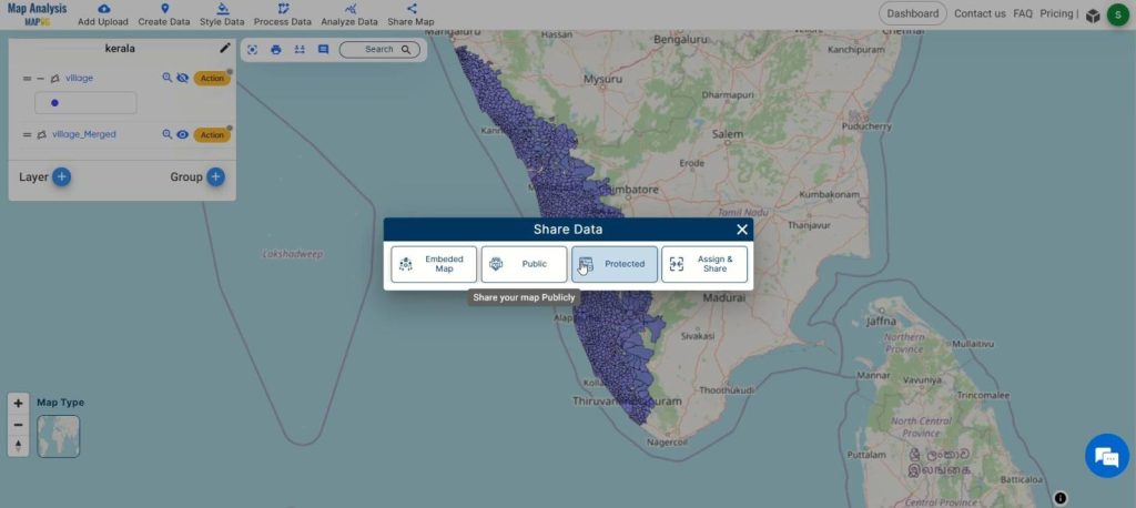
Share Findings:
Share your merged polygon layer effortlessly with colleagues or stakeholders by using the sharing options available in MAPOG.
Major Findings in Polygon Merging with MAPOG:
The process of merging polygons with MAPOG yields several significant findings. Firstly, it enhances data clarity by creating clearer boundaries, thereby improving the overall visualization of spatial data. This clarity contributes to simplified analysis, as the merged polygons streamline spatial data management, making it easier to analyze and interpret datasets. Moreover, the merging process facilitates more informed decision-making by providing users with a consolidated view of geographic information. It also optimizes resource utilization by reducing redundancy and eliminating overlapping polygons, leading to more efficient workflows. Additionally, merged polygons enable enhanced visualization of spatial patterns and relationships, aiding in data exploration and interpretation. Furthermore, MAPOG‘s polygon merging capabilities promote increased collaboration by providing a unified dataset that can be easily shared and analyzed by multiple stakeholders.
Domains and Industries Benefiting
- Urban Planning
- Environmental Management
- Infrastructure Development
- Real Estate
- Agriculture
- Emergency Management
- Transportation
- Utilities
- Natural Resource Management
- Government and Public Services
Conclusion
In summary, MAPOG‘s polygon merging feature offers valuable benefits across multiple industries, enhancing data clarity and decision-making. From urban planning to agriculture, its versatility streamlines spatial data management. For inquiries or assistance, contact us at support@mapog.com.
Other Articles
- Create a Map to find suitable sites for constructing a new house
- Create Map for Analyzing Water Quality using Heat Map Style
- Create Map – School Map Area Coverage Through Buffer Analysis
- Mapping Safety Create GIS Map : Game-Changing Approach to Hospital Risk Analysis
- Create Map for Real Estate Developer for Best Site Selection
- Create Map for Landfill Optimization: Spatial Analysis Approach
- Create Off-Road Hiking Routes: Using Bearing Angles and Distances
- Creating Safe Routes for Armies and Rescue Teams
- Mapping Tourist Spots Reachable Within an Hour with Isochrone Maps
- Analysis of Forest Fire and Map Risk Areas with Buffer Tool
- Mapping highway Buffer and Building Overlap Analysis – Extend Roads Width
- CREATING BUFFER MAPS TO IMPROVE THE SECURITY OF AIRPORTS AND OTHER INFRASTRUCTURES
- Digitalization of Road Networks by Drawing Line on Map