Let’s start journey of strategic real estate development with the power of spatial analysis for property location. Today, we unravel the challenges faced by real estate developers in finding the perfect spot. Let MAPOG Map Analysis guide you through the intricacies of strategic real estate insights in the unique landscape and spatial analysis for property location.
Key Concept to Create Map for Real Estate for Best Site Selection
At the core of our approach is the seamless fusion of GIS technology with location data, providing real estate developers with actionable insights. We prioritise a holistic analysis, addressing accessibility, market demand, and environmental factors. To enhance transparency, a data link used in this analysis will be provided at the end of the article, allowing for further exploration and informed decision-making in the real estate landscape.
Below are the steps tackling the challenge of optimal site selection in real estate
We address complexities using GIS technology with MAPOG, resolving issues related to accessibility, market demand, and environmental consideration with the power of spatial analysis for property location.Let’s navigate the process step by step:
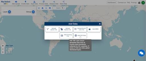
Step1: Add GIS data with MAPOG’s ‘Add GIS Data‘ tool: Lay the foundation for informed decision-making by incorporating geographic data into your analysis.
1. Click on the “Add Upload” button then choose the “Add GIS Data” tool.
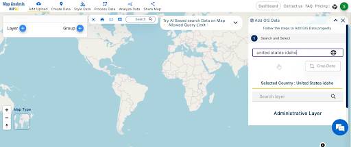
2. You can see the “Add GIS Data” Tool successfully open on the right side of your screen. Search the country name.
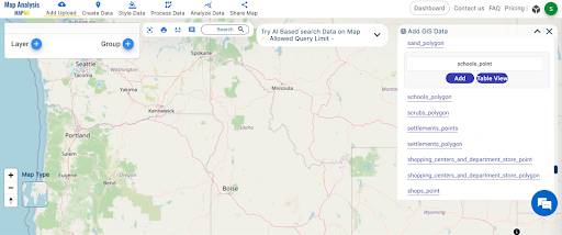
3. Select and add the school point data. similarly add the hospital and road data.
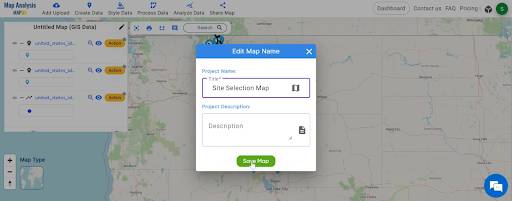
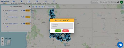
Step 2: Rename the Title and the layer
1.Click on the rename button on the left side of your untitled map. Name the untitled map and click on the “Save Map” option.
2. Change the layer name for better understanding.
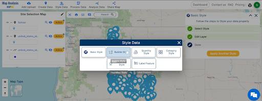
Step3: Visualize school data with the ‘Bubble Style‘ tool: Gain a comprehensive view of the educational landscape, identifying key areas for development.
1.Click on the “Style Data” option and choose the “Bubble Style” tool.
2. You can see the “Bubble Style” Tool successfully open on the right side of your school. Here select the school layer. Select the “Bubble Circle” option and then choose the bubble radius.
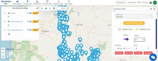
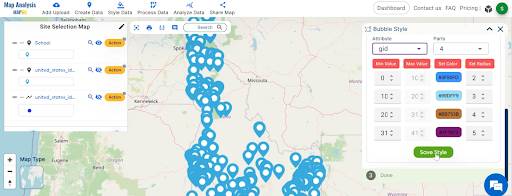
3. Now select the attribute and click on the save style option.
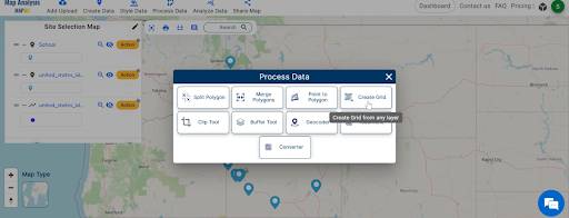
Step4: Grid creation for schools and hospitals: Establish a structured framework for analysis, ensuring thorough coverage of potential sites.
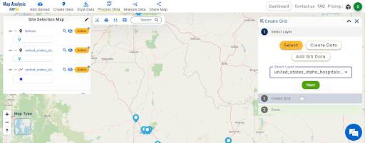
1.Click on the “Process Data” option then choose “Create Grid tool”.
2. Here, select the hospital layer. and click on the next option.
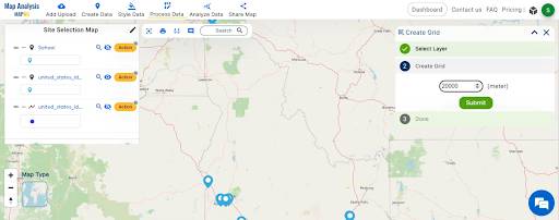
3.Choose the grid range and click on the submit button.
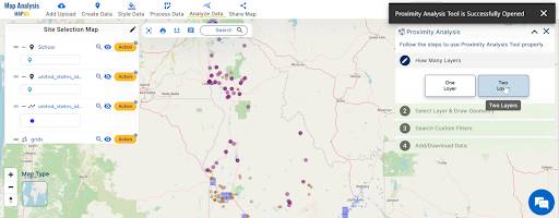
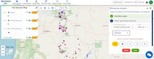
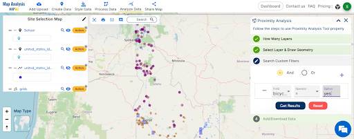
Step5: Uncover areas where schools lack road accessibility with Proximity Analysis:
Identify challenges and opportunities in real-time, refining your understanding of site suitability.
1. Click on the “Analyze data” option. And choose “Two Layers”.
2. Now the finding feature is the road layer. that are outside and the selected layer is schools and Click on the “Next” button.
3. Now choose the field “bicycle” and the option is “yes”.
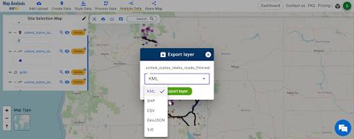
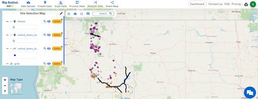
Step6: Explore sharing and exporting:
Tailor your findings for the real estate landscape, facilitating effective communication and collaboration among stakeholders.
Major Findings:
- Identify areas where schools lack road accessibility.
- Customise the findings to the unique landscape, providing location-specific insights.
- Arm developers with actionable information to make informed decisions.
- Provide a strategic edge by integrating critical insights into the decision-making process.
Main Domain and Industry:
Enter the realm of real estate development, where MAPOG seamlessly integrates GIS technology with location considerations, addressing accessibility, market demand, and environmental factors.
Conclusion:
‘Smart Site Selection with GIS: Strategic Real Estate Insights’ through MAPOG Map Analysis has demystified the complexities of real estate decision-making. By leveraging GIS technology, we’ve provided a clear pathway for developers to make informed choices. The integration of location-specific insights and data transparency empowers stakeholders, ensuring a strategic edge in site selection. Thank you for joining us on this journey of simplifying site selection, and we invite you to explore more tools for location analysis as you navigate the dynamic realm of real estate development.
Link of the Data:
Explore the data further through our GIS Data product, uncovering valuable information for in-depth analysis and understanding.
- United States of Idaho School Point
- United States of Idaho Road Lines
- United States of Idaho Hospital Point