Landfills, where various environmental factors interact to shape microclimates and hydrological patterns, represent complex ecosystems. Effective management and mitigation strategies require a thorough understanding of these landfill areas. Therefore, this article explores the integration of the MAPOG in GIS based Landfill Optimization.
If you are interested in creating Urban agriculture map, explore this article-Creating GIS Solutions for Urban Agriculture Map.
Key Concept for Landfill Optimization
Utilizing MAPOG, the key concept focuses on optimizing landfills by partitioning them for composting various waste types and establishing grids across buffer zones to analyze the microclimate of the landfill area. The article includes references to GIS Data utilized in this process.
To explore more tools in MAPOG, read this article-Biodiversity Conservation: Step-by-Step Guide to Clip Polygon for Effective Maps. You can also go through the article –Create Map for Real Estate Developer for Best Site Selection
Steps for Landfill Optimization
Step 1 Upload the data
To access the MAPOG Map analysis interface, navigate and click on the “Add Upload” option in the menu bar positioned at the upper left end. Then, proceed to select the “Add GIS Data” option to include the necessary data.
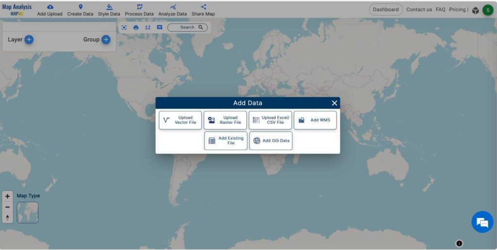
Using the AI search option or manually selecting, actively choose the area of study. Subsequently, scroll down to locate the landfill data. Finally, proceed to add the data to the platform by clicking on the “Add” button.
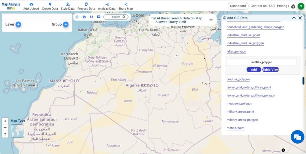
Click on the Add button to add the data to the platform, subsequently incorporating it into the system.
Step 2 Project Title
We successfully added GIS data. Now, we need to rename the untitled project and provide a project description in the description box.
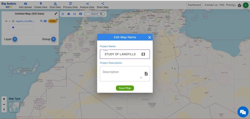
Additionally, we should proceed to the next step by ensuring the project has an appropriate title and detailed description entered in the designated fields.
Step -3 Rename the layers
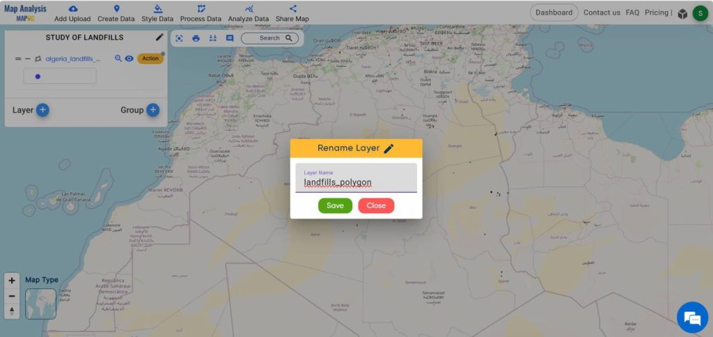
To improve comprehension, select the action button linked to the data layer and proceed to rename the landfill data layer.
Step -4 Styling
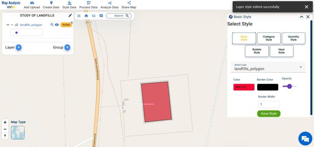
Click on the action button associated with the data layer to style your data with appropriate colors. Next, proceed to the edit style option, and then select the basic style option.
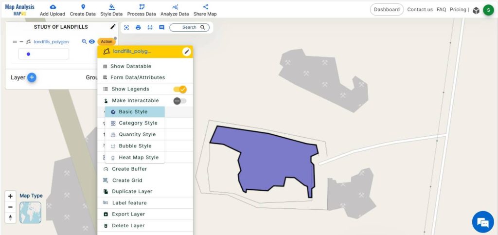
Select an appropriate color for your data and then save the chosen style.
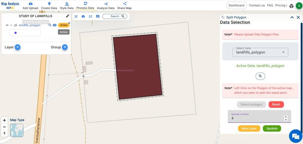
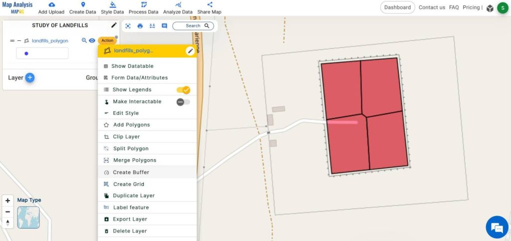
Step 5: Split polygon
Let’s divide these landfills into equal parts so that we can compost different types of waste.
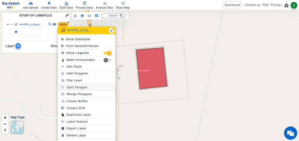
To accomplish this, move on to the action button of the landfill data layer, then utilize the split polygon tool by clicking on it. Afterward, select the polygon layer and specify the desired number of parts for the polygon to be split into before submitting the changes.
Step 6 Buffer Analysis
To create a buffer zone of 1000 meters around the landfill area, click on the action button within the landfill data layer.
Choose the Create buffer option, activate the dissolve option for enhanced outcomes, and then specify a range of 1000 meters before clicking Submit.
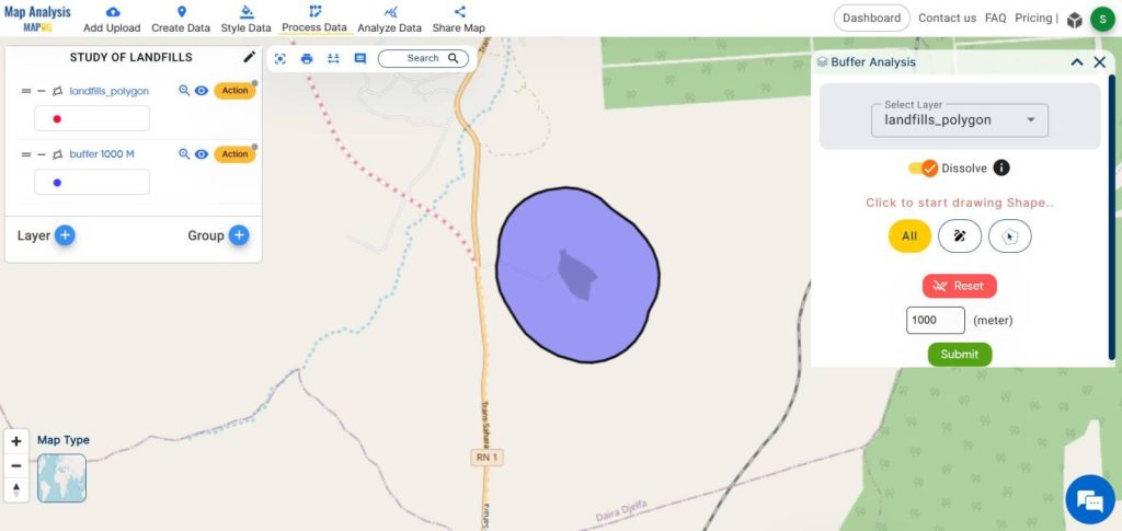
Successfully, a buffer zone of 1000 metres was added, and subsequently, the layer was renamed for better understanding.
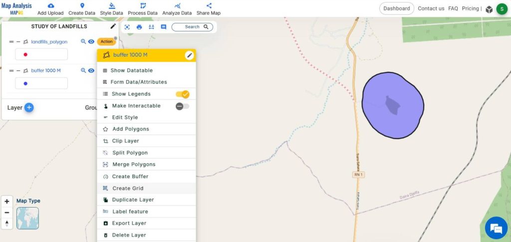
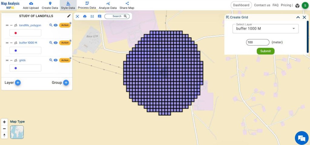
Step 7: Create grid
Let’s create a grid over these landfill buffer zones to study the microclimate and collect samples for research purposes. Begin by accessing the action button of the buffer data layer of landfill, then select the create grid tool. Next, choose the layer of landfill buffer data and set the range of the grid before submitting it.
Additionally, as users click on each grid, the screen will display the relevant information about that area.
Activate the annotation tool and utilize the mouse to indicate text on the grids, ensuring to click on it.
Step- 8 Share your map
Select the share data option to distribute this map to your friends and the public. You have the flexibility to either copy the link or send it directly.
This article will help you to find suitable sites for constructing a house- Create a Map to find suitable sites for constructing a new house.
Major Findings
- Efficient Land Use
- Environmental Protection
- Microclimate Analysis
- Sampling Site Identification
- Enhanced Waste Management
Domain and Industry
MAPOG directs our technological efforts, with a specific focus on the environmental pollution sector. In order to delve into landfill optimization, a combination of Geographic Information Systems (GIS) and spatial analysis is essential. Additionally, we must utilize advanced techniques to ensure effective research outcomes.
Conclusion
The findings emphasize the significance of adopting GIS platforms such as MAPOG for environmental research. Additionally, they provide a sturdy framework for assessing pollution levels, pinpointing contamination hotspots, and informing evidence-based management strategies.
GIS Data Links
Landfill data -https://mapanalysis.mapog.com/map-analysis/add-gis/landfills_polygon