Take a scenic trip through the mountains with us as we reveal the ideal fusion of technology and nature. Off-road hiking route using bearing angle and distance calculation becomes an immersive and smooth experience when you use MAPOG‘s revolutionary application. With the help of MAPOG, let’s explore the natural beauty of the surroundings and make sure that our walk in the breathtaking heights is one to remember. Begin your journey by the efficiency, safety, and success of military aviation of “Make Routes for Military Aerial Planning- Through Bearing angle and Distance calculation – Online Route Compass” that are contingent upon the precision of route compass tools and military aerial route planning.
Now we are on Google Play store also. Below is the link for download.

Route Compass Mobile App for calculating distance and bearing angle.
Key concepts for Creating Off-Road Hiking Routes
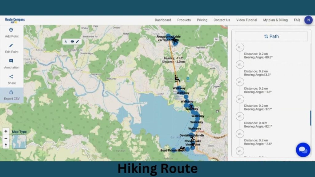
This is the comprehensive route output map that will be presented to us at the project’s conclusion. Our goal is to simply illustrate the trekking path. This map’s thematic quality is evident in its ability to provide meaningful details about the routes, landscapes, and viewpoints. Join us as we walk you through the process of making this effective map in MAPOG. Now let’s get started!
Create Off-road hiking route using bearing angle
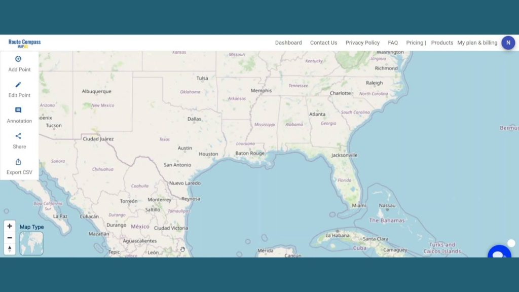
Step 1: Open Route Compass Tool
First, navigate to the Route Compass Tool.
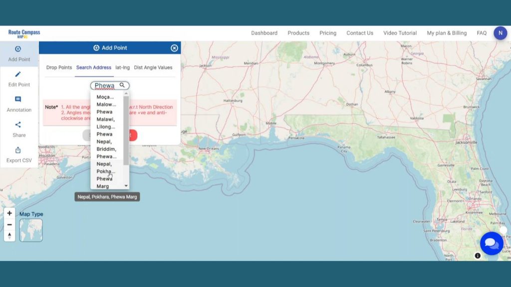
Step 2: Create Route:
Now, after coming to the Route Compass interface you’ll see a the Add point button click on the Search address button and search for the location you desire.
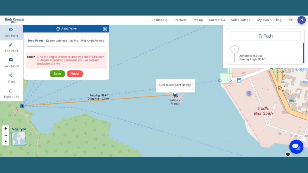
Step 3: Add Points
Now, let’s add the way points as per our source and destination. We’ll be adding the point by the lake and in between the mountains. And we’ll going to be only focusing on walkway routes, Viewpoints and temples in that area as we are making a hiking route. You can add as much points you want to make more enhanced and detailed route.
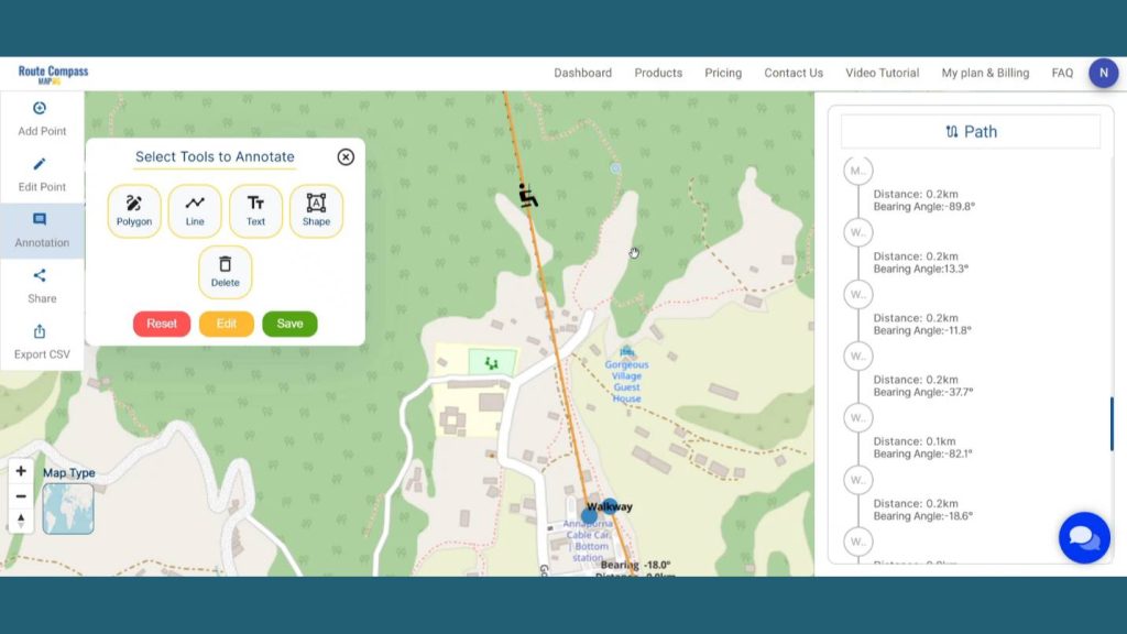
Step 4: Edit Points
To Edit any Point, click on the Edit Point option. You can Also Drag and change the location by simply clicking on the point and drag it. It let the user change the labels of the waypoints for better understanding.
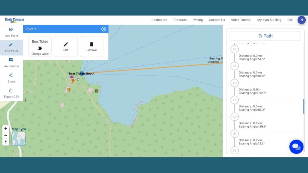
You can even view the distance and bearing angle between 2 points on the right side of the screen. It helps the user to get more detailed information about the route they are creating.
Step 5: Add Icons for better explanation
Additionally, MAPOG give the opportunity to enhance the map by adding the Icons. First go to the Annotation and click on shape button.
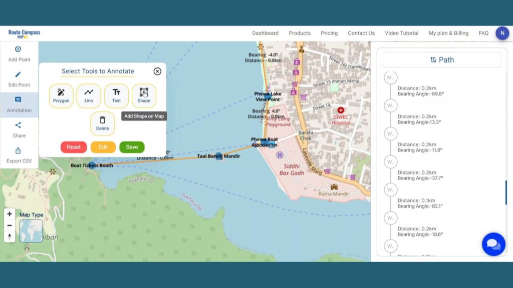
An icon box will open on the screen. Then you can search for a particular icon and drop it on the map. This lets the user explain the exact use of any particular path or location to provide context to the audience.
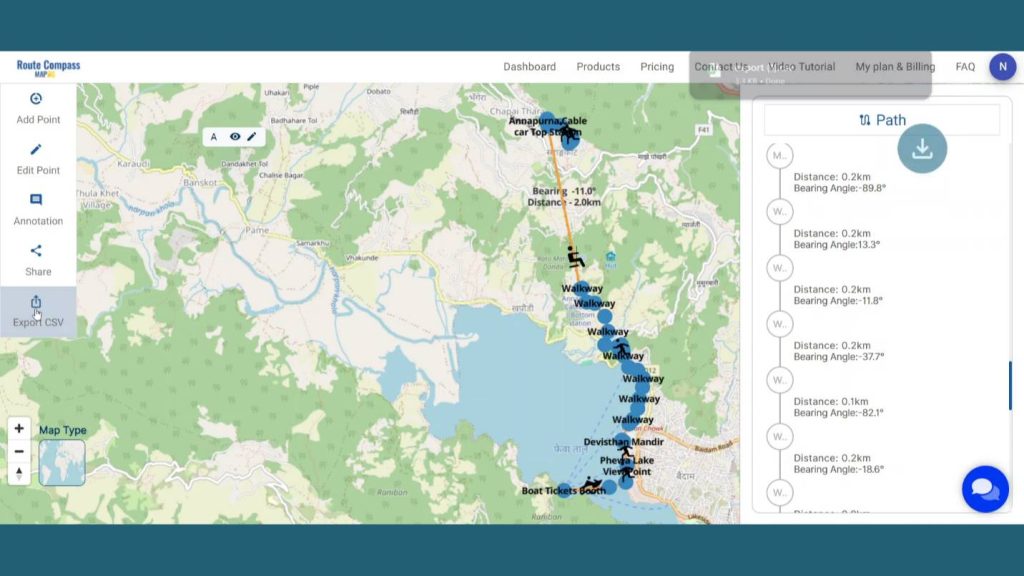
Step 6: Export in CSV
Here is an Export CSV option that let the user download the route data for further uses. The data come with all the details like distance latitude, longitude and bearing angle.
Step 7: Results & Analysis
With our map now enriched with details, let’s make those final adjustments. You’ve just crafted a thematic ROUTE map, a valuable asset for tourist experiences, promotes safety, and provides a valuable tool for travel agencies, adventure companies, and local businesses catering to trekking enthusiasts.
Major Findings
Enhanced Safety and Accuracy: MAPOG’s Route Compass tool ensures precise navigation, reducing lostness and enhancing safety during the hiking journey.
Optimized Adventure Experience: It optimizes hiking routes by considering terrain, elevation, and points of interest, enhancing the adventure experience and making it more enjoyable.
Efficient Resource Utilization for Tourism Industry: The mapped hiking routes can enhance tourism by optimizing adventure packages, enhancing resource utilization, and enhancing the overall tourist experience by tour operators.
Domain and Industry
This map is a powerful tool for Tourism and Hospitality, Outdoor Recreation and Adventure Sports, Mapping and GIS Services, and Technology and App Development, Local Businesses and Services and Educational and Research Institutions and Emergency Services. As the narrative unfolds, venture into the realm of urgent response with “Fast Emergency Response: Using GIS and Isochrone Maps for 10-Minute Ambulance Arrival“
Conclusion
I tailored on listening to my instincts among the diverse options provided by the advanced Route Compass of in my hiking trail design process. Plan Scenic Hiking Route with Route Compass Tool allows the visitors of MAPOG to receive all information regarding those stunning tourist objects. Therefore, the location will become the first one to travel to and those who came will trust it’s a positive experience for everyone.
Here are some other blogs you might be interested in
- Protecting Wetlands: Guide to Create GIS Map for Nature
- GIS Analysis in Urban Planning: Reshaping Transportation Future Insights of state/city
- Mapping Tiger Attack Hotspots – Create an Online Map and Share
- Mapping Healthcare Efficiency: GIS Buffer Analysis of Hospital Locations
- Add WMS- Two step online view of WMS layer on a map
- Plot ATM locations on a map and embed on your website
- Map habitat locations of endangered animals & keep track of their living
1 thought on “Create Off-Road Hiking Routes: Using Bearing Angles and Distances”