Our discussion focuses on “Creating GIS Solutions for Urban Agriculture Map,” delving into how GIS technology enables efficient planning and management for urban agriculture. This exploration offers insights into farmland distribution, urban encroachment risks, and potential mitigation strategies. Through GIS analysis, we aim to address the challenges faced by urban farmers and foster sustainable practices amidst urban expansion. Join us as we uncover the transformative potential of GIS solutions in reshaping urban agriculture landscapes.
Key Concept to Creating GIS Solutions for Urban Agriculture Map
Our aim is to demonstrate the practical applications of GIS technology in addressing the complex issues surrounding urban expansion and agriculture. Throughout this discussion, we’ll emphasize the importance of collaboration between farmers and city planners, drawing insights from recent articles such as “GIS Analysis in Urban Planning: Reshaping Transportation Future Insights of state/city” and “Make Routes for Military Aerial Planning- Through Bearing angle and Distance calculation – Online Route Compass“. Additionally, we’ll provide access to relevant data links for further exploration.
Unlocking the potential of MAPOG Analysis for enhancing urban agriculture is a straightforward process that empowers stakeholders to make informed decisions.
Let’s walk through a step-by-step example of how we can conduct this analysis:
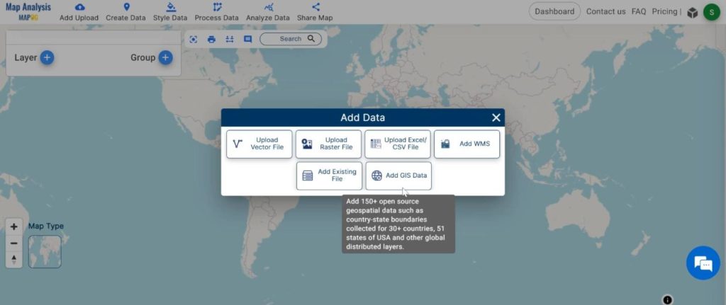
Step1: Adding Datasets:
Begin by importing the necessary datasets, including railway line data and city point data.
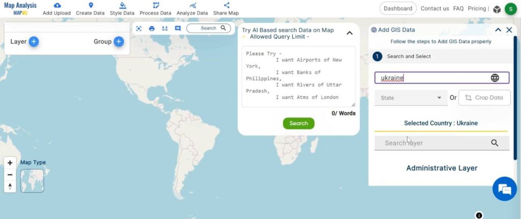
1.Click On the “Add Upload” button and choose the “Add GIS Data” option.
2.Search the country name
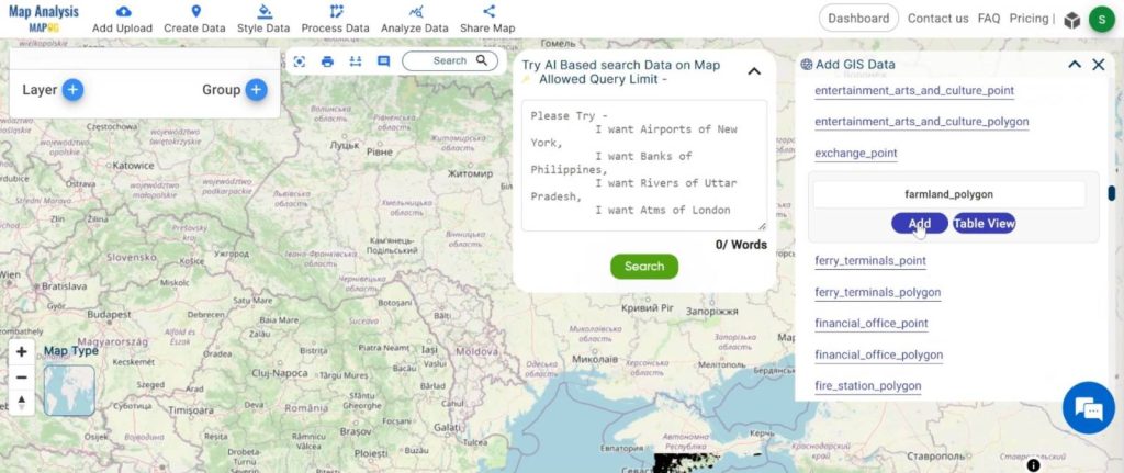
3.Add the Farmland and Settlement data. Click on the “Add” Option.
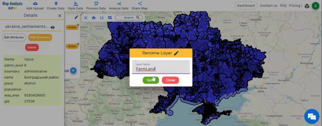
Step 2: Name the untitled map and Rename the layer:
1.Here you have to name the untitled map
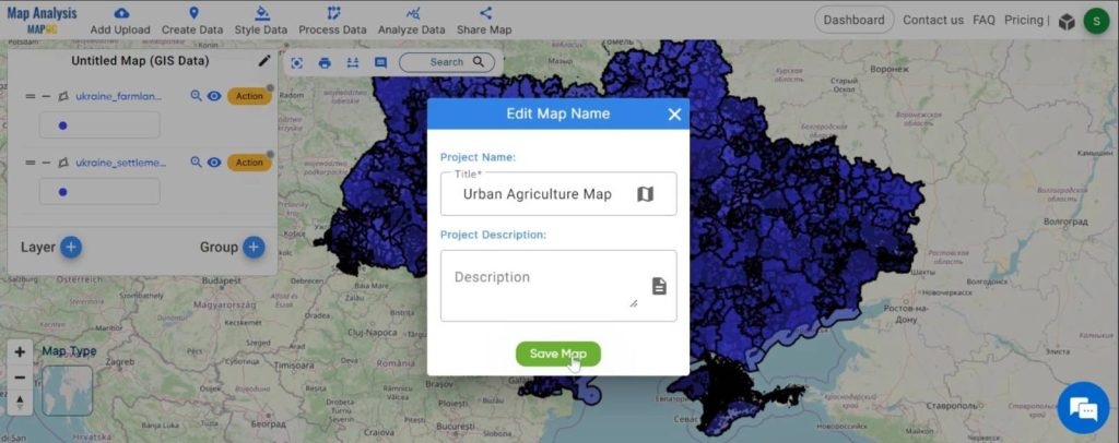
2.Rename the layer
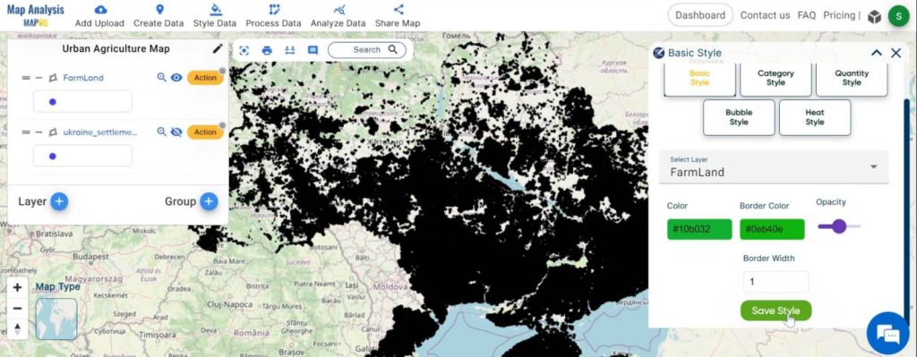
Step3: Styling Farmland:
Customise the visualisation of railway point data to ensure clear and accurate analysis of transportation networks.
1. Click on the ‘Style Data‘ button and choose the “Basic Style” option.
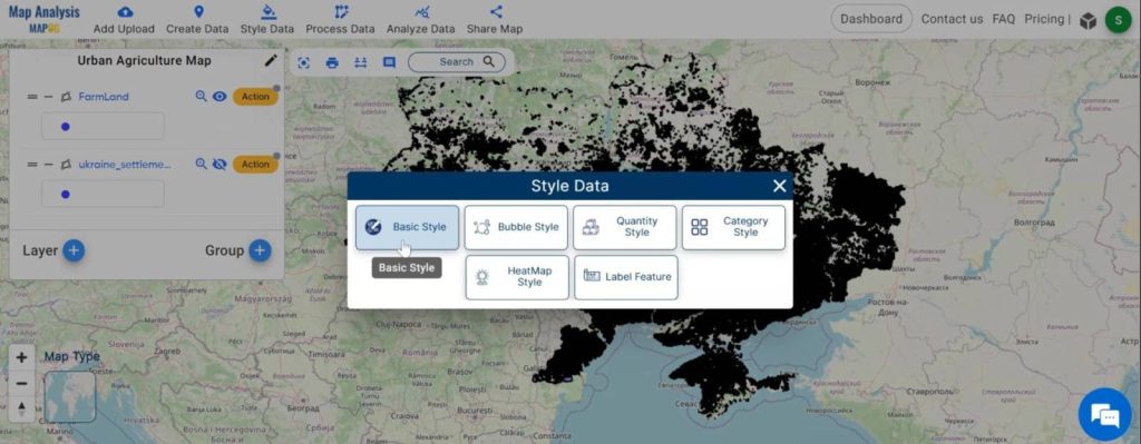
2.You can see the “Basic Style” Tool successfully opened on the right side of the screen.
Here, select the layer. then change the colour and click on the “Save Style”.
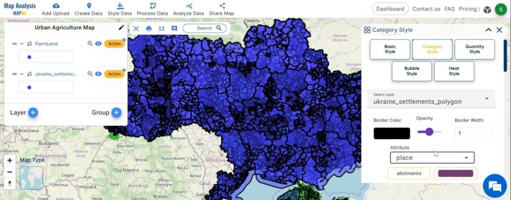
Step4: Category Styling:
Styling the Settlement to visually distinguish it from the Farmland polygons enhances clarity and comprehension of the farm- settlement interaction.
1.Click on the “Action” button and choose the “Category Style” option.
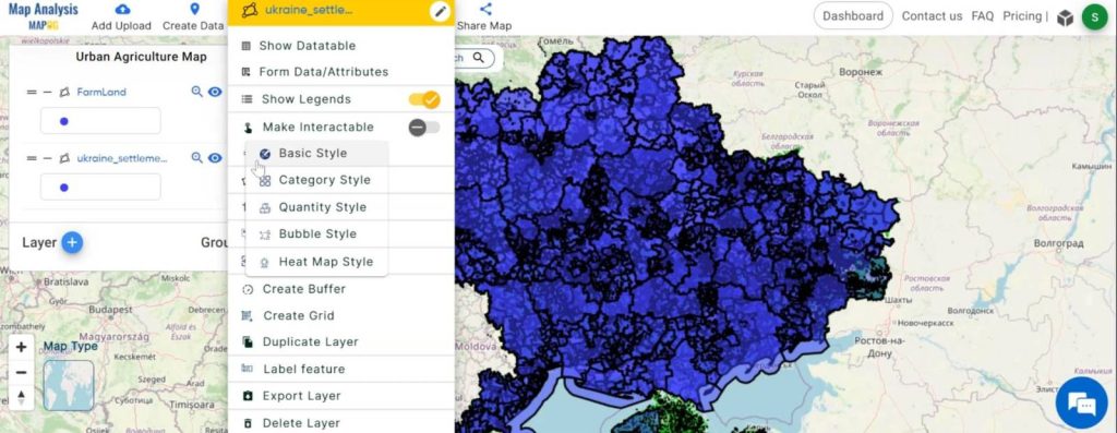
2.You can see the “Basic Style” Tool successfully opened on the right side of the screen.
Here, change the colour and click on the “Save Style”.
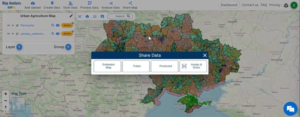
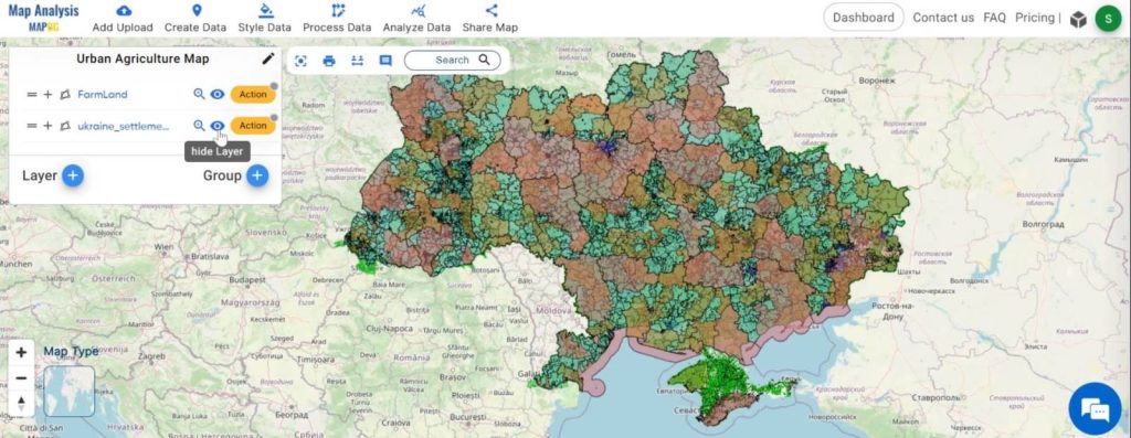
Step5: Sharing Data:
Export the generated maps showcasing transportation accessibility for stakeholder evaluation and decision-making.
Major Findings:
- MAP O G Analysis reveals transportation patterns and accessibility gaps in urban areas.
- Identification of areas requiring improvement empowers city planners and transportation agencies to prioritise investments and policy interventions.
- This analysis aids in enhancing transportation accessibility for all residents by informing data-driven decision-making.
Domain and Industry:
This article focuses on the intersection of agriculture and urban planning, highlighting the challenges and opportunities presented by urban expansion. By harnessing GIS technology, stakeholders can better understand the dynamics of land use and develop strategies to protect farmland, promote food security, and preserve natural habitats.
In conclusion, GIS solutions offer invaluable tools for managing land use conflicts and mitigating the impact of urbanisation on agriculture. By leveraging spatial analysis and collaboration, we can foster sustainable development practices that support the needs of both rural and urban communities. Moving forward, it’s essential to continue exploring innovative approaches to address the evolving challenges of urban growth and agricultural sustainability.
Link of the Data:
Explore the data further through our GIS Data product, uncovering valuable information for in-depth analysis and understanding.
Exploring Our Previous Blogs:
- GIS Analysis in Urban Planning: Reshaping Transportation Future Insights of state/city
- Make Routes for Military Aerial Planning- Through Bearing angle and Distance calculation – Online Route Compass
- Create Map for Real Estate Developer for Best Site Selection
- Biodiversity Conservation: Step-by-Step Guide to Clip Polygon for Effective Maps
- Create map online | Mapping Education Institute Places | Category Style based on type
- Mapping Zones With Specific Farming Fields : Planning Sustainable Irrigation
1 thought on “Creating GIS Solutions for Urban Agriculture Map”