In an era marked by evolving threats and heightened security concerns, the protection of vital infrastructure stands as a paramount imperative. In this article, we delve into the innovative approach of infrastructure protection through buffer analysis, highlighting its efficacy in safeguarding airports, power plants, transportation networks, and more. Join us as we explore how MAPOG helps to CREATE BUFFER MAPS TO IMPROVE SECURITY OF AIRPORTS AND OTHER INFRASTRUCTURES. Discover the power of proactive infrastructure protection and stay one step ahead in an ever-changing landscape, only with MAPOG MAP ANALYSIS.
KEY CONCEPTS
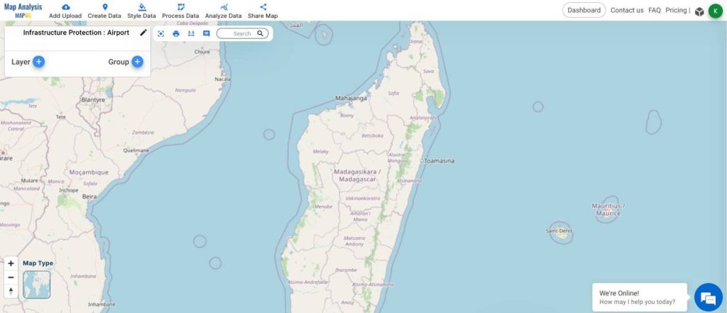
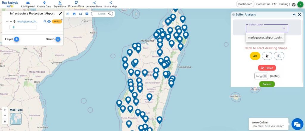
Our goal is to create a map of buffer zones around the Airports to help decision-makers make effective decisions for infrastructure Protection. For Demonstration purposes, we have taken the airports of Madagascar. Buffer zones have multiple applications, some of them are creating a map of school area coverage through buffer analysis and creating a map to find suitable sites for constructing a new house. All the GIS data used are available in MAPOG GIS DATA. and are linked at the end of the blog.
STEPS TO CREATE INFRASTRUCTURE PROTECTION MAP THROUGH BUFFER TOOL IN MAPOG.
Below are the steps to follow to create the Infrastructure protection Map through buffer analysis.
Step 01: Adding the DATA
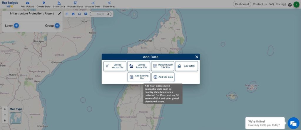
- Click on the ADD UPLOAD button from the top left.
- Click on ADD GIS DATA
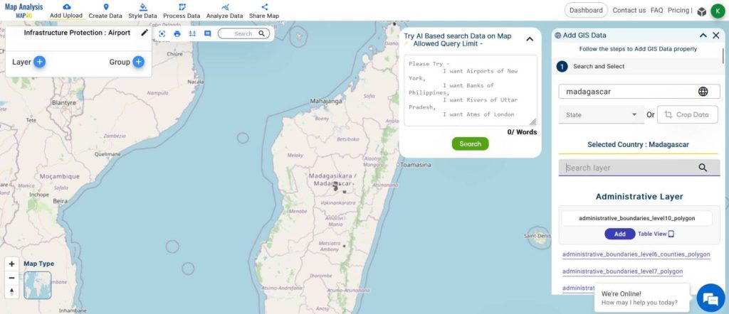
- Search for the Country from the window on the right.
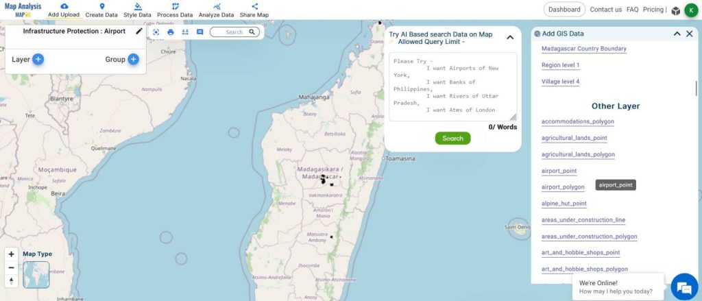
- Select the AIRPORT POINT layer and click ADD.
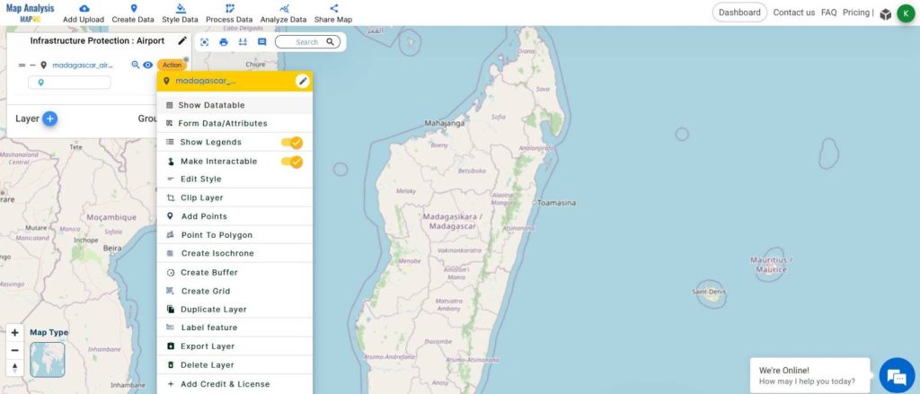
- You can check the attribute table by clicking on ACTION from the Layer Menu and Clicking SHOW DATA TABLE
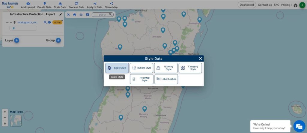
02: Styling the Points ( Optional )
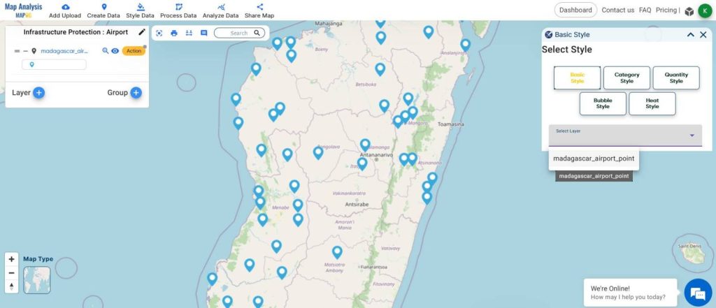
- From the STYLE DATA tool at the top, select basic styles.
- Choose the point layer from the select layer option.
- Select the required icon and hit SAVE STYLE.
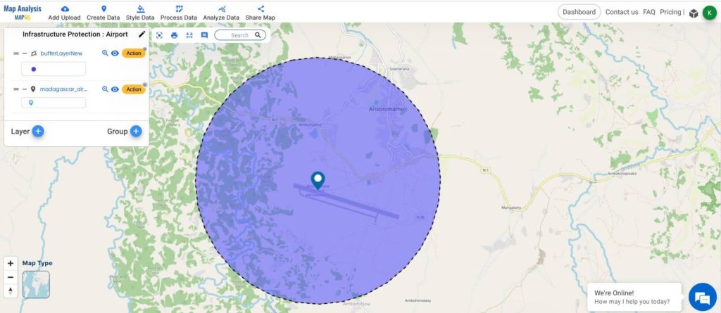
03: Creating Buffer Layer
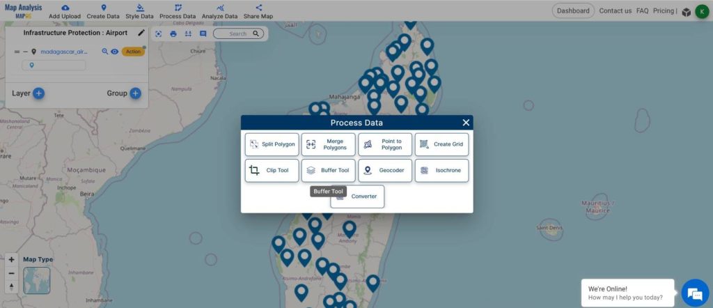
- From the top tools, click on PROCESS DATA and select BUFFER TOOL.
- Choose the points layer from the select layer option in the RIGHT SIDE window.
- Give the Range and click on Submit.

04: Final Output
- Zoom in to the map to observe the buffer clearly.
- Share the map using the SHARE MAP tool from the toolbar.
MAJOR FINDINGS
- The MAPOG MAP ANALYSIS helps in creating the buffer maps with ease.
- The tool is really good at helping teams make security decisions with proper data.
- The buffer analysis helps in knowing the areas surrounding the critical infrastructure.
BENEFICIAL DOMAIN: Infrastructure Management.
For infrastructure protection teams and security forces, the MAPOG Map Analysis emerges as an indispensable tool. Its robust capabilities in buffer analysis revolutionize the way critical assets are safeguarded. By precisely delineating buffer zones around infrastructure components, the tool enhances security measures and fortifies defenses effectively. MAPOG Map Analysis empowers teams with dynamic insights, enabling proactive planning and strategic decision-making to mitigate potential risks.
The MAPOG Map Analysis tool serves as a game-changer in infrastructure protection, offering essential features like buffer zone creation, dynamic mapping, and risk assessment. For any inquiries or support needs, feel free to contact us at support@mapog.com to ensure seamless assistance and optimize your infrastructure protection strategies.
CONCLUSION
Utilizing MAPOG Map Analysis for mapping regions analogous to critical infrastructure assists experts in formulating decisions aimed at enhancing the security and safety of these vital assets. By leveraging advanced buffer analysis techniques, teams can proactively identify vulnerabilities, establish security perimeters, and optimize resource allocation for maximum effectiveness.
The dynamic features and intuitive interface of MAPOG Map Analysis empower stakeholders to stay ahead of potential risks and adapt to evolving security challenges seamlessly. As we continue to navigate the complexities of safeguarding essential infrastructure, MAPOG remains committed to providing innovative solutions that enhance resilience and ensure the safety of our communities.
GIS DATA USED
VIEW OUR PREVIOUS BLOGS:
Creating Safe Routes for Armies and Rescue Teams
Creating Travel Guides: Mapping with GIS Buffer Zones
Airport Shopping Isochrone: Find Stores Within Your Time Frame
Plotting Airports on MAP: Simplifying Logistics and Planning
I’ve been browsing on-line greater than 3 hours lately, yet I never discovered any interesting article
like yours. Planning route for hiking best online tool.