In the realm of modern travel, where innovation meets wanderlust, “Creating Travel Guides: with GIS Buffer Zones” emerges as a beacon of exploration. Powered by cutting-edge Geographic Information Systems (GIS) technology, using the user-friendly MAPOG Map Analysis tool. This groundbreaking endeavour seamlessly connects travellers with an array of tourist spots within easy reach of airports. From data collection to final styling touches, every step is meticulously crafted to enhance the travel experience, transcending traditional limitations and transforming journeys into dynamic adventures waiting to be mapped.
Key Concept for Creating Travel Guides
In our groundbreaking initiative, “Creating Travel Guides: Mapping Your Journey with GIS,” the key concept lies in seamlessly connecting travellers with nearby tourist spots through innovative Geographic Information Systems (GIS) technology. Much like our other endeavours, such as “Creating Safe Routes for Armies and Rescue Teams” and “GIS Analysis in Urban Planning: Reshaping Transportation” this project exemplifies our commitment to leveraging GIS for practical solutions in diverse domains. As we unveil this exciting journey, stay tuned until the end of the video, where we’ll provide access to the data, empowering adventurers to embark on their own mapped explorations.
Embarking on a journey of GIS exploration, we present a systematic guide to materialize our mapping analysis, akin to unfolding a treasure map leading to hidden gems near airports. Picture this as your compass, guiding you through the intricacies of connecting airport data with tourist spot information seamlessly.
Below, we break down the step-by-step process that demystifies our GIS endeavor, transforming it into an accessible and enlightening adventure, akin to charting a course through uncharted territories.
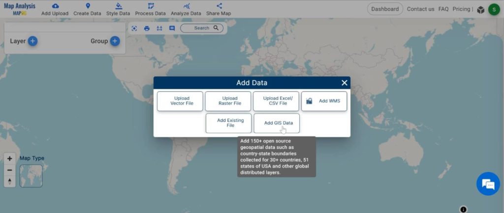
Step1 : Add the Data
Integrate the crucial dataset into our analysis, enhancing the depth and accuracy of our mapping endeavor.
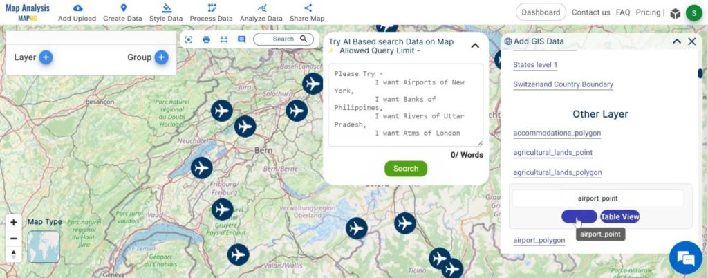
1. Click On the “Add Upload” button and choose “Add GIS Data” option.
2.Search the country name
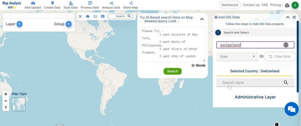
3.Add the Airport and Tourism point Data. Click on the “Add” Option.
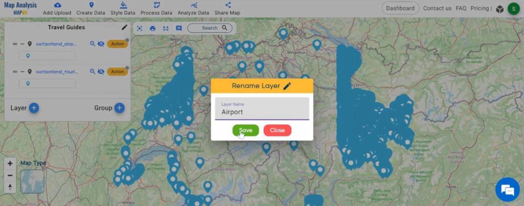
Step2 : Name Untitled Map and Layer:
Here you have to name the untitled map
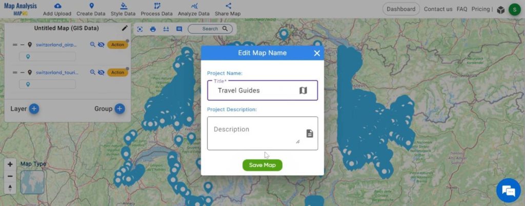
Rename the Layer
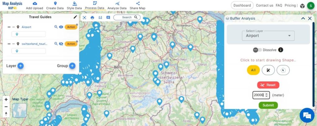
Step3: Buffer Creation:
Employing airport data, we create Buffers, delineating travel time boundaries, providing a visual representation of your exploration radius from the airport.
- Click On the “Process Data” button and choose the “Buffer Tool” option.
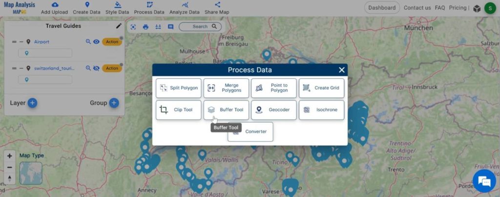
2. Now select the layer and set the buffer range. And click on the “Submit” button.
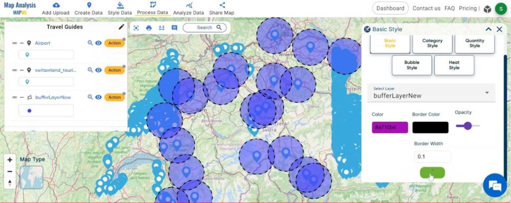
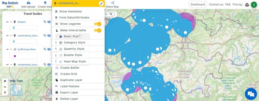
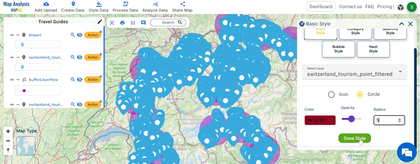
Step4: Buffer Styling:
These Buffers are meticulously styled to offer visual cues of accessibility, with darker shades denoting longer travel times, thereby aiding in efficient itinerary planning.
- Click on the “Action” button and choose the “Basic Style” from “Style Data”.
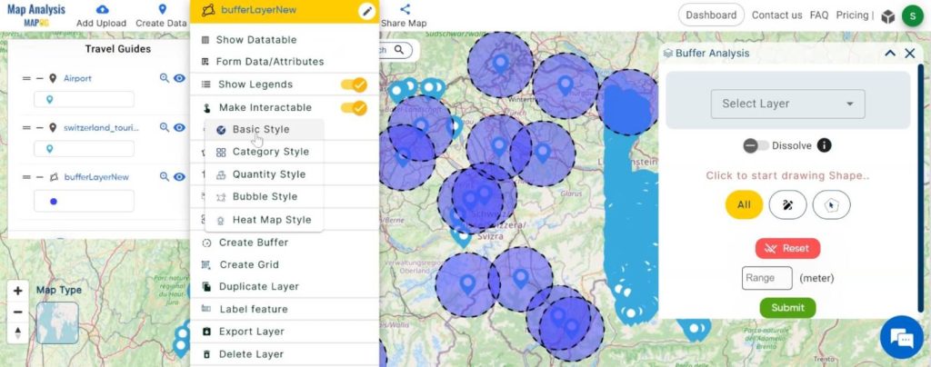
2. Here, set the color and click on the “Save Style” button.
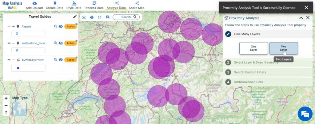
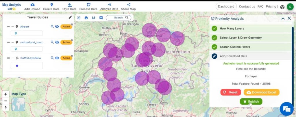
Step4: Proximity Analysis:
Utilizing proximity analysis, we pinpoint the nearest tourist spots within a radius of 20,000 meters from the airports, enabling you to focus on destinations seamlessly fitting into your travel plans.
1. Click on the “Analyze Data” button and choose “Two Layer”.
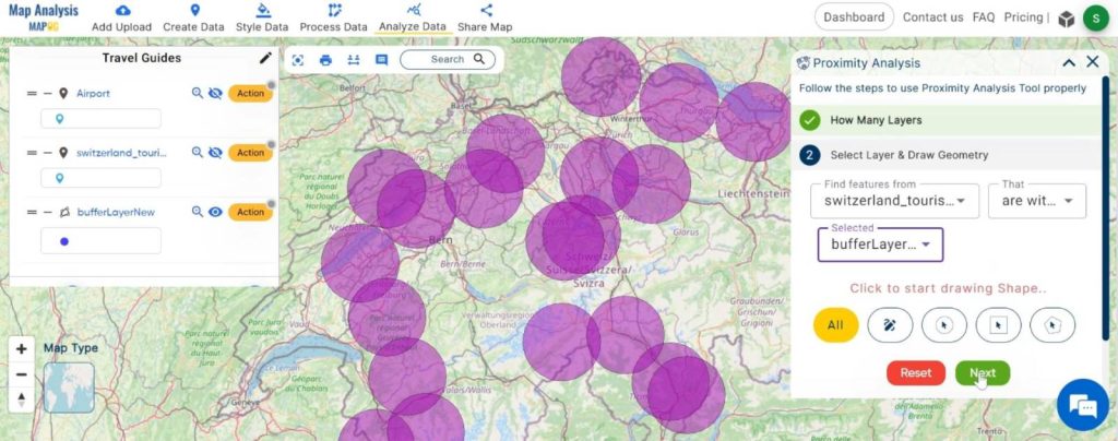
2. Here, select the finding feature and selected layer and click on the “Next” button.
3.Choose the field and write the option and click on the “Get Result” option.
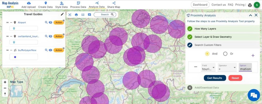
4. We can see the finding feature.
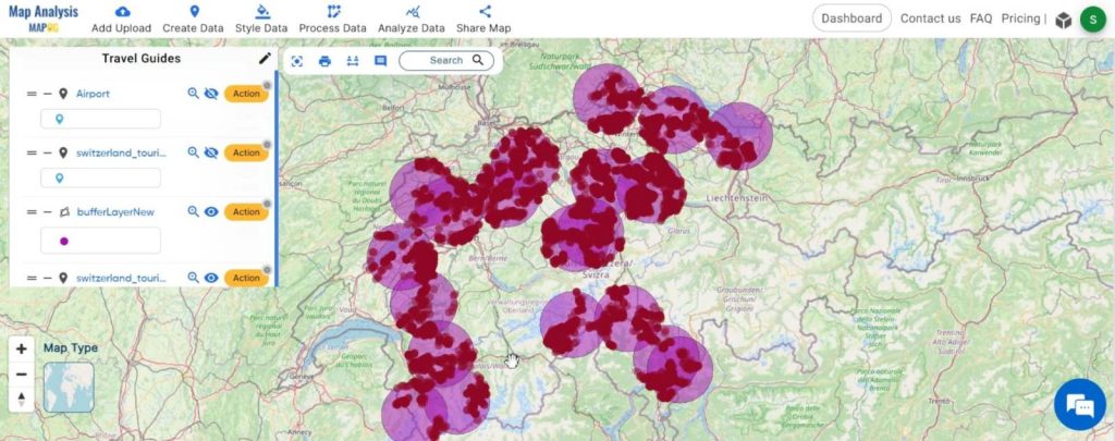
Step5: Styling the Final Result:
Integrating road data further enhances your experience, offering a comprehensive view of the major travel arteries connecting you to your chosen destinations.
- Click on the “Action” button and choose the “Basic Style” from “Style Data”.
2. Here, set the color and click on the “Save Style” button.
Step6: share the map:
Enable travelers to easily share customized maps with friends, family, or fellow adventurers, fostering collaboration and enhancing the exploration experience.
Major Findings:
- Optimal Travel Routes: Our analysis unveils the most efficient and picturesque travel routes from airports to nearby tourist spots, ensuring travelers can embark on seamless journeys.
- Enhanced Accessibility: By pinpointing tourist spots within a radius of 20,000 meters from airports, we facilitate easy access to a diverse array of attractions, enriching the exploration experience.
- Categorised Tourist Spots: The styled tourist spot data allows for swift identification of various categories, such as historical sites or scenic landscapes, catering to diverse traveller preferences and interests.
- Comprehensive Road Network: Integration of road data provides travelers with a comprehensive view of major travel arteries, enabling informed decision-making and smoother navigation throughout their journey.
In conclusion, our MAPOG analysis in Tourism and Hospitality has revolutionised travel planning, seamlessly connecting airports with nearby tourist spots. By optimising travel routes and categorising attractions, we’ve empowered travellers with comprehensive guides to explore with confidence. As we continue to innovate, we invite adventurers to embark on mapped explorations, unlocking unforgettable experiences and new horizons. Let MAPOG Map Analysis be your compass as you navigate the world of adventure and discovery.
Link of the Data:
Explore the data further through our GIS Data product, uncovering valuable information for in-depth analysis and understanding.
Exploring Our Previous Blogs:
- GIS Analysis in Urban Planning: Reshaping Transportation Future Insights of state/city
- Make Routes for Military Aerial Planning- Through Bearing angle and Distance calculation – Online Route Compass
- Creating Safe Routes for Armies and Rescue Teams
- Create Off-Road Hiking Routes: Using Bearing Angles and Distances
- CREATING BUFFER MAPS TO IMPROVE THE SECURITY OF AIRPORTS AND OTHER INFRASTRUCTURES
- Precision Agriculture: Using GIS Buffer Zones for Eco-Friendly Fertilizer Management
- Empowering Sustainable Agriculture: A Guide to Precision Soil Mapping and Labeling with GIS
- Create Map, and Analyze: Optimizing Bank Branch Locations
- Precision Agriculture: Using GIS Buffer Zones for Eco-Friendly Fertilizer Management
- Petrol Pump Accessibility: A Spatial Analysis Guide Using Buffer Zones