Welcome to MAPOG, your guide to exciting adventures! Today, we’re delving into Isochrone Maps—a cool feature that aids in mapping tourist spots nearby within an hour. Join us as we explore how MAPOG makes it incredibly easy to discover interesting places you can reach quickly. Let’s make planning your next adventure a breeze with MAPOG‘s simple and enjoyable Isochrone Maps!
Key Concept:
MAPOG stands at the forefront of adventure planning with its groundbreaking Isochrone Maps feature, offering a seamless way to discover nearby tourist spots within an hour. This user-friendly tool transforms exploration into a simplified and enjoyable experience, redefining how we plan our journeys.
Moreover, within the MAPOG ecosystem, you can explore a broader array of related articles, enhancing the versatility of MAPOG. From agricultural land assessment to collaborative mapping, MAPOG offers a suite of innovative features, making it a holistic solution for various map-related endeavors. Check out these interconnected resources for a deeper understanding and unlock the full potential of MAPOG in your exploration and analysis journey.
- Articles: Make Routes for Military Aerial Planning- Through Bearing angle and Distance calculation – Online Route Compass
- Articles: GIS Analysis in Urban Planning: Reshaping Transportation Future Insights of state/city
Step-by-Step Process for Isochrone Mapping with MAPOG:
- Access MAPOG Platform: Begin by logging into the MAPOG platform, your gateway to simplified adventure planning.
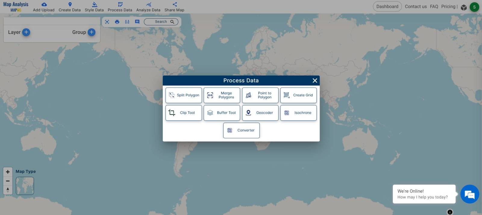
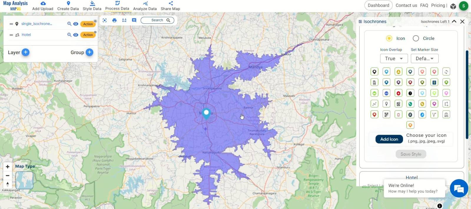
- Initiate Isochrone Mapping Tool: Access the map analysis tool, click on “Process Data,” and choose the Isochrone tool to discover places within your preferred travel time.
- Choose Travel Time Preferences: Set your travel time preferences by selecting “Create Point Manually” within the Isochrone tool. Customize modes of transportation and desired duration for an accurate analysis.
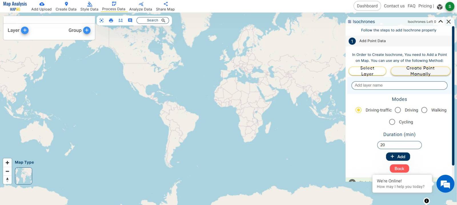
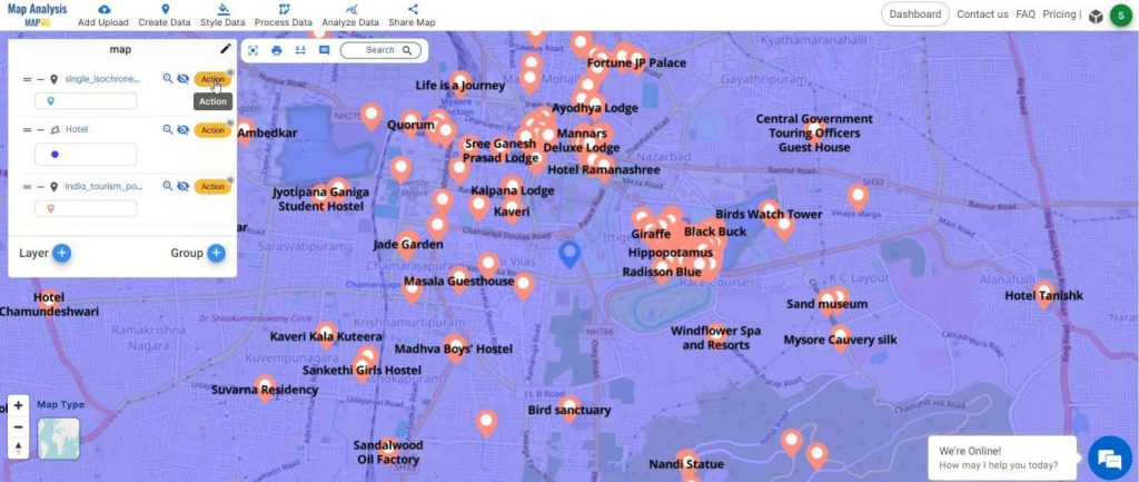
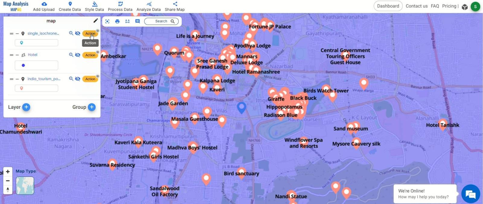
- Generate Isochrone Map: Generate a 60-minute isochrone around your chosen point to identify areas you can reach within the specified time frame. Here we choose a point which is our staying hotel as our starting point
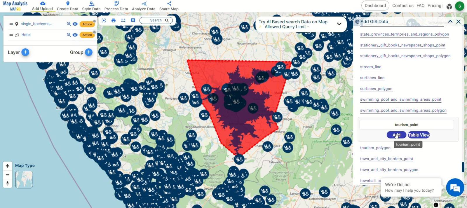
- Incorporate Tourist Spot Data: Utilize the GIS Data tool within the Add Upload option to bring in tourist spot data. Select the file, click “Add,” and easily clip the area you want to explore.
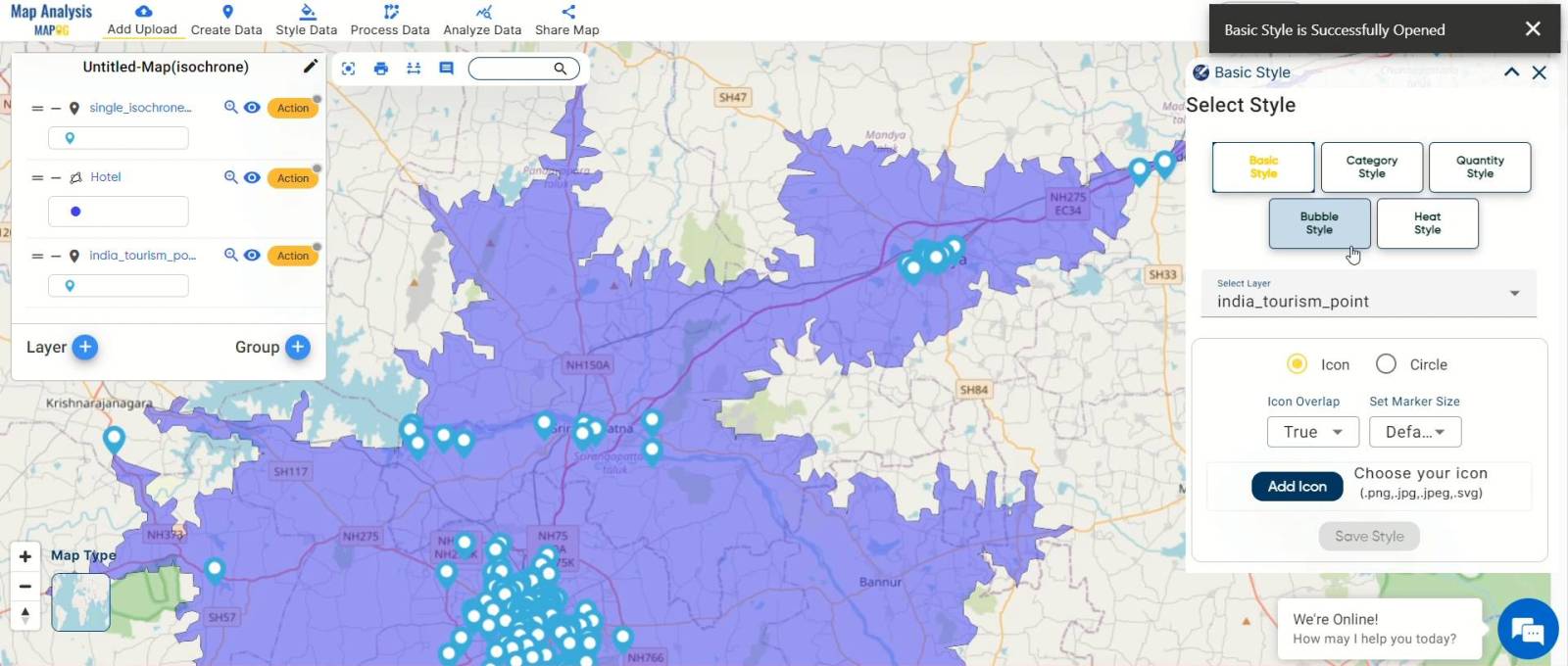
- Adjust Layer Appearance: Access the action button to customize the appearance of your layers. Choose “Edit Style” and opt for the basic style to simplify and enhance the visual representation.
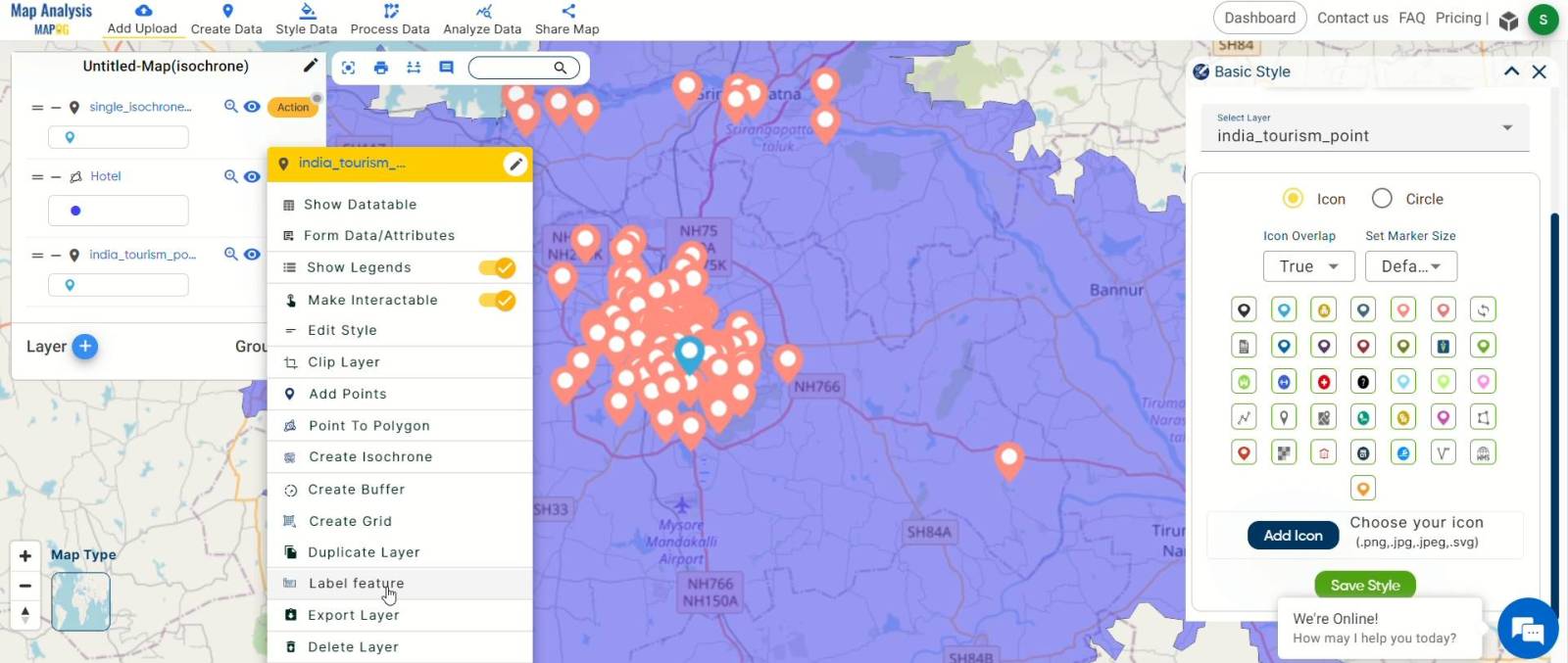
- Label Tourist Spots: Ensure a user-friendly experience by labeling tourist spots using the “Label Feature” option in the action button of the tourist spot layer.
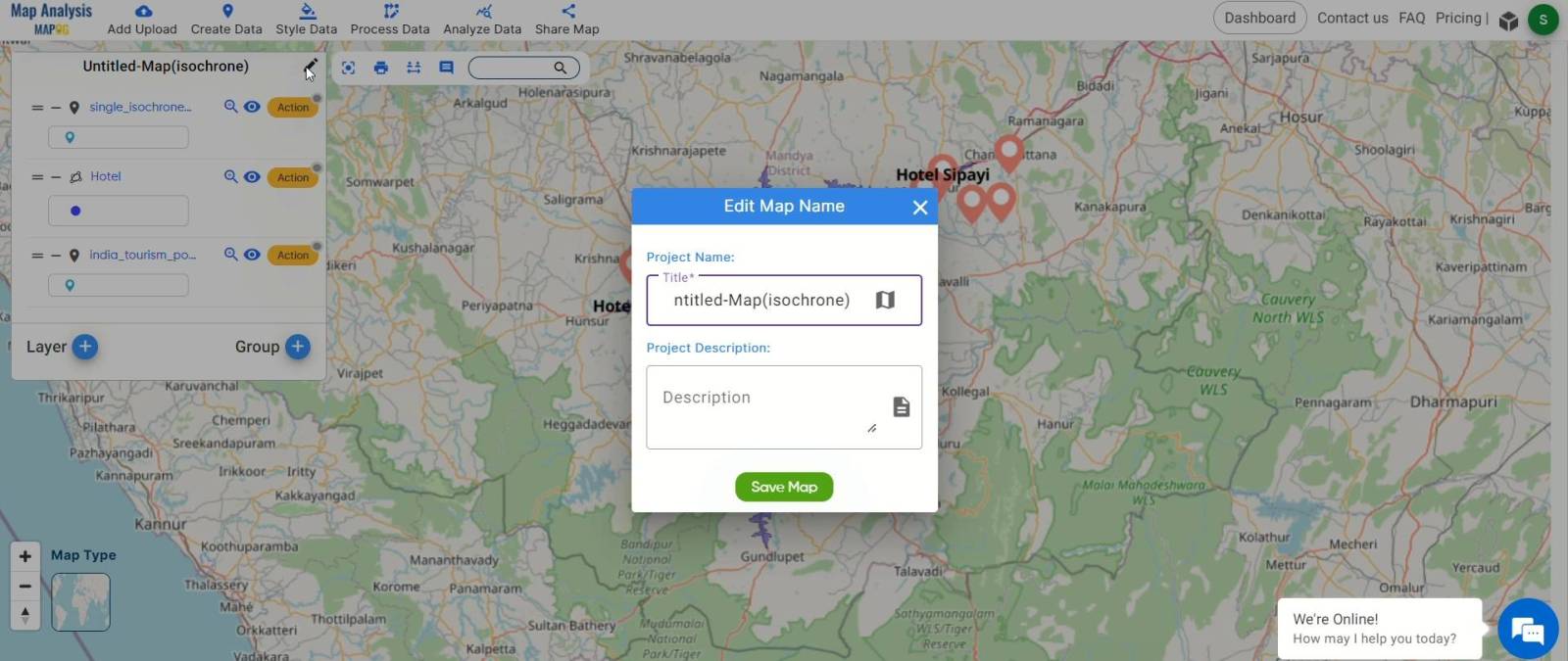
- Organize and Save: Keep your project organized by renaming your map. Click the pencil icon, choose a fitting name, and hit “Save Map” to streamline your adventure planning.
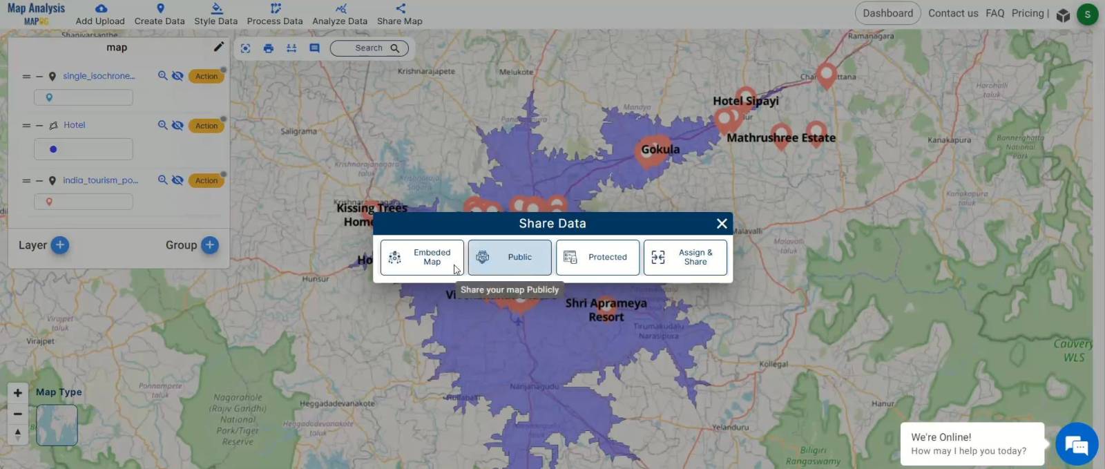
- Share with Ease: Share your exciting findings effortlessly with friends or travel buddies. MAPOG allows you to share your Isochrone Map, building anticipation for upcoming adventures.
Explore the world with confidence, guided by MAPOG‘s step-by-step Isochrone Mapping process for a simplified and enjoyable adventure planning experience.
Major Findings in Isochrone Mapping with MAPOG:
- Efficient Spot Identification: MAPOG swiftly identifies nearby tourist spots within specified travel times, streamlining the discovery process.
- Customizable Preferences: Users can easily personalize travel preferences, ensuring accurate and tailored analyses.
- Clear Visuals: MAPOG‘s “Edit Style” feature ensures a clear and simplified visual representation of isochrone maps.
- Seamless Data Integration: GIS Data tool integration enables the incorporation of tourist spot data, offering a comprehensive view.
- User-Friendly Labeling: MAPOG‘s “Label Feature” enhances user-friendliness, allowing easy labeling of tourist spots for clear navigation.
- Significance of Analysis: Users gain insights into how Isochrone Mapping efficiently identifies tourist spots, aiding in effective exploration planning.
Domains and Industries Benefiting
- Travel and Tourism
- Urban Planning
- Real Estate
- Transportation and Logistics
- Hospitality and Leisure
- Emergency Services
- Market Research
- Outdoor Recreation
- Education and Research
- Local Businesses
- Event Planning
Conclusion
In conclusion, Isochrone Mapping with MAPOG emerges as a versatile tool, shaping efficient decision-making across industries; for inquiries and support, reach out to us at support@mapog.com, marking a significant step towards a more informed, sustainable, and efficient future.
Other Articles
- Protecting Wetlands: Guide to Create GIS Map for Nature
- GIS Analysis in Urban Planning: Reshaping Transportation Future Insights of state/city
- Fast Emergency Response: Using GIS and Isochrone Maps for 10-Minute Ambulance Arrival
- Mapping Tiger Attack Hotspots – Create an Online Map and Share
- Make Routes for Military Aerial Planning- Through Bearing angle and Distance calculation – Online Route Compass
- Mapping Healthcare Efficiency: GIS Buffer Analysis of Hospital Locations
- Add WMS- Two step online view of WMS layer on a map
- Plot ATM locations on a map and embed on your website
- Map habitat locations of endangered animals & keep track of their living
- Create Map on Literacy Rate
- Create Map – DIGITIZING SOLAR, HYDROELECTRIC, WIND AND BIOMASS POWER PLANTS – RENEWABLE ENERGY
- Create a Map to find suitable sites for constructing a new house
- Create Map for Analyzing Water Quality using Heat Map Style
- Create Map – School Map Area Coverage Through Buffer Analysis
- Mapping Safety Create GIS Map : Game-Changing Approach to Hospital Risk Analysis
- Create Map for Real Estate Developer for Best Site Selection
- Create Map for Landfill Optimization: Spatial Analysis Approach
- Create Off-Road Hiking Routes: Using Bearing Angles and Distances
- Creating Safe Routes for Armies and Rescue Teams
2 thoughts on “Mapping Tourist Spots Reachable Within an Hour with Isochrone Maps”