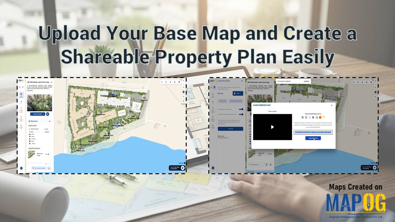
Upload Your Base Map and Create a Shareable Property Plan Easily
Static floor plans often confuse potential buyers because they lack real-world context. Brokers and developers struggle to convey a lifestyle when using a static PDF. Therefore, you should Upload Your Base Map and Create a Shareable Property Plan Easily to bridge this gap. By leveraging the MAPOG georeferencing capability, you transform a simple layout image … Read more