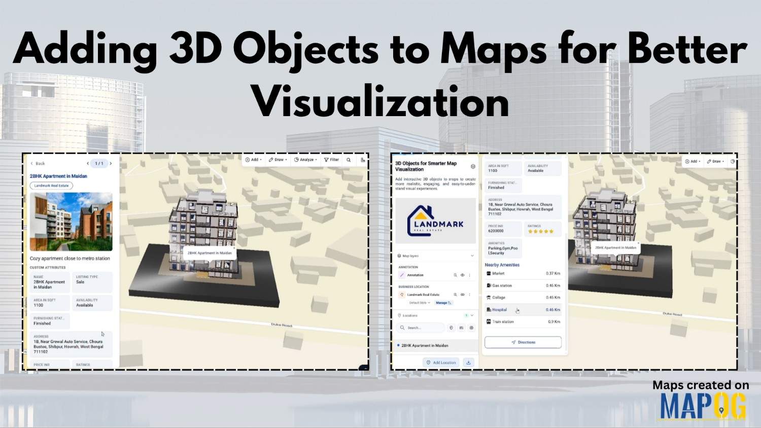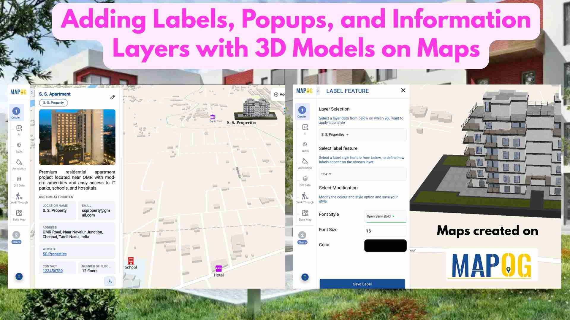
Adding Labels, Popups, and Information Layers with 3D Models on Maps
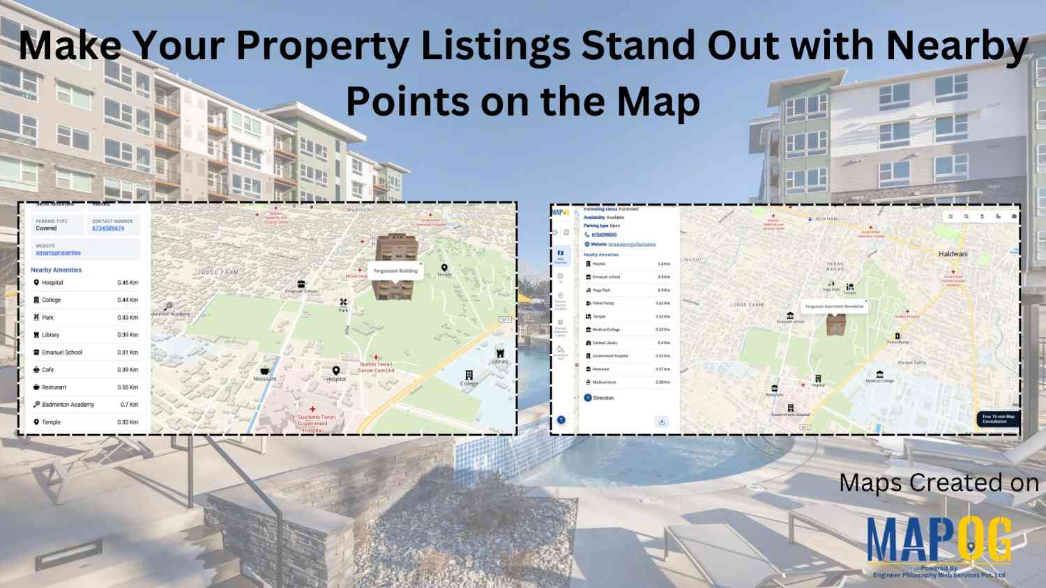
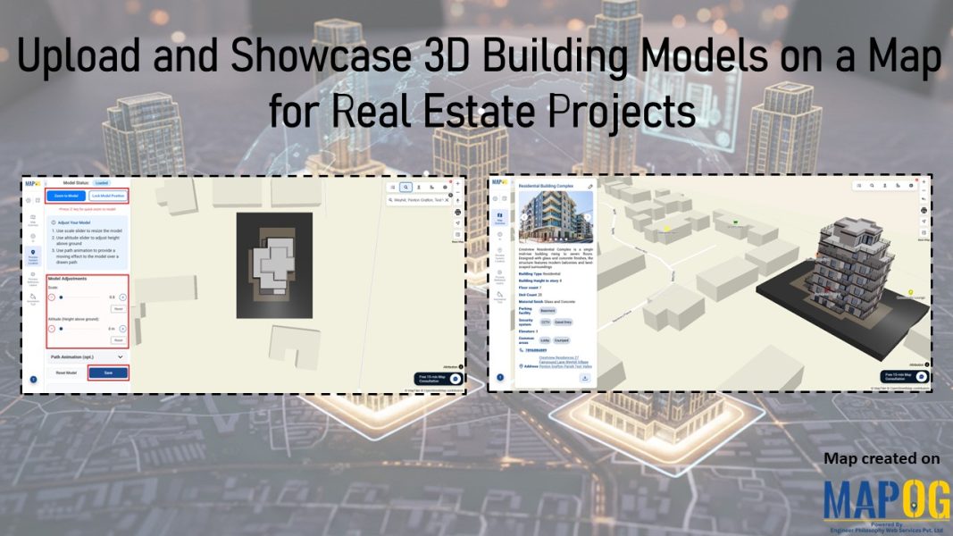
In real estate, property data is often scattered across multiple platforms, making it hard to compare options and gain clear insights. This lack of visibility slows decision-making. Today, clear and precise data visualization is essential for smarter property decisions. With MAPOG, developers can layer filters onto a property map and enhance listings using Information Layers … Read more