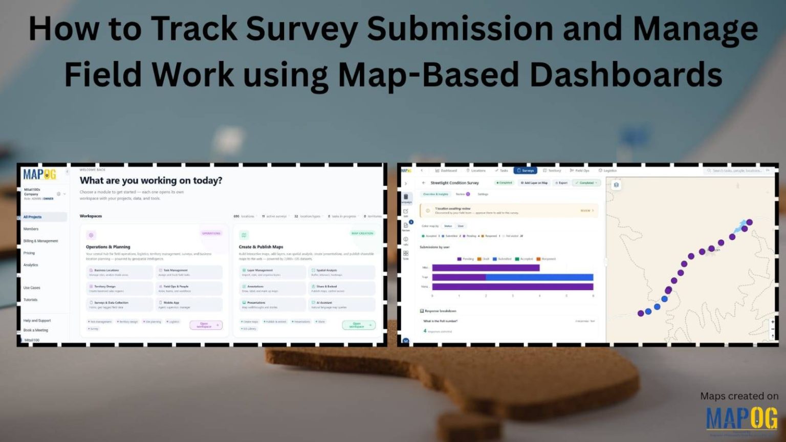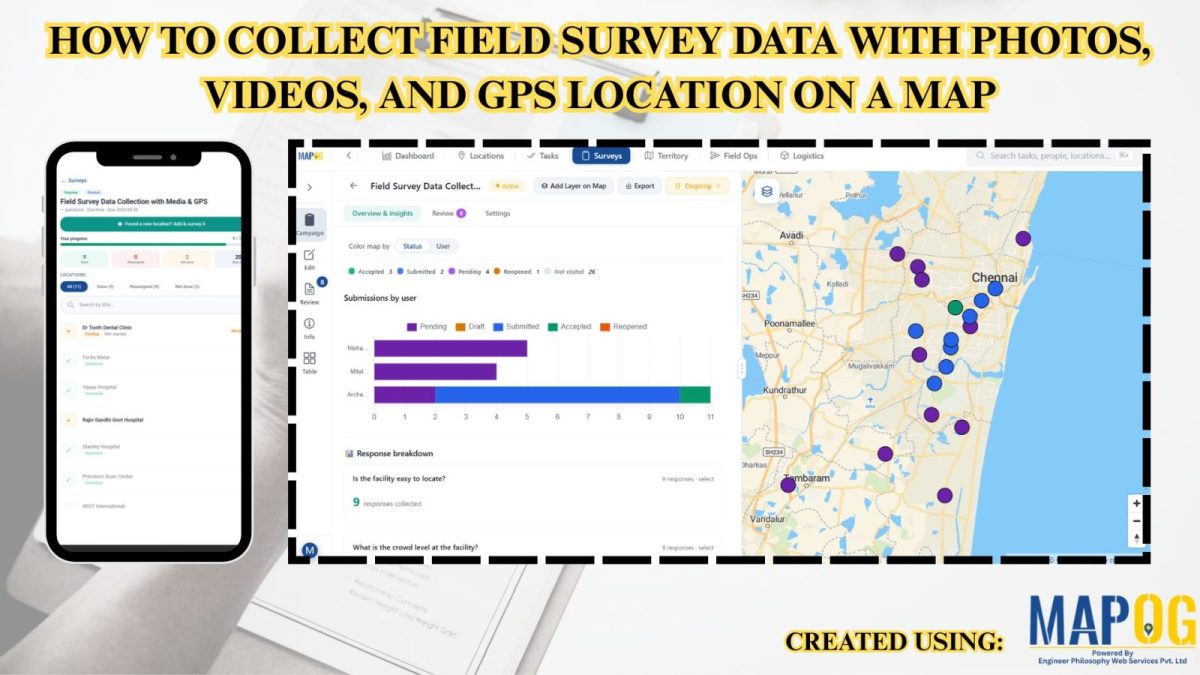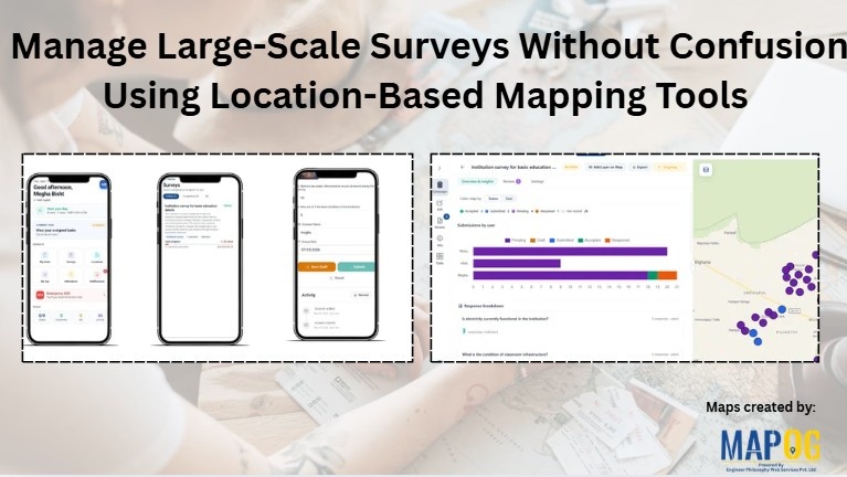
Manage Large-Scale Survey Without Confusion Using Location-Based Mapping Tools
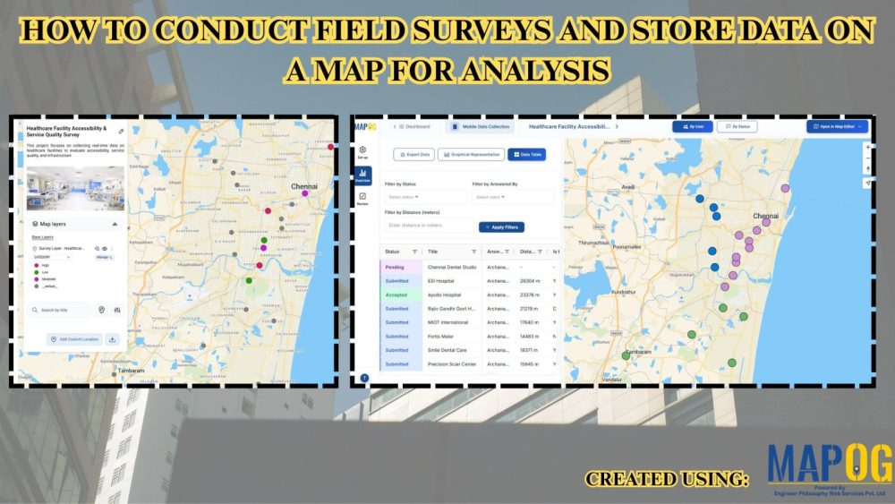
To Manage large scale survey across schools, colleges, Anganwadi centers, and other institutions often becomes difficult when teams rely on spreadsheets, paper forms, or delayed reporting systems. As survey size increases, issues like duplicate entries, missing records, incorrect locations, and poor coordination also increase. Consequently, field operations become slow and difficult to manage. Using MAPOG … Read more