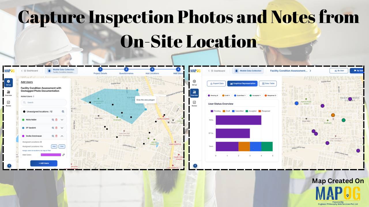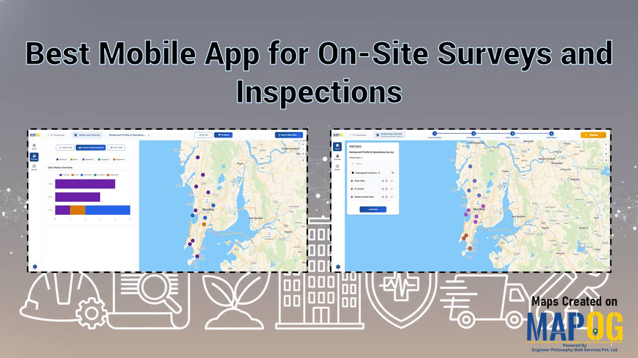
How to Conduct Field Surveys and Store Data on a Map for Analysis
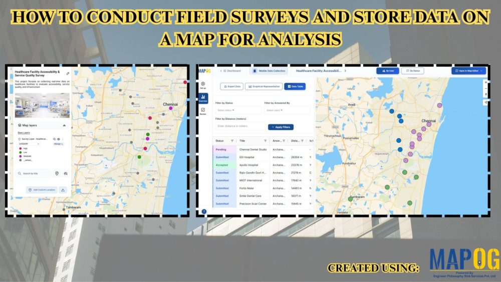
Healthcare systems often face fragmented data and limited visibility, therefore planning and service delivery become challenging. However, MAPOG mobile data collection capability helps teams conduct Healthcare Facility Surveys and analyze accessibility by capturing accurate field surveys and store data in real time, ensuring consistency and enabling faster, data-driven decisions. Key Concepts: Field Surveys and Store … Read more