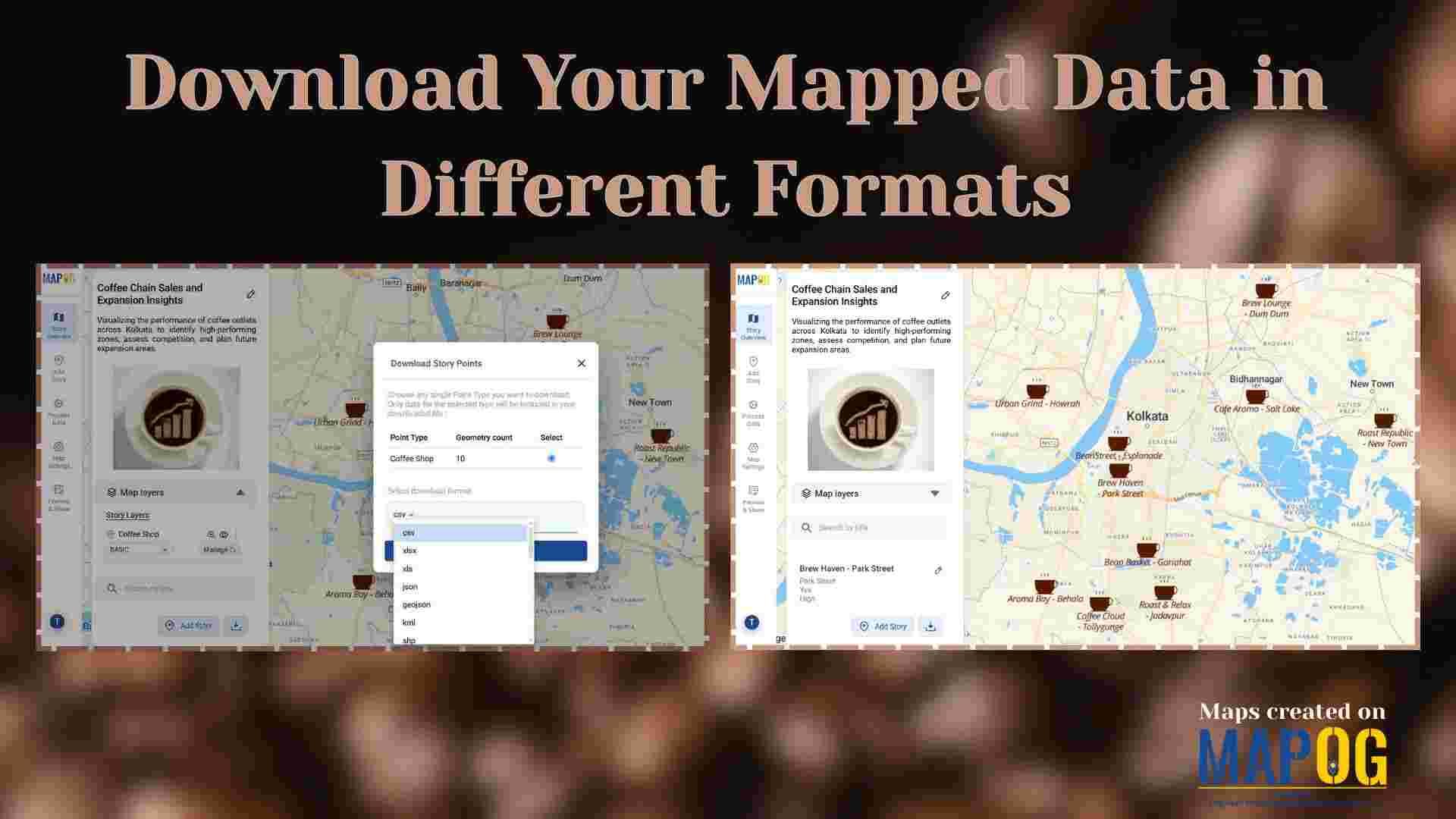
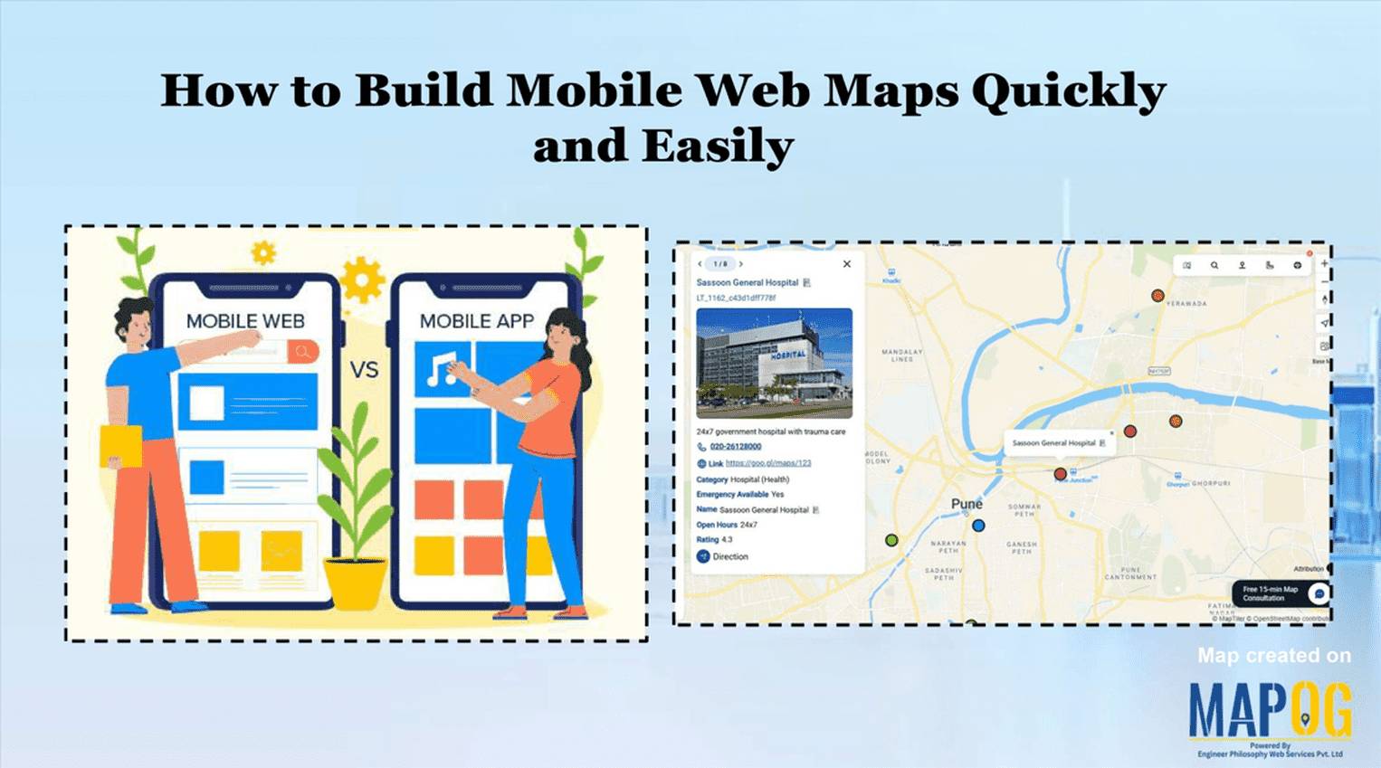
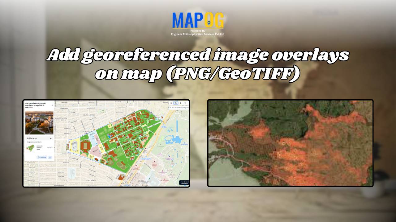
Interactive Mapping

Color-Code Map Points by Category (Online, No-Code)

To begin with, Color-Code Map Points is a simple yet powerful way to transform raw data into clear, visual insights. Moreover, this approach enables governments, planners, and communities to classify projects, services, or assets into instantly understandable categories on a single interactive map. As a result, we can instantly track and visualize metro stations in … Read more

Convert Excel/CSV to an Interactive Map (Free, No-Code)

Converting Excel/CSV into an interactive map is a practical method for visualizing location-based information without programming skills. In other words, users upload spreadsheet data , such as addresses, coordinates, or place names into a mapping platform that displays it spatially. Therefore, no-code tools like MAPOG make this process accessible enabling users to geocode locations, categorize … Read more

Monitor & Maintain CCTV Installations with Interactive Maps

Monitor & Maintain CCTV Installations with Interactive Maps

Running a CCTV Installation Map helps businesses manage hundreds of camera sites, clients, and service requests efficiently. Traditionally, companies relied on Excel sheets, WhatsApp chats, or handwritten registers, which made tracking installations confusing. But managing installations, clients, and service records in scattered places quickly becomes confusing. That’s where an interactive map comes in — a … Read more

Share an Interactive Map with Teammates (View or Edit Access)

Best Way to Share Interactive Maps Online with View and Edit Access

Today, readers and team members expect more than just static information when exploring content or managing data online. Whether it’s tracking locations, updating details, or monitoring progress, interactive maps make collaboration simple and engaging. With MAPOG, you can easily share an Interactive Map with teammates, assigning view or edit access to ensure the right people … Read more

How to Map Drainage Points & Stormwater Drains for Smarter Urban Maintenance

How to Map Drainage Points & Stormwater Drains for Smarter Urban Maintenance

To Map Drainage Points effectively is one of the most critical parts of urban infrastructure, since clogged or damaged drains often remain unnoticed until monsoons cause flooding. For example, during heavy rains, municipal teams in many cities spend hours locating hidden or encroached drains before cleaning begins—by then, water logging has already disrupted traffic and … Read more

Smart Hiking Trail Planning Visualize Bearings, Distances, and Key Checkpoints

Smart Hiking Trail Planning: Visualize Bearings, Distances, and Key Checkpoints

As outdoor enthusiasts seek more rewarding and safe adventures, Smart Hiking Trail Planning goes beyond simply picking a path—it’s about understanding the bearings, distances, and key checkpoints along the journey through interactive mapping. Hikers often struggle to gauge accurate directions, track distances between waypoints, or identify important rest spots and landmarks. Without Smart Hiking Trail … Read more

How to Create a Safari Itinerary Map for Your Trip

Create & Share a Safari Itinerary Map for Your Trip

If you’re planning a safari, visualizing your journey on a map can turn your travel plans into an interactive and shareable experience. From visiting to all safari locations and back, mapping your safari helps you track routes, highlight wildlife hotspots, and organize activities. Using MAPOG, you can create a rich safari itinerary map that’s engaging, … Read more

Famous Alumni Map Discover Notable Personalities and Their Universities

Famous Alumni Map: Showcase Notable University Graduates, Achievements & Success Stories

Universities are the birthplaces of leaders, innovators, and change makers. Mapping notable alumni with MAPOG showcases their achievements, highlights global impact, and inspires future generations by tracing where their journeys began through a famous alumni map. Key Concepts: Why Create a Famous Alumni Map? Alumni achievements are often scattered, but a digital map highlights them … Read more

Fire Station Mapping: How GIS Fire Safety Maps Improve Emergency Response & Community Safety

Fire station mapping is an important step as fires spread fast, and when communities lack nearby fire stations, hydrants, or safety infrastructure, the risk of damage rises dramatically. That’s why mapping fire safety infrastructure has become an essential tool for city planners, emergency responders, and local authorities. furthermore using GIS-based interactive tools like MAPOG to … Read more

How Interior Designers Can Manage Projects On-Map, Not on Spreadsheets

Managing interior design projects often feels overwhelming, especially when updates are scattered across WhatsApp chats, shared drives, and endless spreadsheets. For years, spreadsheets seemed like the go-to option; however, they usually fail to provide clarity when teams need real-time visualisation across multiple sites. That’s exactly where interactive maps step in. With MAPOG, Interior design project … Read more