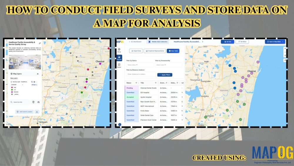
Conduct Solar Site Surveys and Assess Installation Feasibility Using Mobile Data Collection
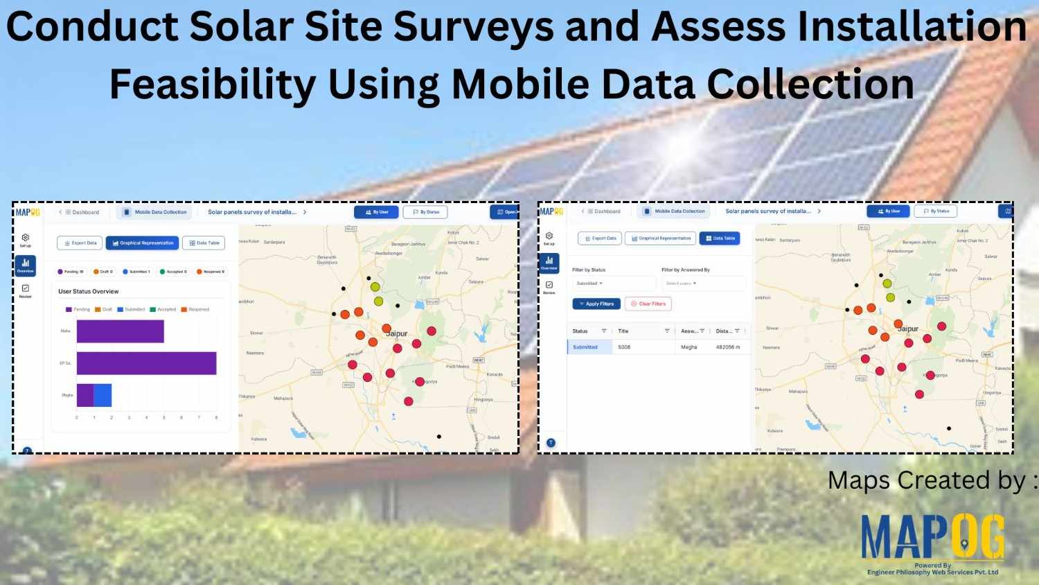
In solar infrastructure projects, inaccurate site observations and delayed updates often slow down execution, leading to redesign and cost overruns. Traditionally, teams rely on manual notes, scattered spreadsheets, or calls, which reduces accuracy and visibility. To address this, companies are now conduct solar site surveys using mobile data collection and digital mapping workflows. This approach … Read more