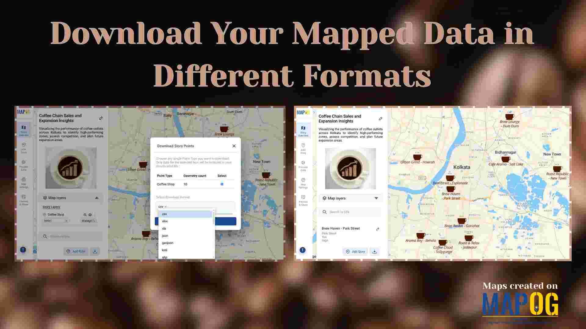
Embedded maps

Best Alternatives to Google My Maps for Sharing Travel Stories

Best Alternatives to Google My Maps for Sharing Travel Stories

If you’re on the lookout for the best alternatives to Google My Maps, you’re not alone. Travelers, bloggers, and content creators are increasingly seeking more flexible, interactive, and storytelling-driven platforms to share their travel memories. While Google My Maps offers basic map-making features, it often falls short in terms of personalization, multi-user collaboration, and storytelling … Read more

Mapping Waste Disposal Sites with GIS for Clean Cities

In fast-growing cities, mapping waste disposal sites with GIS is becoming essential to public health and sustainability. As waste volumes rise, understanding where and how it’s managed is key to building cleaner, more efficient cities. This project uses MAPOG, a cloud-based spatial mapping platform, to visualize key waste disposal sites—ranging from major landfills to Refuse … Read more

Free GIS Mapping Tools for Students and Researchers

Free GIS Mapping Tools for Students and Researchers

In today’s logistics-driven world, Geographic Information Systems (GIS) play a pivotal role in analyzing spatial data for informed decision-making. Fortunately, MAPOG offers Free GIS Mapping Tools that empower students, researchers, and planners to explore and visualize real-world location-based patterns. With tools such as Buffer Zones, Clip and Isochrones, users can easily identify optimal sites for … Read more

How to Create Interactive Maps Without Any Technical Skills

How to Create and Embed Live Maps on Your Website in Minutes

In today’s data-driven world, learning how to create and embed live maps into your blog or Website can instantly boost engagement and clarity. Whether you’re showcasing public services, identifying urban gaps, or promoting inclusivity, interactive maps transform static content into immersive, insightful experiences no GIS skills required. With MAPOG, a no-code mapping tool, anyone can … Read more