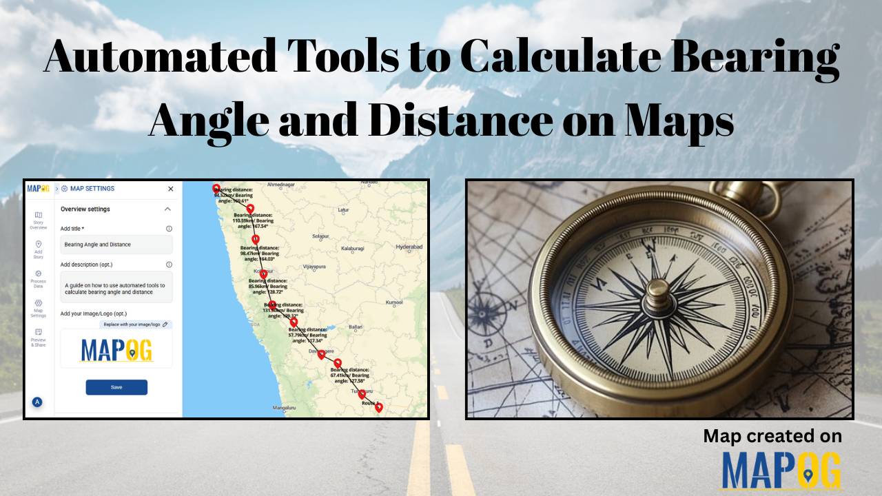
Automated Tools to Calculate Bearing Angle and Distance on Maps
In the world of navigation and surveying, bearing angle and distance measurements—from true north, clockwise in degrees, and along the ground—form the core of accurate mapping. Traditionally, these demanded manual calculations with compasses and trigonometric tables, risking errors in everything from land deeds to flight paths. However, automation has transformed this process. MAPOG computes bearing … Read more