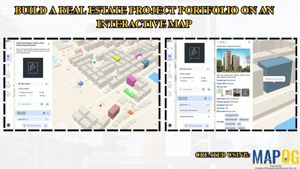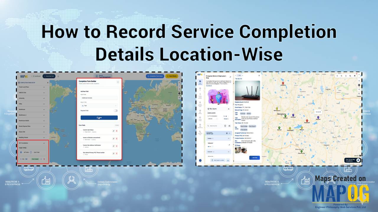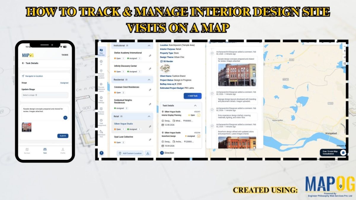
Manage Site Visits and Client Property Tours on a Single Location Using Task Management
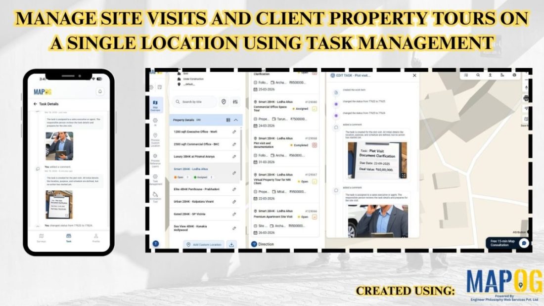
Scattered records make it difficult to manage site visits and client property tours in the real estate industry, but MAPOG transforms visit data into a single interactive map. It improves location visibility, coordination, and scheduling while supporting faster decision-making. Track tasks, monitor visits, and ensure accountability using real-world spatial context instead of spreadsheets. Key Concept: … Read more