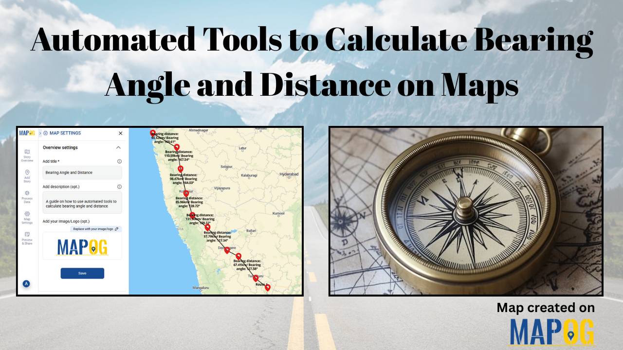
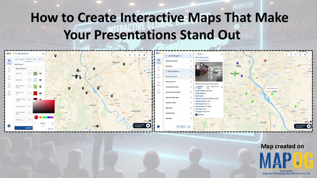
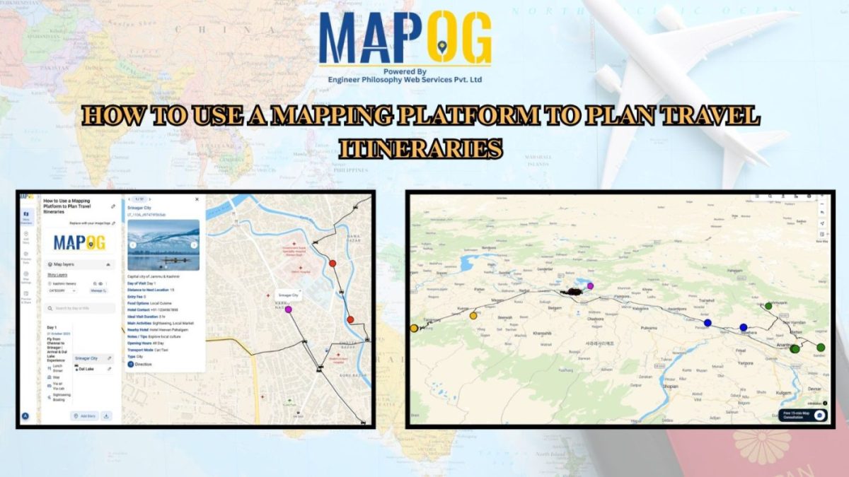
Blog

Decade of forest fire analysis

Analysis of Forest Fire and Map Risk Areas with Buffer Tool

Let yourself loose into a memorable exploration of Analysis of Forest Fire and Map Risk Areas by using the Buffer Tool within MAPOG. Dive into the revelations regarding the insights discovered, the new strategies that emerged, and the overall understanding came about relate to wildfire processes in the past 10 years. Data-driven approaches will be introduced to … Read more

Infrastructure Analysis

CREATING BUFFER MAPS TO IMPROVE THE SECURITY OF AIRPORTS AND OTHER INFRASTRUCTURES

In an era marked by evolving threats and heightened security concerns, the protection of vital infrastructure stands as a paramount imperative. In this article, we delve into the innovative approach of infrastructure protection through buffer analysis, highlighting its efficacy in safeguarding airports, power plants, transportation networks, and more. Join us as we explore how MAPOG … Read more

Landfill Optimization

Create Map for Landfill Optimization: Spatial Analysis Approach

Landfills, where various environmental factors interact to shape microclimates and hydrological patterns, represent complex ecosystems. Effective management and mitigation strategies require a thorough understanding of these landfill areas. Therefore, this article explores the integration of the MAPOG in GIS based Landfill Optimization. If you are interested in creating Urban agriculture map, explore this article-Creating GIS … Read more