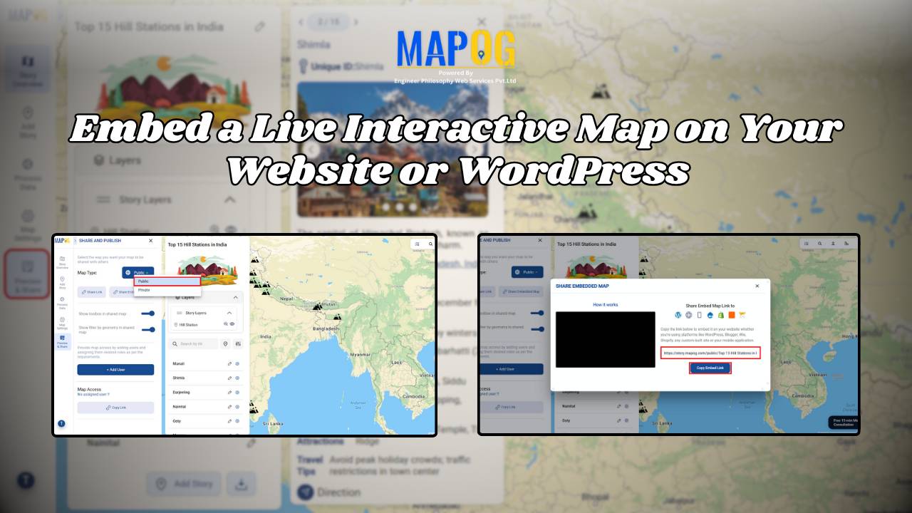
#InteractiveMaps

How to Create Interactive Maps Online - Featured Image

Interactive Map Online – A Beginner’s Guide

With tools like Story by MAPOG, anyone can begin their journey in online mapping or build a digital interactive map without technical skills. With tools like MAPOG, anyone—whether you’re a student, traveler, business owner, or researcher—can create beautiful, clickable maps in just a few steps. These maps help you tell stories, plan trips, share information, … Read more

Flood Risk Mapping with Interactive Web Maps: A SaaS Platform Approach

Flood Risk Mapping with Interactive Web Maps: SaaS Approach

A SaaS-based flood risk mapping platform leverages interactive web maps to provide risk assessments. Using GIS, AI, and hydrological data, it enables governments, insurers, and communities to visualize flood-prone areas, enhance preparedness, and optimize response strategies. Cloud-based accessibility ensures scalability, data integration, and seamless user collaboration for proactive risk management. Key Concept How Flood Risk … Read more