In today’s fast-paced project environments, tracking multiple sites, teams, and resources across locations is a major challenge. Therefore, to manage and share location-based projects, and moreover to help construction managers track distributed sites, project mapping now provides an all-in-one solution.
With MAPOG, even a simple Excel sheet can quickly transform into an interactive map; as a result, teams gain real-time updates, improved collaboration, and easy sharing, thereby reducing confusion and creating a centralized hub for stakeholders.
Key Concept: Why Manage and Share Location-Based Projects?
With intuitive tools, users can easily upload, manage, and share location-based projects. Moreover, by monitoring construction progress and field inspections, mapping provides centralized visibility, real-time tracking, and smarter decision-making, enabling teams to quickly identify bottlenecks and overlaps.
Step-by-Step Guide to Mapping, Manage and Share Location-Based Projects.
1. Prepare Your Location Data
First, prepare an Excel or CSV file with Project Name, Address, Coordinates, Status, Value, and Team Member; then, this data will form the backbone of your project map.
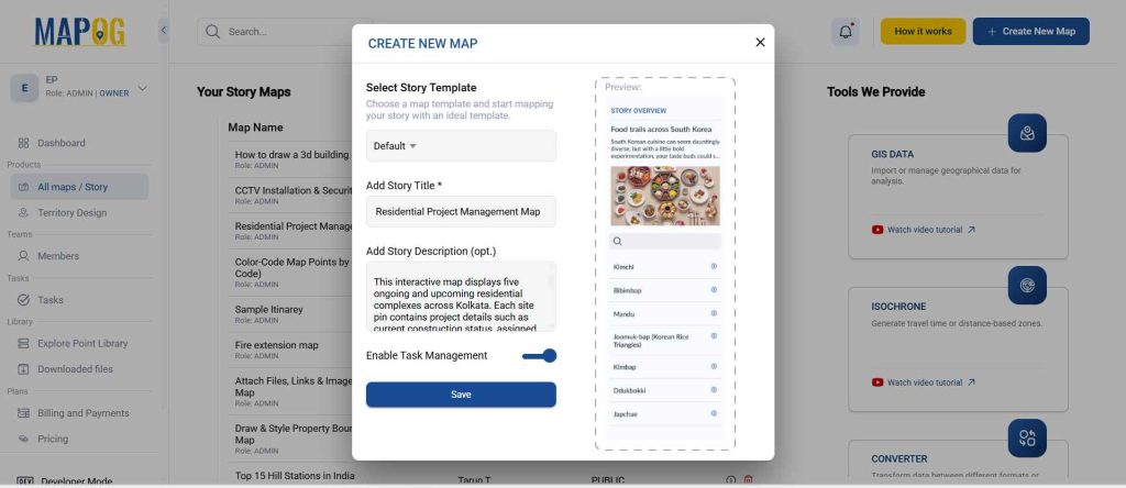
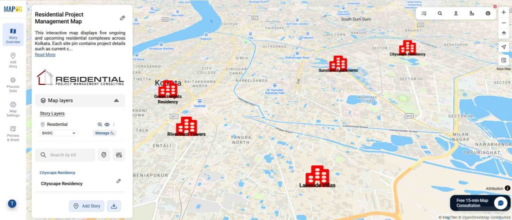
2. Start a New Story in MAPOG
Once your dataset is ready, log in to MAPOG and create a new story. Next, add a title, brief description, and enable task management; finally, save to access the canvas where your project map will be built.
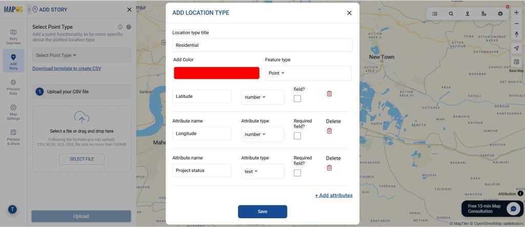
3. Create a New Location Type and Add Attributes
First, define the types of locations you will map before uploading your data. Go to Add Story → Add by Uploading CSV and create a new location type. After that, specify its attributes, such as name, category, or any custom fields relevant to your project.
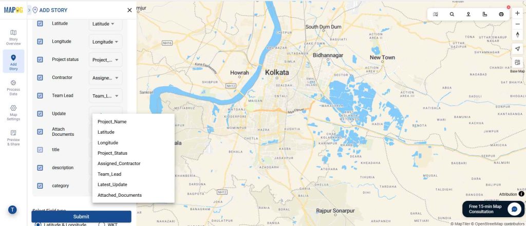
4. Upload Your Project Data
Next, upload your Excel or CSV into MAPOG and match columns like coordinates and project names. Then, your sites will instantly appear as interactive points on the map.
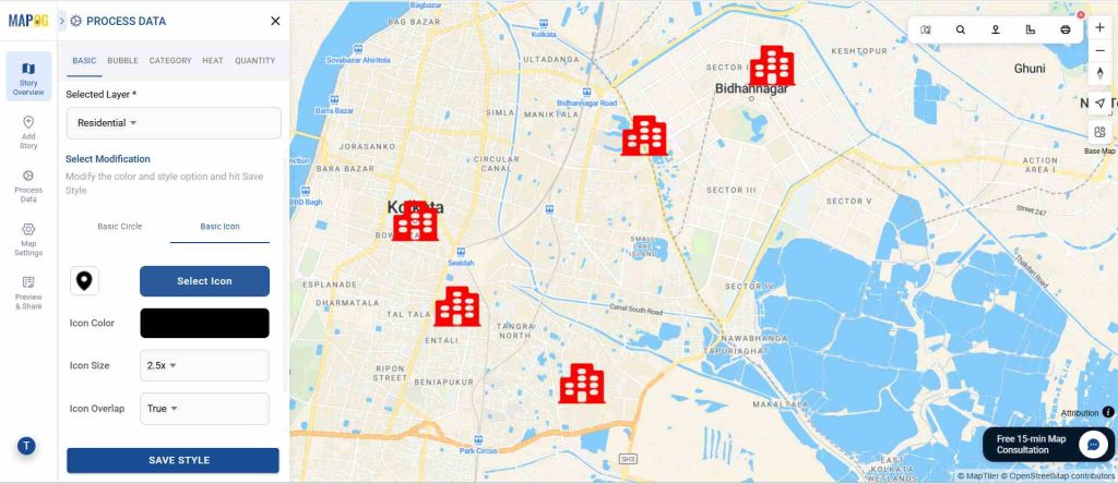
6. Customize Map Styles
Next, customize your map using style layer with colors, icons, or bubble sizes to show status, type, or value, making project importance clear at a glance.
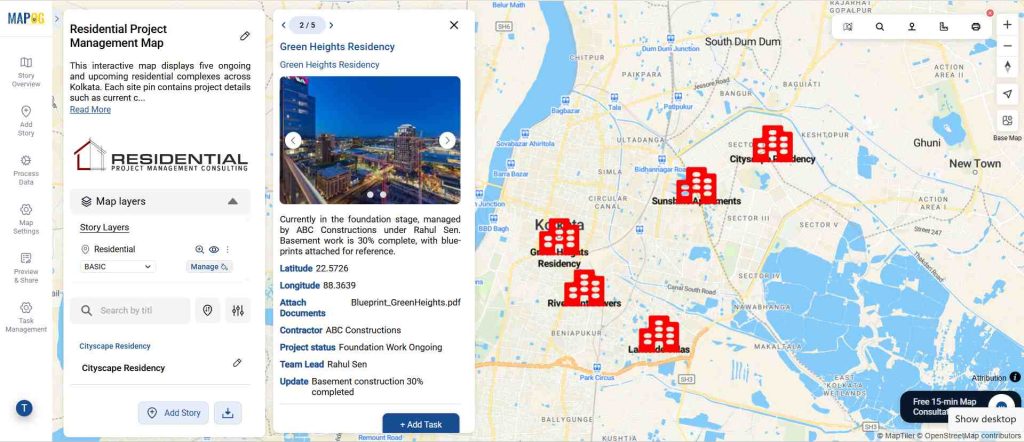
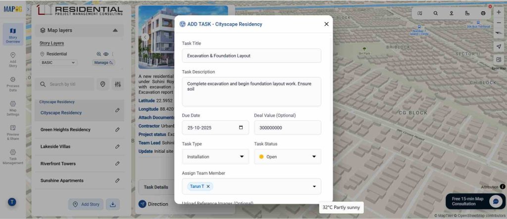
7. Enable Task Management to Manage and Share Location-Based Projects
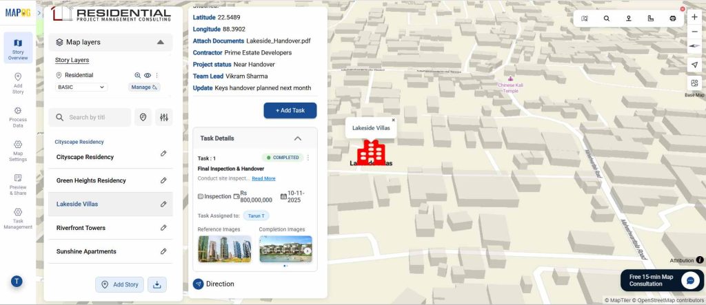
Beyond simple mapping, enabling the task management feature transforms your project map into a live, interactive dashboard. Furthermore, by clicking on individual points, you can add tasks such as inspections, installations, or material deliveries at each site. In addition, each task can include details like due dates, assigned members, deal values, status, and progress updates. Moreover, multiple tasks can be added to a single location, along with images or documents for context. Ultimately, this feature ensures accountability, reduces miscommunication, and keeps every stakeholder aligned by providing a comprehensive view of ongoing work at each project site.
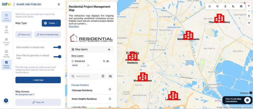
8. Preview and Share the Map
Finally, preview and share your project map to ensure accurate placement and information, publicly or privately by sending a direct link. You can also invite users by email and assign roles such as viewer, editor, or admin. These access controls make it easy to manage who can view or modify the map, ensuring secure collaboration while keeping your projects organized and accessible.
Future: Manage and Share Location-Based Projects
From construction and infrastructure to retail and healthcare, industries are adopting interactive maps as part of their workflow. With task management and real-time updates, maps are no longer static visuals but living, collaborative tools. MAPOG makes project management visual, transparent, and collaborative, giving organizations a competitive edge in planning and execution.
Benefits of Using All-in-One Mapping Tools
The benefits of using such tools extend across sectors. A project manager can rely on one interactive platform to serve as a centralized hub for all project sites. Collaboration becomes seamless because updates can be shared instantly across departments. Operational efficiency improves by reducing delays and errors, while scalability ensures that the same system can be applied to real estate, logistics, healthcare, or infrastructure projects.
Conclusion
Managing and sharing location-based projects online is more than a digital convenience—it is a strategic move towards smarter planning and execution. By leveraging all-in-one tools like MAPOG, organizations can save time, reduce errors, and achieve better collaboration across teams and stakeholders.