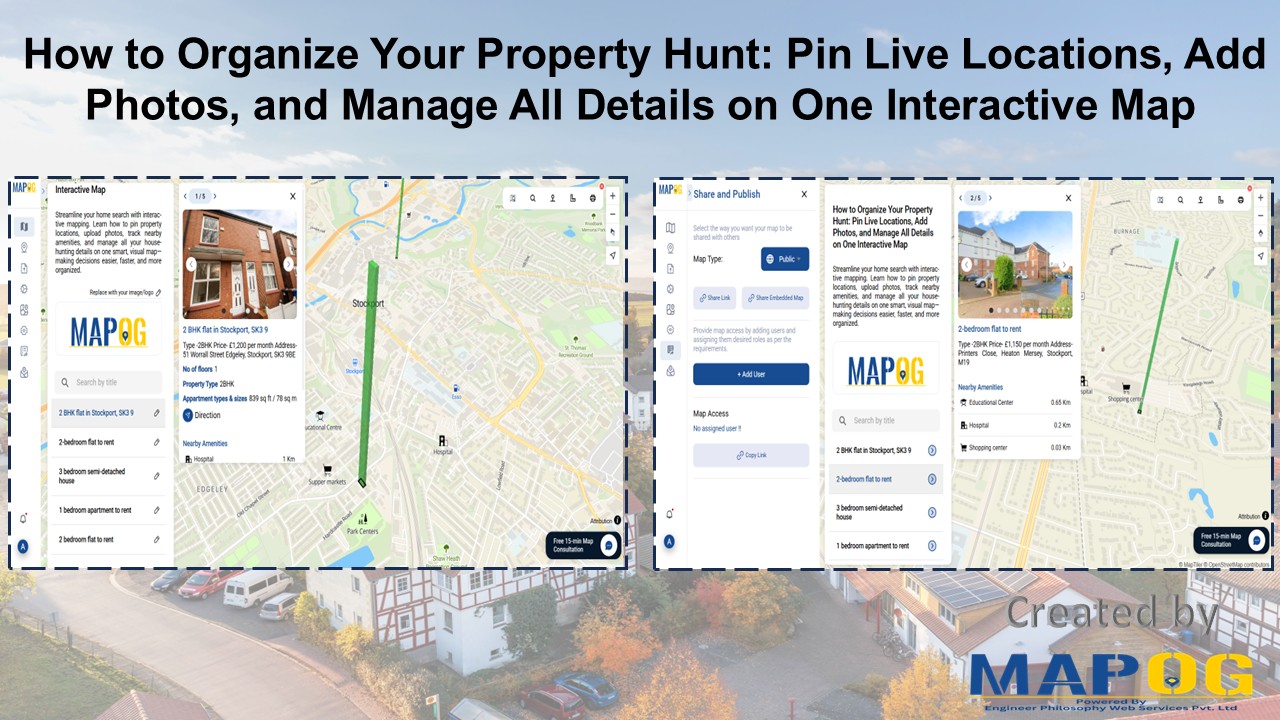
How to Map and Share Retail Store Locations for Your Franchise?
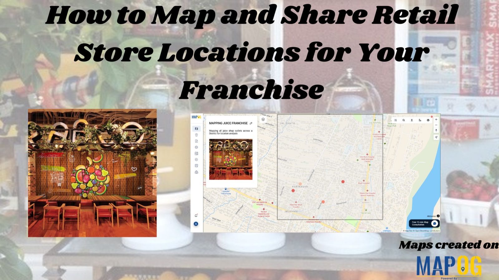
In today’s data-driven world, the ability to map retail store locations for your franchise is one of the smartest moves you can make. Just as visualizing a Safari Itinerary on a map helps travelers craft immersive and efficient journeys, or mapping Spatial Retail Store Analysis with GIS tools enables cities to improve safety and planning, … Read more