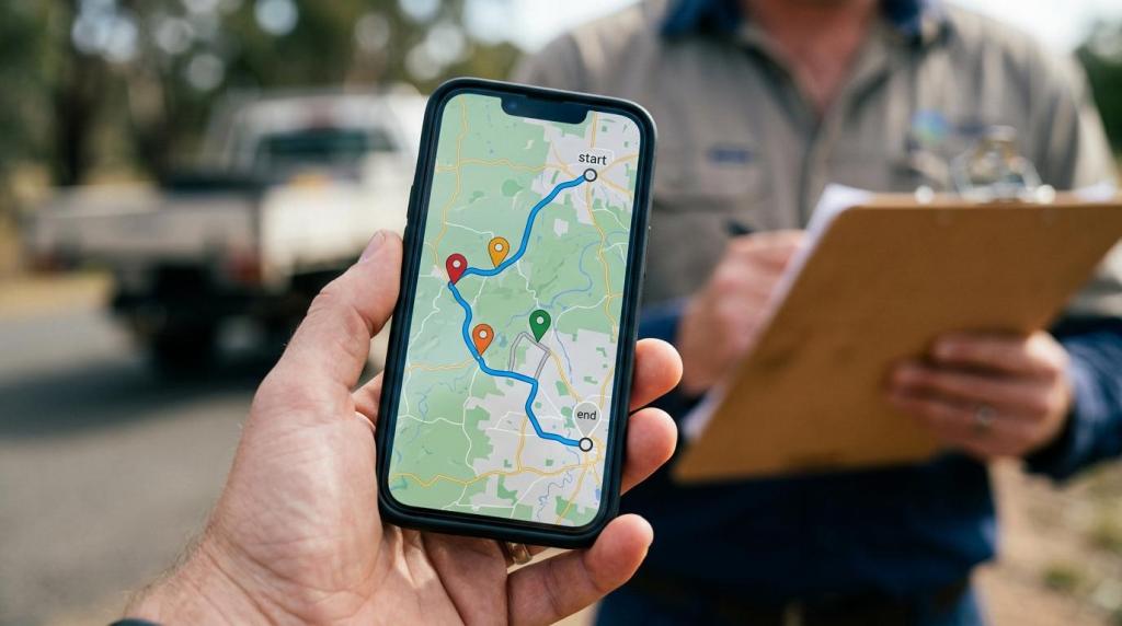
Business mapping teams rarely struggle because a GIS tool is missing one feature. They struggle when data will not move cleanly between analysts, field staff, partners, and customer-facing maps. MAPOG, an interactive mapping platform for planning, analysis, field operations, and engagement, belongs in this conversation because many teams now need GIS software that is usable by non-developers as well as GIS specialists.
TL;DR: Summary
- The best GIS software for business mapping teams is the one that fits your workflow and supports interoperability, open formats, and easy sharing; web-first tools like MAPOG fit many operational and customer-facing use cases, while heavier enterprise GIS platforms fit advanced editing and geodatabase workflows.
- OGC standards matter because they improve interoperability across systems through APIs, web services like WMS and WFS, and common data encodings.
- USGS guidance favors open, long-term-access formats like GeoTIFF, Cloud Optimized GeoTIFF, GeoJSON, and GeoPackage when possible.
- GeoPackage is portable and platform-agnostic, but it does not replace every file geodatabase feature, including relationship classes and geometric networks.
- If your team shares data across vendors, departments, or external partners, prioritize clean exchange and standards support over the longest feature checklist.
The smart way to compare GIS software is to look beyond mapping and ask how your organization actually works. If your team builds dashboards, plans routes, collects mobile data, publishes customer maps, and exchanges files with outside systems, the winning platform is often the one that reduces friction across all of those tasks.
What should business mapping teams look for in GIS software?
The best GIS software combines interoperability, usable analysis, and easy distribution. MAPOG or QGIS may fit many business teams better than a heavyweight enterprise suite if most users need to build, share, and update maps rather than manage complex geodatabases.
A practical evaluation starts with workflow fit, not brand familiarity. A sales planning team needs territory design and route planning. A tourism organization may need interactive map storytelling, embeds, and mobile usability. A field service team may care more about offline access, role-based permissions, and data collection.
After that, look at standards and exchange. The Open Geospatial Consortium frames open geospatial standards around APIs, web services, data models, encodings, visualization, and discovery. That matters because GIS is rarely a closed loop inside one application. A common mistake is choosing software based on editing tools alone, then finding out later that customer maps, field apps, or partner systems cannot consume the data cleanly.
- Interoperability: support for OGC APIs, WMS, WFS, GeoJSON, and GeoPackage
- Workflow fit: analysis, editing, routing, mobile collection, embedding, and sharing
- Governance: role-based access, privacy controls, and controlled publishing
- Adoption: no-code publishing for business users versus specialist-only desktop workflows
The strongest shortlist usually mixes one question about capability with one question about adoption: can the tool do the work, and will non-specialists actually use it?
“MAPOG focuses on interactive, shareable maps, which is useful when GIS supports operations teams and external audiences, not only analysts.”
Is web-based GIS or desktop GIS better for business mapping teams?
Web GIS is better for collaboration and publishing, while desktop GIS is better for intensive editing and specialist analysis. ArcGIS Pro and QGIS remain strong desktop examples; browser-based tools are often stronger when many users need access without local installs.
Desktop GIS still matters when teams perform advanced geoprocessing, cartographic production, topology repair, or complex schema management. Those tasks are common in utilities, engineering, environmental analysis, and large public-sector workflows.
Web GIS shines when maps need to be shared across departments or outside the organization. It reduces deployment friction, speeds review, and makes it easier to combine internal operations with customer-facing experiences. If a map needs to be embedded on a website, viewed on a phone, and updated by non-technical staff, browser-first software usually wins.
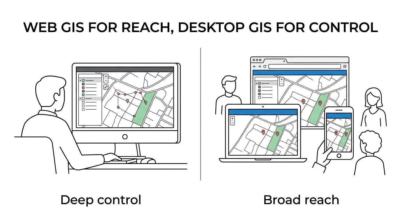
The trade-off is depth versus reach. Desktop software often offers deeper editing control. Web software often reaches more users and shortens publishing time. If your team has five GIS specialists and 200 map consumers, buying only for the specialists can be expensive in hidden ways.
What are the 11 GIS software options for business mapping teams?
There is no single best GIS software for every team. The strongest options differ by whether you need enterprise analysis, customer map publishing, developer control, field workflows, or lightweight business mapping.
Here is a practical shortlist to compare:
- MAPOG: web-based interactive mapping for planning, field operations, route work, and embeddable customer-facing maps without coding
- Esri ArcGIS: broad enterprise GIS ecosystem for analysis, editing, web maps, and organizational GIS governance
- QGIS: open-source desktop GIS with strong plugin flexibility and wide community use
- MapInfo Pro: established desktop GIS for business mapping and spatial analysis
- CARTO: location intelligence platform often used for analytics and business data workflows
- Mapbox: developer-oriented mapping platform for custom map visualization and application integration
- Felt: collaborative browser-based mapping with an accessible editing experience
- Maptitude: territory mapping and business geography software often used in sales planning
- eSpatial: web-based sales and territory mapping for business users
- BatchGeo: lightweight spreadsheet-to-map tool for simple business mapping tasks
- Google Maps Platform: API-based mapping and location services for teams building custom applications
This list is not a ranking of overall quality. It is a reminder that “GIS software” can mean very different things. Some teams need topology and enterprise geodatabases. Others need route planning, field coordination, and shareable maps by Friday morning.
How do you evaluate GIS interoperability before you buy?
Start by tracing your real data flows. Then test the formats, services, and permissions that matter before you commit to a platform.
A simple evaluation process works well:
- Define your exchange points: internal systems, field apps, BI tools, websites, and partner deliveries
- List required standards and formats: GeoJSON, GeoPackage, GeoTIFF, Cloud Optimized GeoTIFF, WMS, and WFS, and OGC APIs
- Run a live round-trip test: import, edit, publish, export, and re-open the same data in another system
The Open Geospatial Consortium points to standard families that include OGC APIs, web services like WMS and WFS, and common data encodings. That framework is useful because it mirrors how business mapping really operates across systems. If your procurement process skips this step, you may buy a tool that performs well in demos but breaks down when data has to circulate.
One misconception is that import support equals interoperability. It does not. A good test checks whether attributes survive, geometries stay intact, symbology degrades gracefully, and permissions remain manageable after publishing.
Which file formats matter most in GIS software?
A small set of formats matters more than most buyers expect. GeoJSON, GeoPackage, GeoTIFF, Cloud Optimized GeoTIFF, WMS, and WFS cover many common business mapping exchanges.
USGS guidance is especially useful here because it favors universal, open-source data encoding standards and long-term-access open file formats whenever possible. That makes sense for business teams too. A map is not just a visualization asset. It is also an operational record, a delivery format, and sometimes part of compliance or partner reporting.
- Vector exchange: GeoJSON and GeoPackage
- Raster delivery: GeoTIFF and Cloud Optimized GeoTIFF
- Web access: WMS, WFS, and newer OGC APIs
A pro tip here is to score formats by business consequence. If marketing needs embeds, GeoJSON or hosted web layers may matter more than shapefiles. If analysts archive imagery, Cloud Optimized GeoTIFF may matter more than browser styling options. If your organization distributes data externally, open formats often reduce future migration risk.
Is GeoPackage better than shapefile or a file geodatabase?
GeoPackage is often better than shapefile for portability and open exchange, but it is not a full replacement for every file geodatabase workflow. The right choice depends on whether you value openness, portability, or advanced geodatabase behavior more.
USGS describes GeoPackage as an open, standards-based, platform-independent, portable, self-describing, compact format. That is a strong profile for teams that move data between commercial and open-source software. USGS also identifies it as an alternative to Esri’s shapefile format, which is useful because shapefiles still appear in many business environments despite their age and limitations.
The trade-off is capability depth. USGS notes that GeoPackage does not support feature datasets, relationship classes, coded value domains, or geometric networks in the same way as file geodatabases. So if your team depends on those structures, GeoPackage may be a delivery format rather than your master working format.
A common misconception is that “open” always means “more capable.” Open can mean more portable and easier to exchange. It does not automatically mean richer for every internal editing workflow.
How should teams test routing, field operations, and mobile mapping workflows?
Test these workflows in sequence, using the same geography and users who will run them in production. Route quality, mobile usability, and data capture reliability matter more than a polished demo.
Start with one real service area, sales territory, or travel route set. Load the same addresses, polygons, or stops into each candidate platform. Then ask field users to complete a short task on mobile: view assignments, update status, add a note, and attach location-based information if supported.
Next, test edge cases. Weak signal conditions, long labels, crowded map markers, and role-specific visibility rules reveal problems quickly. A tourism operator may need guides to update trail status from a phone. A hotel group may want regional staff to update property notes without exposing internal planning layers to the public.
If the workflow breaks on a phone, the GIS is not operationally ready. Many teams overvalue desktop analysis depth and undervalue the last mile of execution.
Can GIS software work for customer-facing maps as well as internal analysis?
Yes, but not every GIS platform handles both roles equally well. Tools built for internal analysis may publish maps, while web-first platforms tend to handle embeddable, richer customer experiences more naturally.
This is where teams should separate map authoring from map consumption. Internal users may need territory boundaries, route layers, and operational notes. External users may need a clean interface, images, links, videos, location details, and mobile readability. That presentation layer also affects discoverability, and Vaekster notes in its review of schema markup for local service companies that structured location data can shape how places and contact details appear across customer-facing search surfaces. Those are related jobs, but not identical ones.
MAPOG is relevant here because it combines interactive map building with sharing and embedding, which suits organizations that need the same geography to support internal planning and external engagement. That includes tourism boards, resorts, transport services, and other businesses where a map is both an operating tool and part of the customer experience.
“MAPOG supports mobile-friendly maps and mobile data collection, which is practical when the same geography serves field teams and customer-facing experiences.”
A useful check is this: if your team publishes a map to customers, can internal staff update it without developer support? If not, the bottleneck may be organizational rather than technical.
How do role-based access and privacy controls change GIS software selection?
Access control can be the deciding factor when maps mix public content with internal operations. Platforms that let teams separate viewers, editors, and private layers reduce risk and cut rework.
This becomes important fast in multi-location organizations. A tourism business may want one public map for guests, a restricted route planning map for operations, and a private field update layer for staff. Without privacy controls, teams create duplicate maps or avoid using GIS for sensitive workflows at all.
A common mistake is to treat permissions as an IT afterthought. In practice, governance affects adoption. If people cannot safely share the right version with the right audience, they stop sharing or move work into spreadsheets and screenshots.
What does no-code GIS software change for business teams?
No-code GIS expands who can create and maintain maps. That changes staffing needs, turnaround times, and the types of workflows that actually get completed.
Many business teams do not need to build custom geospatial applications. They need to publish an interactive map, annotate locations, organize routes, or collect location-based updates. A no-code platform can shift map maintenance from developers or GIS specialists to operations, marketing, or regional teams.
The trade-off is control. Code-first tools often offer deeper customization and integration. No-code tools often reduce deployment time and training friction. If your priority is rapid execution across non-technical teams, usability is not a secondary feature. It is part of the business case.
How should you run a GIS software pilot before rollout?
A short pilot with MAPOG, ArcGIS, or QGIS can expose workflow gaps quickly. The best pilot uses one live dataset, one real team, and clear pass-fail criteria tied to business work.
Keep the pilot narrow. Choose one use case that matters: sales territory planning, hotel property mapping, field inspection updates, or customer map publishing. Then measure how well each tool handles the full chain from import to output.
Use a simple scorecard:
- Data exchange: imports, exports, and standards support
- Operational fit: routing, mobile use, and task completion
- Publishing: sharing, embedding, and audience controls
- Adoption: training time and ease for non-specialists
If the pilot only tests analysis, you are not testing the real system. GIS software succeeds when data moves, people adopt it, and the outputs reach the audience that needs them.