#Floodmapping

Urban Flood Hotspots Mapping

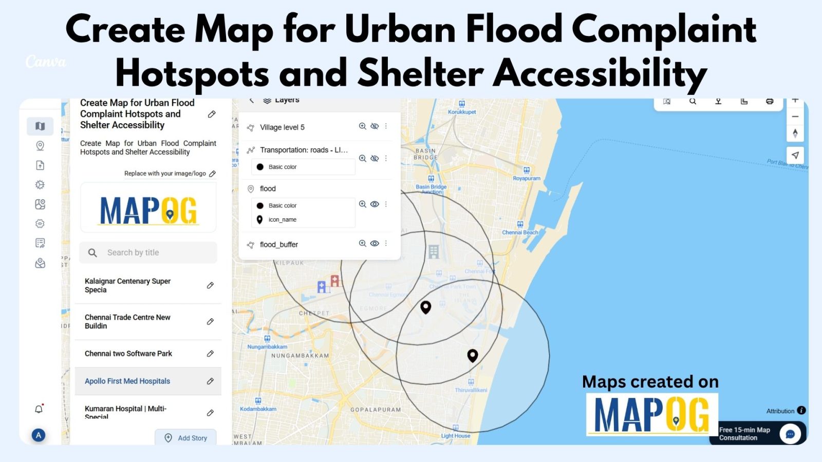
Create Map for Urban Flood Complaint Hotspots and Shelter Accessibility 

In today’s rapidly growing cities, climate change and infrastructure weaknesses have made urban flooding a significant challenge for communities and city planners alike. During heavy rain or storms, certain areas become prone to waterlogging, flood risks, and complaints, putting nearby properties and people at risk. At the same time, identifying high-risk zones and nearby shelters—and … Read more

Role of GIS In Irrigation Planning and Water Resource Management

Role of GIS In Irrigation Planning and Water Resource Management

GIS plays a vital role in irrigation planning and water resource management by optimising site selection, assessing water demand, designing irrigation networks, and analysing crop suitability. Additionally, it enhances decision-making through spatial analysis, monitors water distribution, prevents water logging, and integrates data for sustainable and efficient water resource utilisation. Key Concept in Monitoring GIS in … Read more