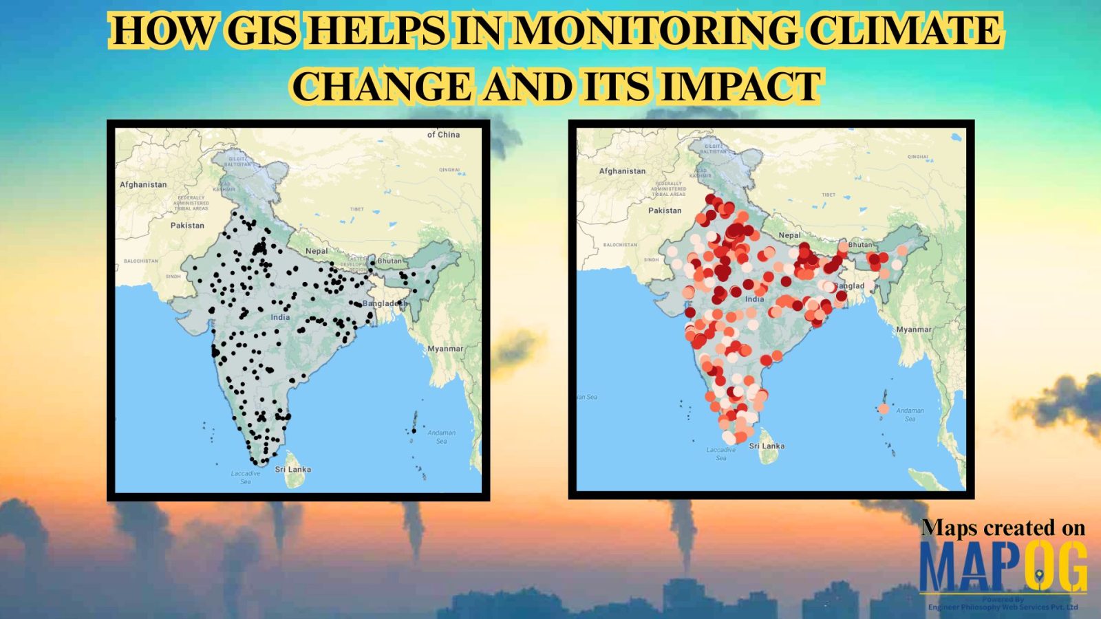
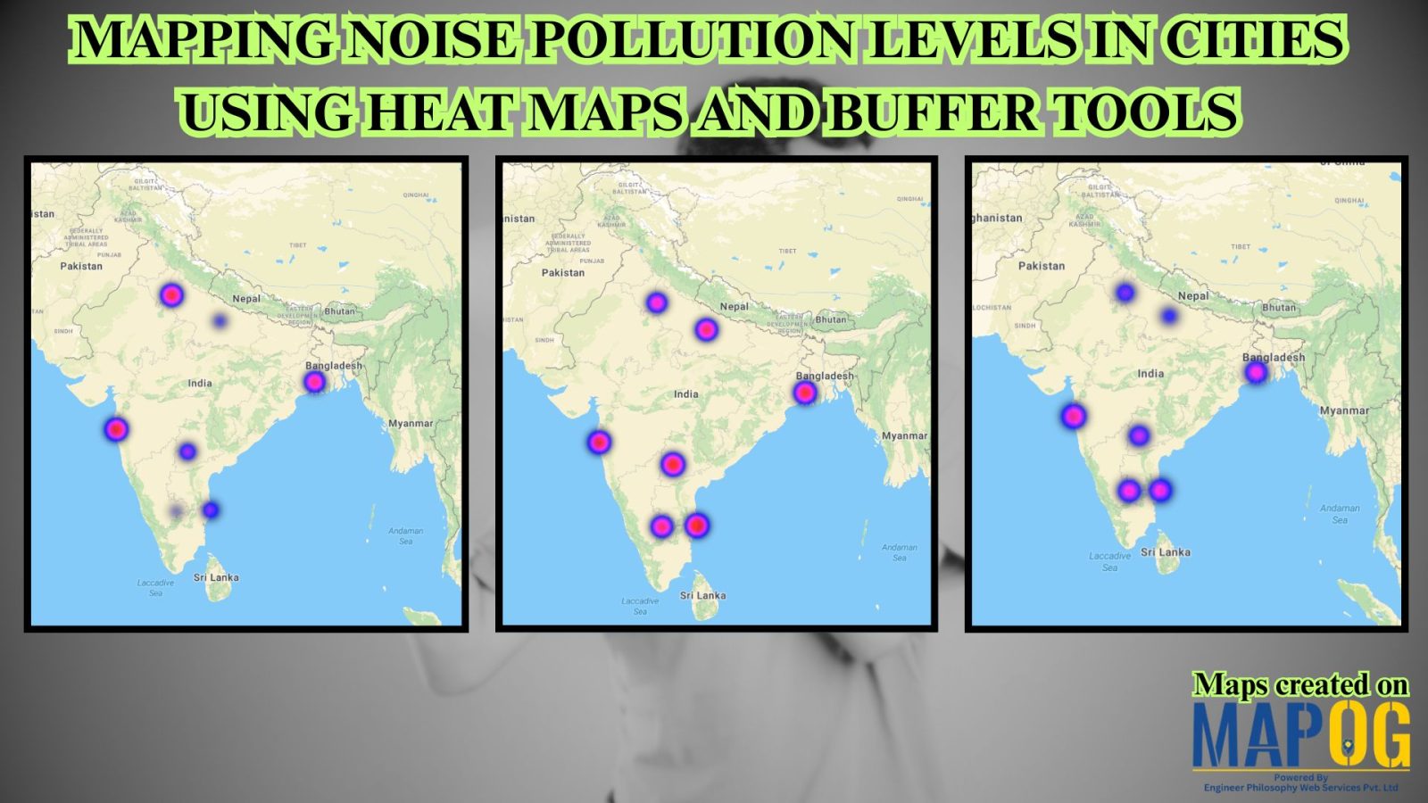
Uncategorized

Real-Life Crime Tracking Maps: Using GIS for Urban Safety

Real-Life Crime Tracking Maps: Using GIS for Urban Safety

Geographic Information Systems (GIS) have become an indispensable tool in enhancing urban safety by providing detailed Real-Life crime tracking maps and analysis. By combining geospatial data with law enforcement records, GIS enables cities to visualize crime hotspots, predict patterns, and address cyber security concerns. Furthermore, it supports effective planning for strategic law enforcement deployment. Through … Read more

Power Grid and Infrastructure mapping and planning using GIS

Power Grid and Infrastructure mapping and planning using GIS

Geographic Information Systems (GIS) are revolutionizing power grid mapping and infrastructure planning. By linking geospatial intelligence with electrical grid data, GIS enables utility companies and energy planners to visualize, assess, and optimize power distribution networks. Furthermore, it supports everything from the planning of substations and transmission lines to the ongoing monitoring of grid performance. As … Read more

Mapping Top National Parks: Preserving Nature

Mapping Top National Parks: Preserving Nature

Mapping Top National Parks play a vital role in conserving biodiversity and protecting natural landscapes while offering recreational opportunities that connect people with the environment. Additionally, these protected areas serve as sanctuaries for endangered species, geological wonders, and cultural heritage. From towering mountain ranges to vast desert expanses, national parks also support sustainable tourism, scientific … Read more

How GIS Helps in Monitoring Climate Change and Its Impact

How GIS is Transforming Climate Change Monitoring and Impact Analysis

GIS (Geographic Information Systems) plays a critical role in tracking, analyzing, and visualizing the climate change and its impact. By integrating satellite imagery, environmental sensors, and spatial data, GIS enables scientists, policymakers, and environmental organizations to understand complex climate patterns and their effects on ecosystems and human communities. It supports long-term monitoring, predictive modeling, and … Read more

Flood Risk Mapping with Interactive Web Maps: A SaaS Platform Approach

Flood Risk Mapping with Interactive Web Maps: SaaS Approach

A SaaS-based flood risk mapping platform leverages interactive web maps to provide risk assessments. Using GIS, AI, and hydrological data, it enables governments, insurers, and communities to visualize flood-prone areas, enhance preparedness, and optimize response strategies. Cloud-based accessibility ensures scalability, data integration, and seamless user collaboration for proactive risk management. Key Concept How Flood Risk … Read more

Facilitating warehouse location selection

Optimizing Warehouse Location Selection with GIS for Supply Chain Efficiency

GIS optimizes supply chains and logistics by enabling precise route planning, fleet tracking, warehouse Site Selection, Demand Forecasting, and Risk Assessment. It enhances inventory management, facilitating warehouse location selection, reduces transportation costs, improves delivery efficiency, and supports data-driven decision-making, ensuring streamlined operations, better resource utilisation, and improved customer satisfaction across supply networks. Key Concept in … Read more

Role of GIS In Irrigation Planning and Water Resource Management

Role of GIS In Irrigation Planning and Water Resource Management

GIS plays a vital role in irrigation planning and water resource management by optimising site selection, assessing water demand, designing irrigation networks, and analysing crop suitability. Additionally, it enhances decision-making through spatial analysis, monitors water distribution, prevents water logging, and integrates data for sustainable and efficient water resource utilisation. Key Concept in Monitoring GIS in … Read more

GIS In Air Quality Monitoring and Pollution Control

GIS plays a crucial role in air quality monitoring and pollution control. It maps sources, tracks emissions, and Identifies Hotspots for better decision-making. GIS supports in Air Quality mapping, Urban Planning, Evaluates Control Measures, and helps reduce key pollutants like PM, NOx, SO2, CO, O3, and VOCs through technology and regulations, promoting sustainability. Key Concept … Read more

Isochrone Analysis in GIS: Optimize Travel Times for Faster Delivery & Urban Planning

In the fast-paced world of urban logistics, the ability to understand and optimize travel times is essential for businesses like food and grocery delivery services. One powerful tool in their arsenal is isochrone analysis. Isochrone Analysis: Mapping Travel Times, Let’s explore what isochrones are, how they work, and the significant impact they have on streamlining … Read more

How to Use GIS Grid Tools for Mapping Healthcare Services and Improving Access

In the quest to enhance health care service delivery, GIS provides a robust platform for mapping and analyzing health care services across different regions. Utilizing grid-based mapping techniques in GIS allows for a detailed. The equal-area analysis of service distribution with highlighting areas. Mapping Health Care Services: Utilizing Grid Tools in GIS, This article outlines … Read more