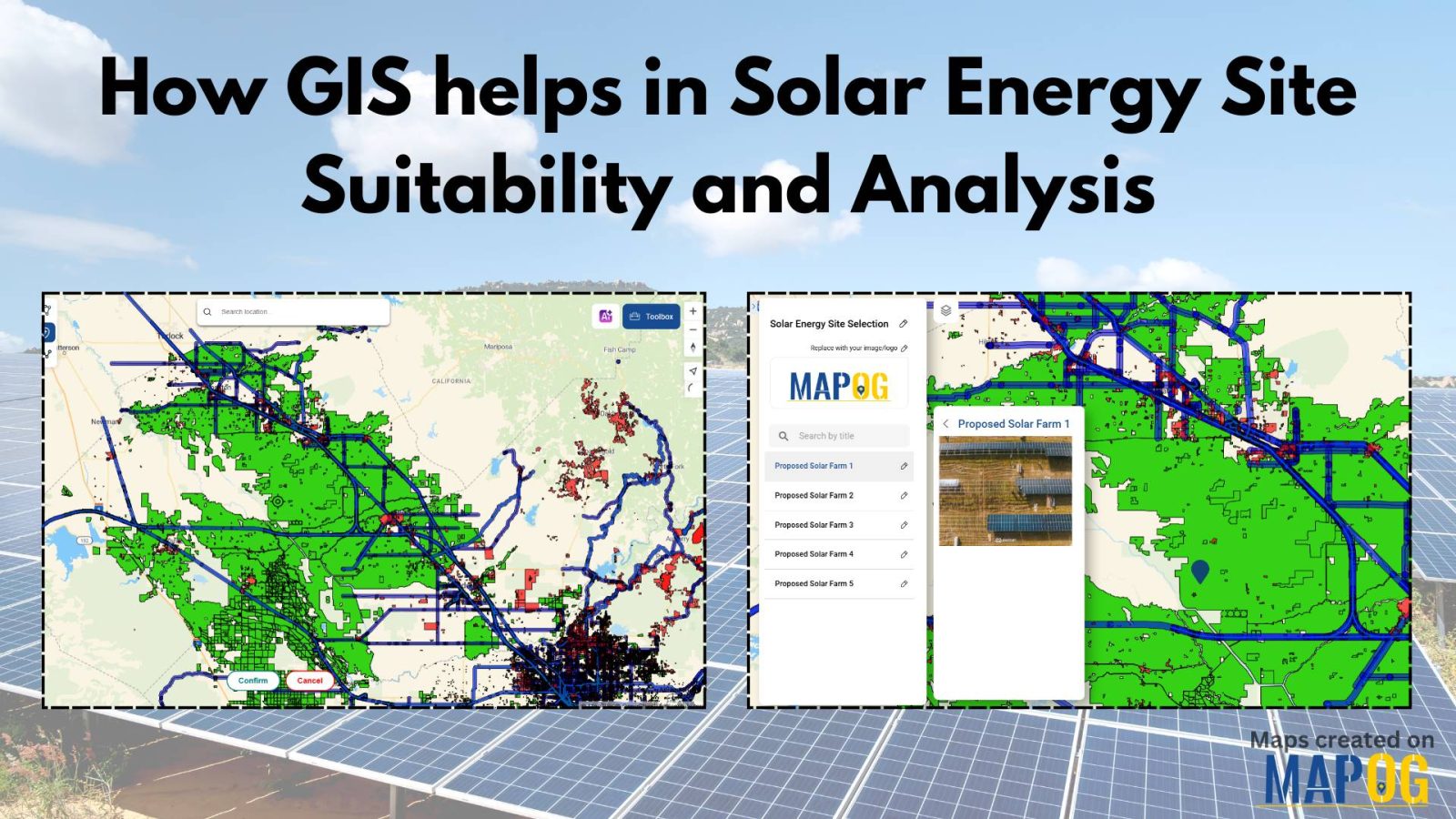
How to create a New GIS Datasets from another datasets
Insights from GIS data: Urban planning, environmental protection, healthcare, real estate benefit, aiding decision-making.
Farming faces big challenges when wars or natural disasters hit. Figuring out the damage to agricultural land is crucial. That’s where tools like MAPOG come in. This article is all about “Agricultural Land Damage Assessment due to War and Natural Calamities.” We’ll explore simple ways to understand and tackle the damage, using tools like MAPOG. … Read more
Unveiling Noise Pollution: Worldwide Analysis In MAPOG, let us converge our means available and join in the task of using both technology and natural awareness, so that we may initiate a move towards the future of sustainability, using the language of noise, so let´s decipher it with accuracy and clarity. Through MAPOG, we can discover … Read more
Mapping the road-river intersections of road and rivers using MAPOG proximity analysis tool for the smooth transportation and safety.
In the realm of environmental analysis and land management, extracting specific geographic features from larger datasets is essential for informed decision-making. In this use case, we explore the extraction of forest areas from a larger dataset using the Filter Tool in MAPOG Map Analysis. By uploading a shapefile of the region and a forest area … Read more
In energy infrastructure management, ensuring the safety and integrity of pipeline networks is very important. The influence of pipelines extends far beyond their physical footprint, encompassing the communities, ecosystems, and infrastructure that lie in their vicinity. Understanding and mitigating the potential risks of pipeline activities necessitate a holistic approach. In this article, we delve into … Read more
MAPOG uses geospatial intelligence to analyze Residential Land Use in Natural Reserves, enabling decision-makers to balance conservation and community needs. It helps identify sustainable development opportunities and informs regulatory frameworks, promoting responsible land management. Key Concepts to Identify Residential Land Use in Natural Reserves! The project’s output map visualizes residential land use in natural reserves, … Read more
Water resource allocation maps offer a crucial solution to the challenge of uneven water distribution. This article explores their pivotal role in promoting fairness, sustainability, and resilience in communities. With insights from MAPOG Map Analysis, we unveil how these maps are transforming the water management landscape. KEY CONCEPTS Our goal is to create a map … Read more
By utilizing MAPOG, the suitable sites for implementing charging stations for electric vehicles near the roads can be mapped.
Mapping locations through addresses using the Geocoder tool is a game-changer in the field of Geographic Information Systems (GIS). MAPOG Map Analysis leverages this technology to convert addresses into precise geographic coordinates, enhancing accuracy in urban planning, navigation, and emergency services. Discover how MAPOG’s powerful Geocoder tool can transform your mapping projects. KEY CONCEPTS Our … Read more