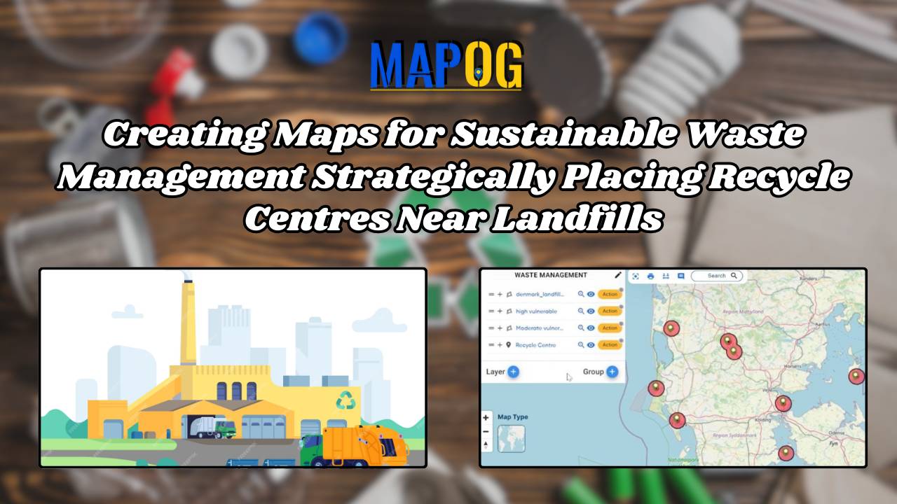
Creating Maps for Sustainable Waste Management: Strategically Placing Recycle Centres Near Landfills
Locate landfill sites-create two buffer zones-Style them with distinct color-plot recycle center near landfill sites.
Locate landfill sites-create two buffer zones-Style them with distinct color-plot recycle center near landfill sites.
Carbon Stock Mapping – Incorporate bubble style for visualize the data – Add labels showing the values of carbon stock
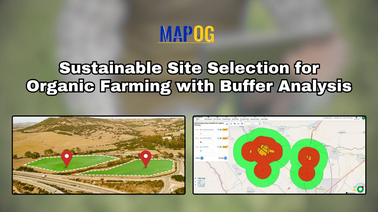
Finding the best areas for organic farming is crucial for maximizing yield and ensuring sustainability. With MAPOG’s map analysis, you can easily identify suitable locations for organic farming. Our Buffer Tool helps pinpoint optimal zones by evaluating various environmental factors, ensuring your farm thrives. Explore how MAPOG can guide you to the perfect spot for … Read more
“Land Use Compliance using Border Intersection in MAPOG” enables urban planners to quickly identify and address non-compliant land use by analyzing the intersections of property boundaries with zoning attributes. Key Concepts Identifying these non-compliance areas quickly and accurately is crucial for effective urban management and enforcement. Steps to create Land Use Compliance using Border Intersection … Read more
Mapping the rivers within a state is crucial for understanding their interaction with other geographical features. Using the MAPOG Map Analysis platform, you can easily visualize these intersections. The Cross Intersection tool helps you identify where rivers cross roads, railways, and boundaries, providing valuable insights for environmental monitoring and urban planning. Discover how MAPOG can … Read more
You can optimize your supply chain using the Isochrone tool, With MAPOG MAP ANALYSIS. Isochrone mapping helps visualize travel times around supply depots, pinpointing the best locations for efficient deliveries. Discover how this simple yet powerful technique can transform your logistics. KEY CONCEPTS Our goal is to create a simple and interactive map that covers … Read more
GIS analysis reveals where pharmacies should be located near hospitals, ensuring timely access to medicine and enhancing public health outcomes.
Map forest types with category style for comprehensive analysis. Visualize diverse ecosystems and land cover for informed environmental management.
Understanding and analyzing sports activities in various areas is crucial for making informed decisions about community health, engagement, and infrastructure investments. Mapping Sports Activity: Using Levels for Analysis, By using the level feature and category style in GIS, we can visualize and categorize sports activities on a map effectively. Key Concept of Create Sports Maps … Read more
Banks strive to ensure that their branches and ATMs are conveniently located for their customers. Mapping Bank and ATM Locations Using Near by Neighbour Analysis, To achieve this, they use a sophisticated technique called ‘Near by Neighbour’ analysis. This method helps banks determine the optimal placement of ATMs and branches, ensuring customers have easy access … Read more