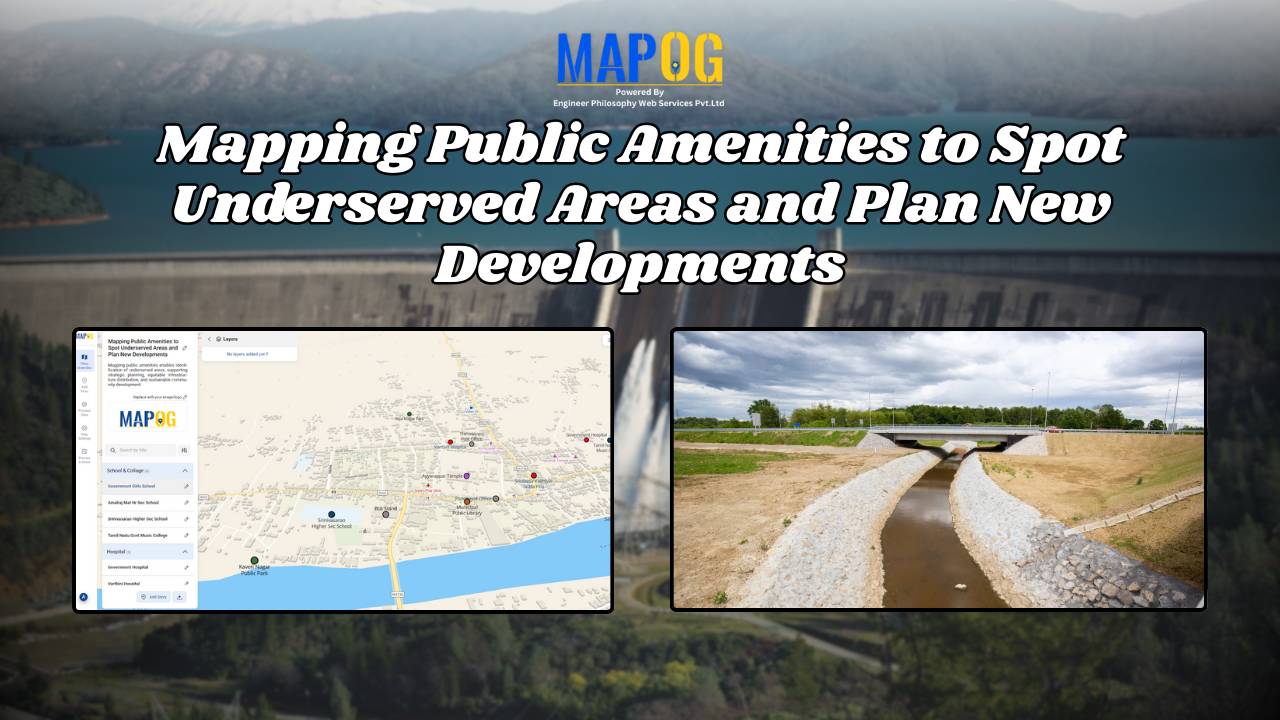
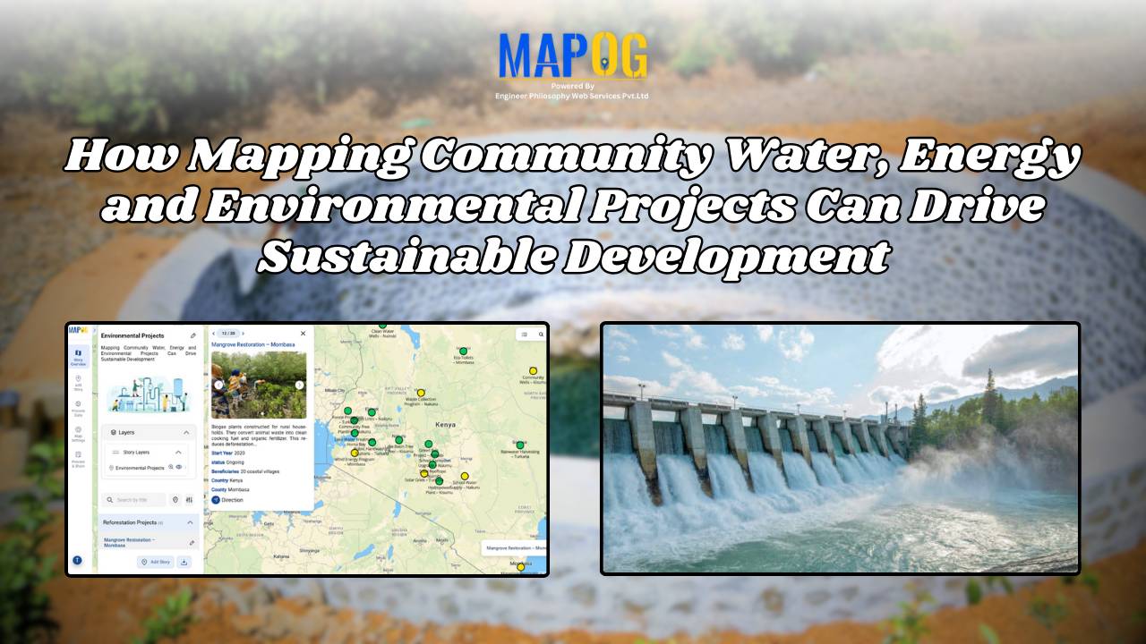
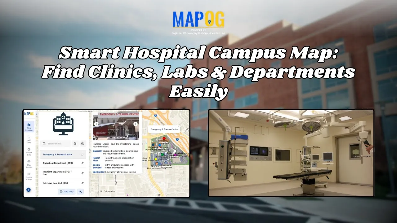
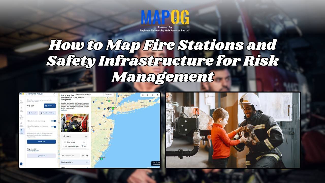
Easy Map Creation

Monitor Deforestation-Free Farming Using GIS Mapping and Spatial Analysis Tools

In sustainable land management, it’s critical to monitor deforestation-free farming using spatial GIS tools that help understand how agriculture interacts with ecosystems. As deforestation becomes a pressing concern, agri-businesses and regulators require spatial evidence to ensure farming doesn’t encroach on forested areas. With MAPOG, spatial data becomes a powerful tool for environmental accountability and transparent … Read more

Mapping History with GIS: Turn Historical Events into Interactive Stories

Historical events have, over centuries, shaped civilisations and cultures. Consequently, mapping history with GIS tools provides new insights into how past events unfolded geographically. As a result, this promotes deeper engagement, improves retention, and simultaneously encourages an immersive way of exploring timelines and stories. Moreover, by integrating GIS tools with historical data, storytelling becomes more … Read more

Mapping Military Flight Paths

Mapping Military Flight Paths: How GIS Helps Calculate Distance and Bearing Angles

Mapping Military Flight Paths is a crucial component in modern aerial defense planning. With the continuous rise of geographic intelligence, GIS technology now plays a central role in not only plotting accurate coordinates but also in calculating distances and determining precise bearing angles. This process, therefore, goes far beyond simply drawing lines on a map—it … Read more

Mapping Emergency Services Near Education Institutions Using GIS

How to Map Emergency Services Near Educational Institutions Using GIS Tools

Ensuring the emergency services Near Education become more critical than ever safety of students in educational institutions is a high priority in urban and regional planning. As cities expand rapidly and population density increases.  This article explains how Geographic Information Systems (GIS) can be effectively used to map emergency services near educational institutions. For this … Read more

How to Map and Manage a Franchise Business with Location and Service Filters

If you’re planning to expand your food chain or track multiple branches across cities, then learning how to map a franchise business with smart filters is a true breakthrough. By doing so, you can visualize store data on an interactive platform, which in turn helps you easily organize locations, services, and customer insights. Whether you’re … Read more

Mapping Hospital Coverage and Categories Using Convex Hull

Mapping Rural Hospital Coverage Using GIS and Convex Hull

Mapping Hospital Coverage and Categories, locations in rural areas ensures that communities have access to essential healthcare during emergencies. Visualising hospital distribution and overall coverage helps identify underserved regions and gaps in healthcare infrastructure. With MAPOG, users can build interactive GIS maps showing hospital points, health facility types, and Convex Hull polygons that represent the … Read more

How to Use GIS Mapping for Solar Development A Step-by-Step Guide to Smart Site Selection

How to Use GIS Mapping for Solar Development: A Step-by-Step Guide to Smart Site Selection

Planning utility-scale Solar Site Suitability Mapping projects with MAPOG involves overlaying layers like GHI, land parcels, flood zones, and transmission lines. Spatial filters quickly eliminate unsuitable areas, helping prioritize sites that are both high in solar potential and accessible to the grid streamlining smart, data-driven solar development. Key Concept: Solar Site Suitability Mapping While many … Read more

Mapping Cyclone Shelter Locations for Coastal Safety Using GIS

Mapping Cyclone Shelter Locations for Coastal Villages Using GIS

Mapping Cyclone Shelter Locations in coastal villages need quick access to shelters during emergencies. Visualizing shelter locations and their accessibility helps uncover gaps in disaster readiness. With MAPOG, users can build interactive GIS maps showing shelter distribution, village settlements, roads, and key geographic features. Instead of complex tools, this method uses simple layers and spatial … Read more

Create a Real Estate Map with Filters for Price, Location, and Property Type

Mapping has become an essential tool in the real estate industry to display property data and attract potential buyers visually. One such powerful and easy-to-use tool is  MAPOG, which allows users to Create real estate Property Map with filters such as price, location, and property type. This article walks you through the methodology step-by-step, explains … Read more

Create a map Fire Stations to Industrial Areas: Mapping Using GIS Tools

In rapidly growing cities, fire safety is critical—particularly in industrial zones, where risk is high and emergency response must be quick. Moreover, fire stations in industrial areas play a key role in reducing disaster response time. This project uses MAPOG, a cloud-based spatial mapping platform, to visualize and analyze coverage gaps in fire response infrastructure. … Read more