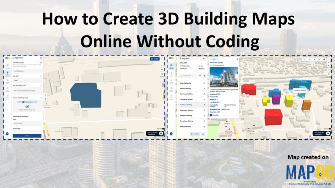
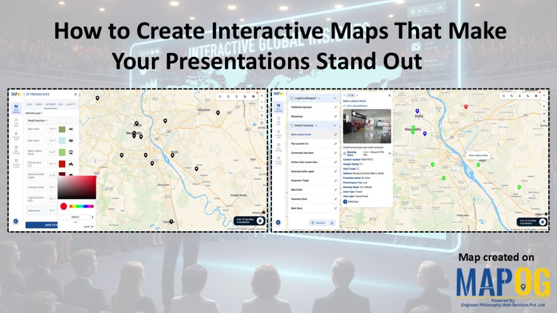
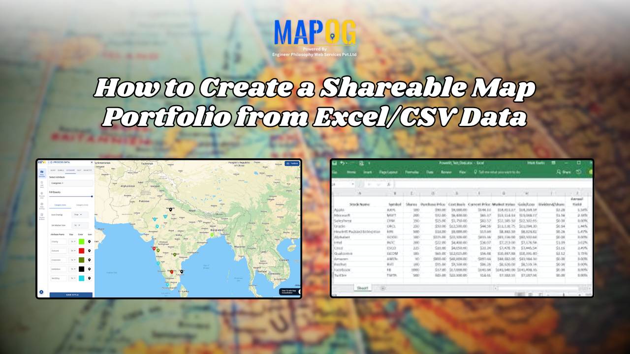
Optimizing Urban Transportation: GIS-Based Railway Accessibility and Mobility Planning
Insights on urban transportation accessibility: areas lacking train access, station locations, improved connectivity for smoother mobility.
Easily convert addresses or place names into geographic coordinates for powerful spatial analysis and visualization
In the pursuit of sustainable development, understanding and mitigating pollution around construction sites have become imperative. This article delves into the innovative approach of utilizing MAPOG to map pollution around construction zones levels effectively. By harnessing the power of GIS technology, this study aims to provide a comprehensive understanding of pollution dynamics in construction zones, … Read more
“Choosing windmill sites: a strategic approach. Explore key factors for optimal selection and maximize renewable energy potential.”
In the realm of road network categorization and labeling, accurate mapping is essential for both efficient travel planning and enhanced safety. By leveraging advanced techniques in cartography and GIS, we can create clear, usable road maps that optimize emergency responses, transportation planning, and urban development. This article delves into the methodologies of categorizing and labeling … Read more
Accessibility to educational institutions is a fundamental aspect of ensuring equitable education opportunities for all. Pedestrian crosspoints near Educational Institutions play a crucial role in facilitating safe and convenient access to educational institutions. MAPOG is a powerful tool for evaluating and improving accessibility infrastructure. This article explores the application of MAPOG in identifying Pedestrian Crosspoints … Read more
In urban planning and land management, digitization of land parcels and equitable division stand as pivotal tasks. Digitization emerges as a transformative tool, promising accuracy, transparency, and accessibility in the division process. In this article, we delve into the process of digitizing land parcels and equitable division using MAPOG Map Analysis. Join us as we … Read more
In an era where energy plays a pivotal role in shaping the economic and social landscapes, equitable distribution of power is paramount. “Creating Energy Maps: Unpowered Settlements”, This article delves into the realm of MAPOG Map Analysis to identify potential energy deserts—areas where settlements lack the crucial infrastructure of energy power lines or towers. By … Read more
Coastal erosion poses a significant threat to coastal regions, jeopardizing not only the natural beauty of beaches but also the structural integrity of sea walls essential for coastal protection. In response to this challenge, MAPOG undertakes a comprehensive mapping initiative for coastal erosion assessment and mitigation. This article explores how MAPOG delineates erosion-prone areas along … Read more
Incorporate isochrones-adding multiple isochrones for different modes and times-utilizing that to show railway platform accessibility