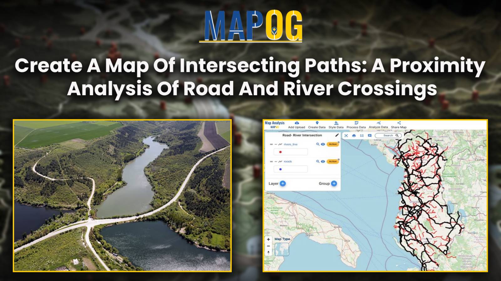
Create a map of Intersecting Paths: A Proximity Analysis of Road and River
Mapping the road-river intersections of road and rivers using MAPOG proximity analysis tool for the smooth transportation and safety.
Mapping the road-river intersections of road and rivers using MAPOG proximity analysis tool for the smooth transportation and safety.
In the realm of environmental analysis and land management, extracting specific geographic features from larger datasets is essential for informed decision-making. In this use case, we explore the extraction of forest areas from a larger dataset using the Filter Tool in MAPOG Map Analysis. By uploading a shapefile of the region and a forest area … Read more
Welcome to MAPOG! Today, we’re thrilled to guide you through the process of enriching your shapefiles by adding additional attributes using our Map Analysis Tool. By following a few simple steps, you’ll be able to enhance the depth and detail of your mapping projects, unlocking new insights and possibilities. Whether you’re in urban planning, environmental … Read more
In energy infrastructure management, ensuring the safety and integrity of pipeline networks is very important. The influence of pipelines extends far beyond their physical footprint, encompassing the communities, ecosystems, and infrastructure that lie in their vicinity. Understanding and mitigating the potential risks of pipeline activities necessitate a holistic approach. In this article, we delve into … Read more
Explore the intersection of cutting-edge technology and environmental responsibility in civil engineering. This article focuses on Environmental Impact Assessments (EIAs), emphasizing the role of the MAPOG Route Compass in precise spatial analysis. Discover how this innovative tool revolutionizes decision-making, shaping a future of conscientious engineering practices. Now we are on Google Play store also. Below … Read more
Unlock global trade with MAPOG’s Route Compass. Optimize world trade routes for strategic planning and seamless logistical operations
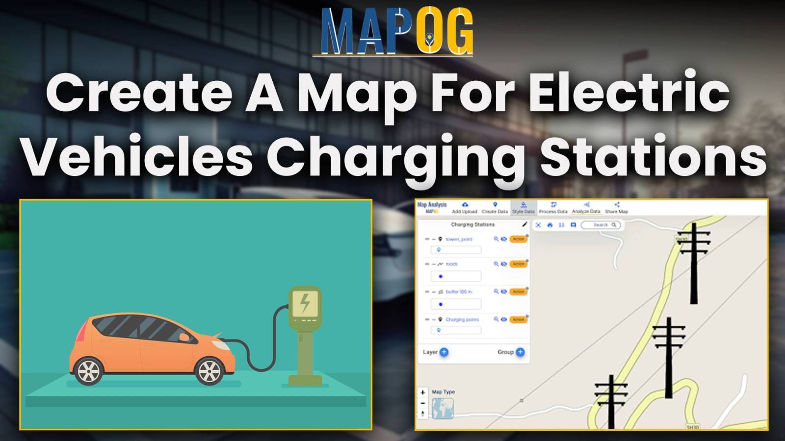
By utilizing MAPOG, the suitable sites for implementing charging stations for electric vehicles near the roads can be mapped.
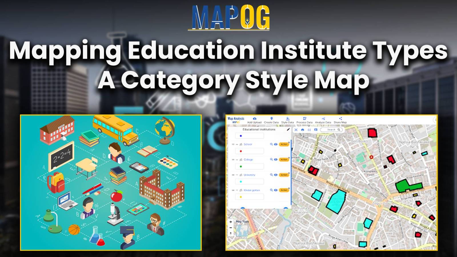
In the realm of spatial analysis, understanding the distribution and types of educational institutions is paramount for effective planning and decision-making. With the advent of advanced GIS platforms, such as MAPOG, utilizing tools like proximity analysis has become instrumental in categorizing educational institutions with precision and efficiency. This article delves into the key concept of … Read more
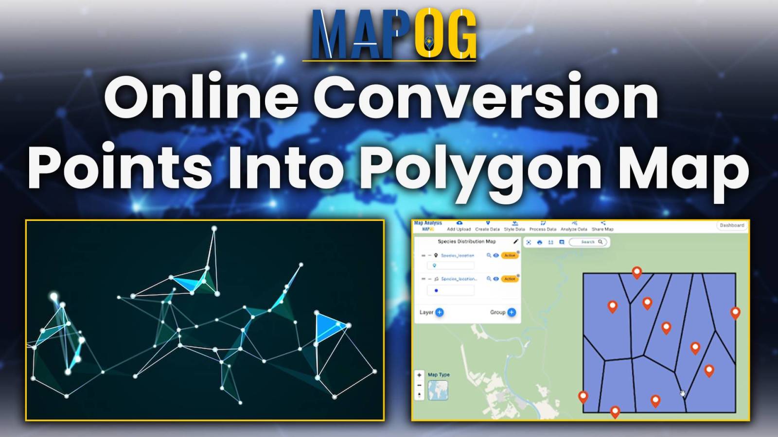
The Point to polygon tool is used to build a polygon that represents the smallest region or area that encloses a set of points. The Point to Polygon tool essentially converts point data, representing specific locations, into polygonal shapes. These polygons serve as a visual representation of the distribution or extent of any phenomenon under … Read more
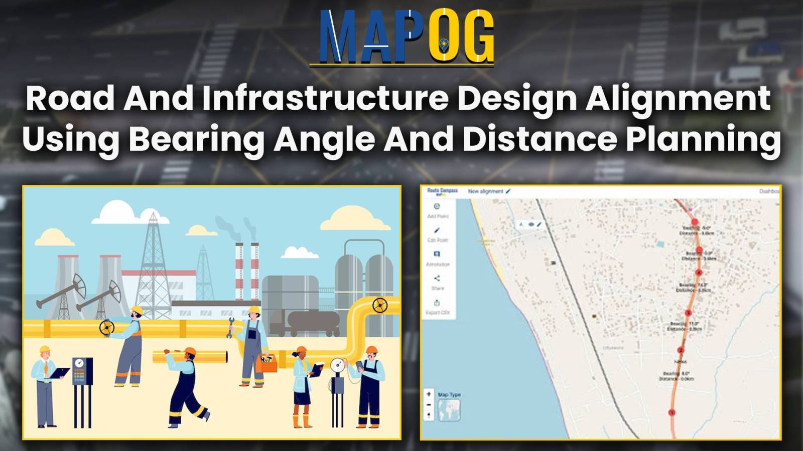
Optimize road and infrastructure design using MAPOG Route Compass. Achieve precise alignment through advanced bearing and distance.