Welcome to MAPOG Route Compass, your ultimate guide to seamless navigation in road and infrastructure design. This article provides an in-depth look at how MAPOG Route Compass optimizes alignment through precise bearing and distance planning.
Explore the capabilities of MAPOG Route Compass through a final analysis based on a random example. Uncover intriguing insights that highlight the tool’s potential in providing comprehensive navigation solutions.
Key Concept
MAPOG Route Compass stands as an innovative solution, transforming road and infrastructure design by providing precision through bearing and distance planning. Designed for a diverse audience, including Civil Engineers, Planners, Government Agencies, Construction Companies, and more, the tool ensures accurate project execution. The ability to create alignments, customize maps, and share projects seamlessly demonstrates its user-friendly nature. The tool’s unique feature of downloading information in CSV format enhances accessibility, solidifying MAPOG Route Compass as an essential companion for stakeholders in the intricate landscape of road and infrastructure development.
Step-by-Step Guide: Leveraging MAPOG Route Compass for Precision in Road and Infrastructure Design
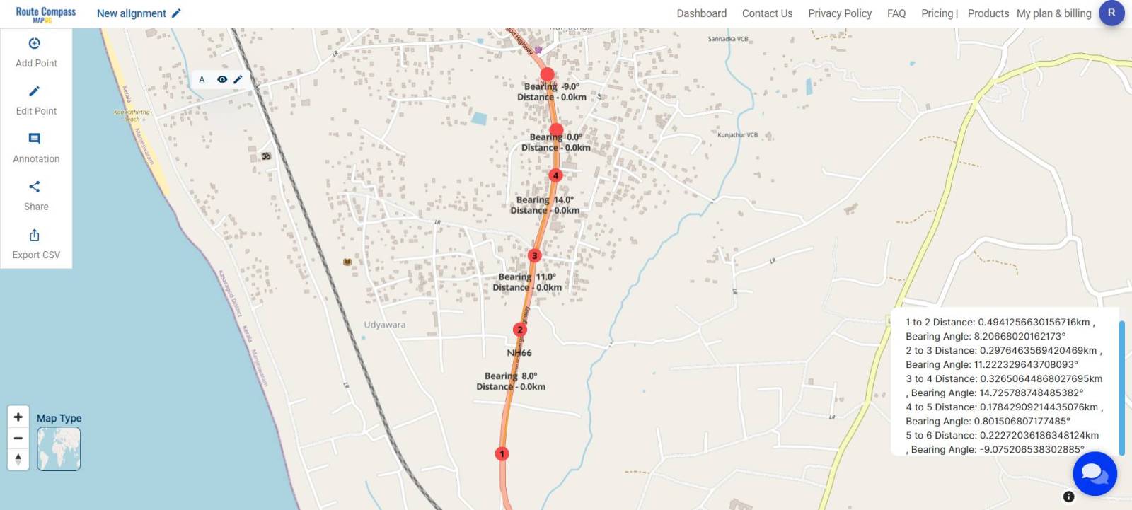
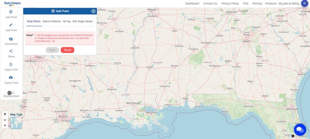
Step 1: Creating Your Alignment
To begin, select a road network and utilize the ‘Add Points’ option in MAPOG Route Compass to initiate your alignment. Within the ‘Add Points‘, you can specifically employ the ‘Drop Point‘ function to tailor the alignment according to your requirements.
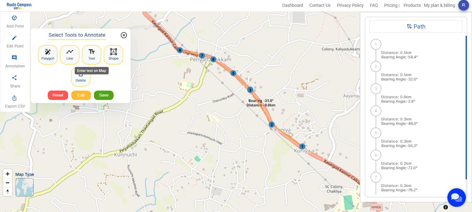
Step 2: Map Customization and Analysis
Assign labels to each point, such as NH66 for the initial point and NH66 new alignment for the final one. Incorporate annotation tools like Polygon, Line, Text, and Shape for a detailed and accurate map. These tools help mark specific areas, and indicate route variations.
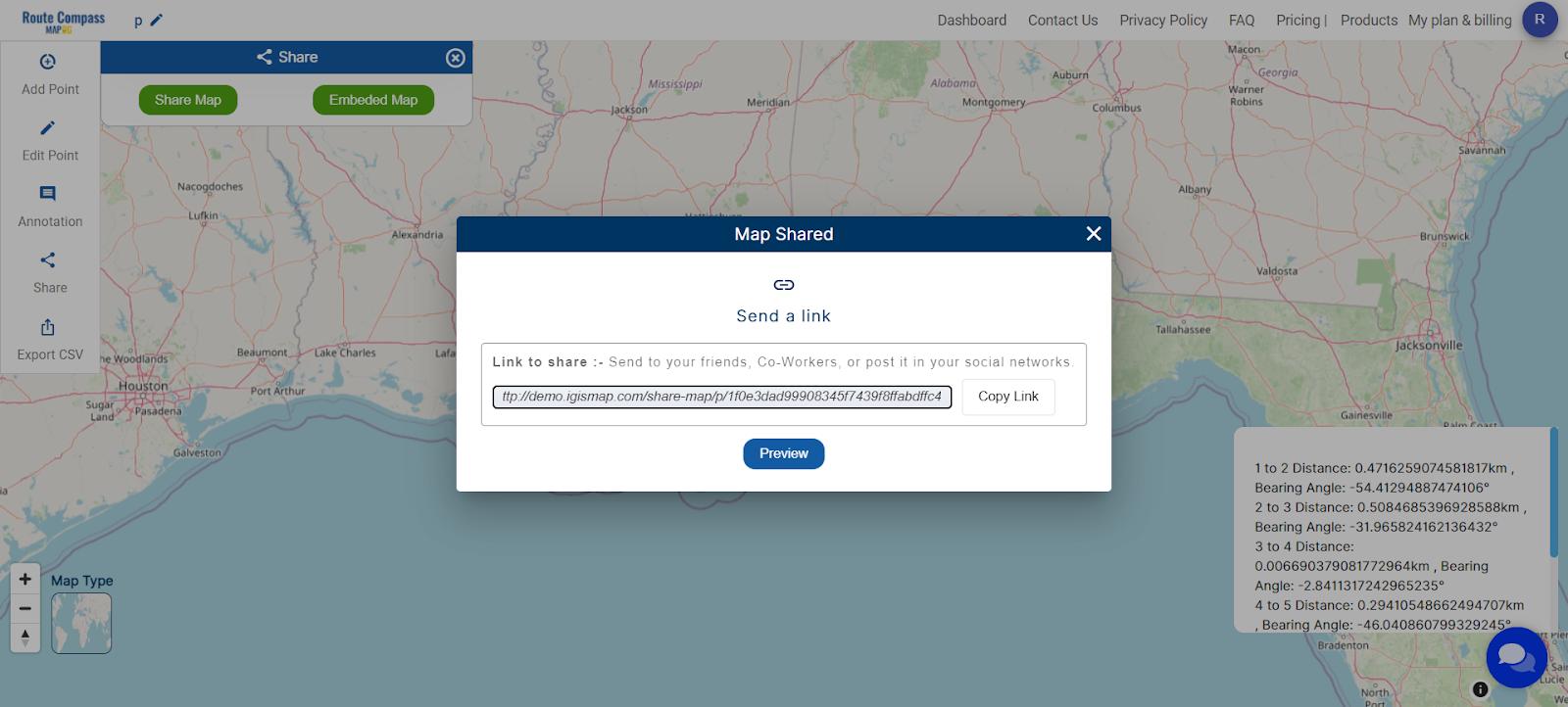
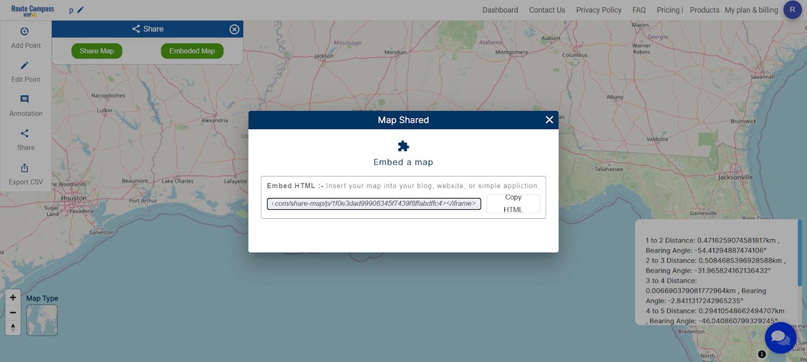
Step 3: Sharing and Embedding Options
Facilitate collaboration by sharing your project. Use the ‘Share Map’ option to send it to friends or post it on social media. For embedding into a blog or website, opt for ‘Embed HTML’ for seamless integration.
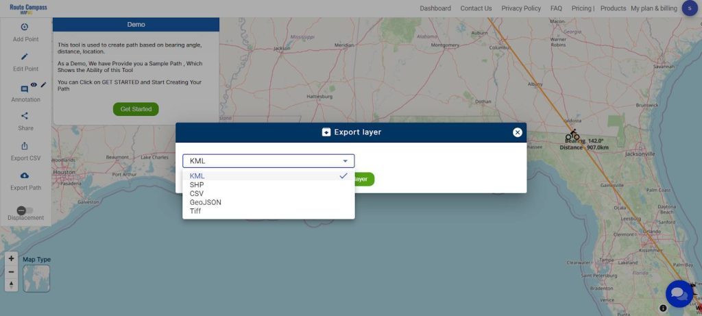
Step 4: Downloading Information in CSV Format
For added convenience, MAPOG Route Compass allows the download of all information in a CSV file format. This feature ensures accessibility and easy sharing of project data. You can also use the export path tool for downloading the data.
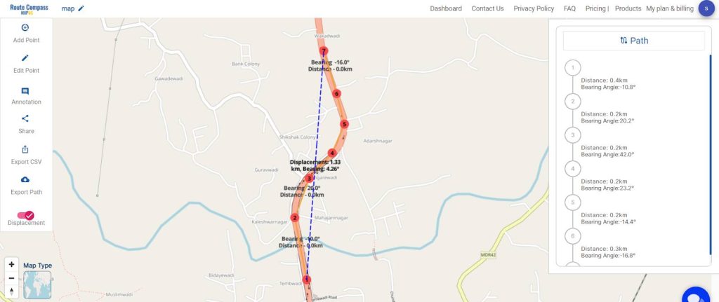
Step 5: Check Displacement from Starting Point to Last Point
Evaluate Displacement: After mapping the marathon route, use MAPOG Route Compass to check the displacement from one point to the last point.
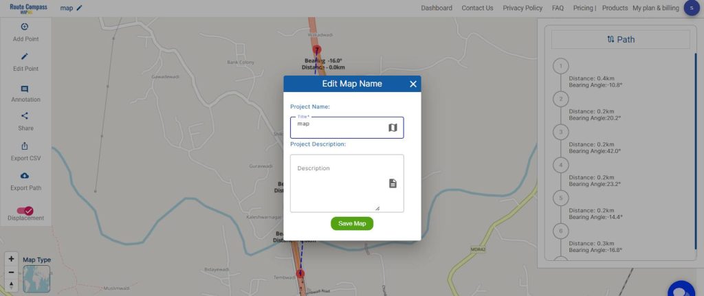
Step 6: Save and Rename Project
Save your project by clicking the pencil icon above, where you can also rename your project for better organization.
Major Findings
MAPOG Route Compass stands out as a user-friendly tool for designing road networks and infrastructure projects. Its accuracy in distance and bearing planning ensures seamless project execution. The sharing, embedding, and downloading features enhance versatility, making it convenient for various applications. With MAPOG Route Compass, precision in road and infrastructure design becomes a tangible reality.
Domains and Industries Benefiting
In the realm of road and infrastructure design, precision plays a pivotal role. MAPOG Route Compass caters to various stakeholders, ensuring accurate project execution for Civil Engineers, Planners, Government Agencies, Construction Companies, Environmental Planners, Surveyors, GIS Professionals, Transportation Authorities, and Infrastructure Investors.
Conclusion
In conclusion, MAPOG Route Compass emerges as a comprehensive tool that not only aids in project planning and execution but also fosters connectivity and collaboration among stakeholders. For any inquiries or assistance, reach out to support@mapog.com. Explore the MAPOG Route Compass app on the Google Play Store and discover other innovative products.
Other Articles
- Protecting Wetlands: Guide to Create GIS Map for Nature
- GIS Analysis in Urban Planning: Reshaping Transportation Future Insights of state/city
- Fast Emergency Response: Using GIS and Isochrone Maps for 10-Minute Ambulance Arrival
- Mapping Tiger Attack Hotspots – Create an Online Map and Share
- Make Routes for Military Aerial Planning- Through Bearing angle and Distance calculation – Online Route Compass
- Mapping Healthcare Efficiency: GIS Buffer Analysis of Hospital Locations
- Add WMS- Two step online view of WMS layer on a map
- Plot ATM locations on a map and embed on your website
- Map habitat locations of endangered animals & keep track of their living