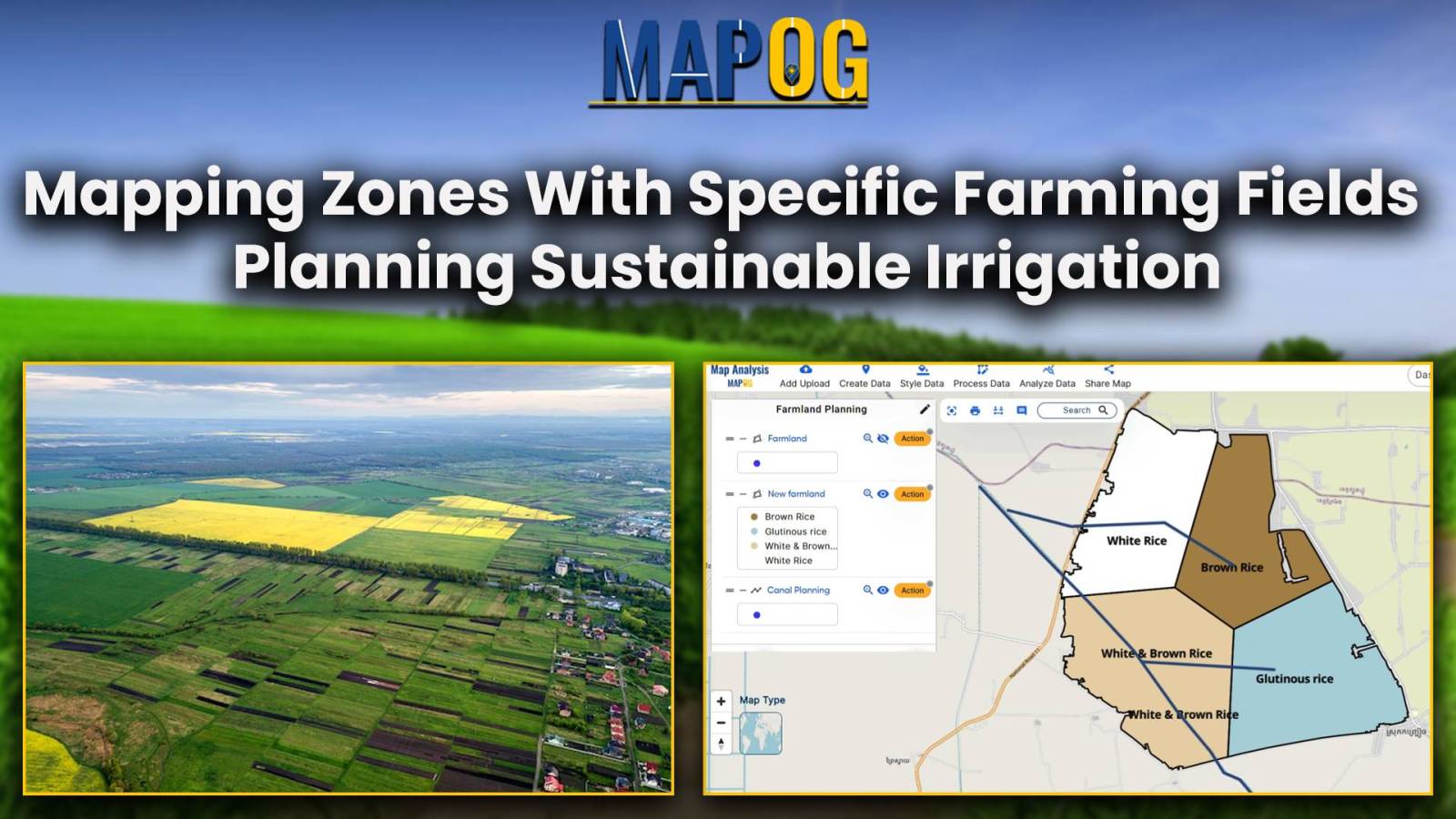
Mapping Zones With Specific Farming Fields : Planning Sustainable Irrigation
Optimize your precision farming planning with MAPOG’s advanced mapping tools. Increase crop yield and sustainability through efficient resource allocation.
Optimize your precision farming planning with MAPOG’s advanced mapping tools. Increase crop yield and sustainability through efficient resource allocation.
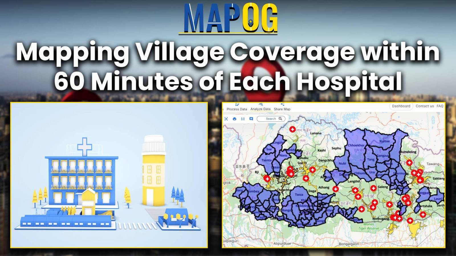
Improve public health by analyzing hospital accessibility with MAPOG. Discover how to strategize healthcare infrastructure for diverse communities.
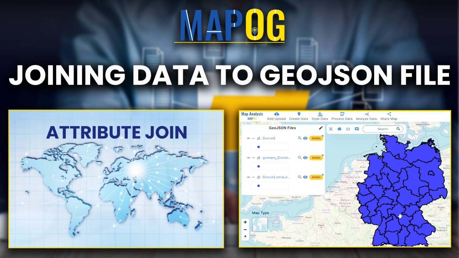
Attribute Joins enrich spatial analysis, revealing insights, informing decisions, and guiding actions across diverse domains for a sustainable future.
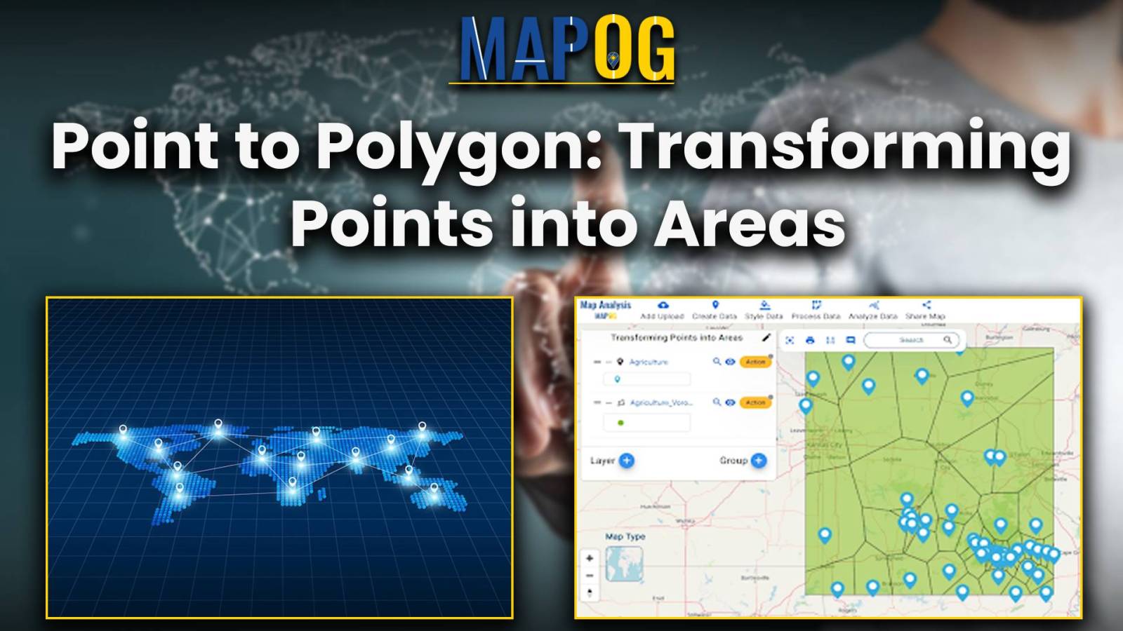
This analysis reveals spatial patterns, distributions, and relationships, understanding land use, resource allocation, and urban development.
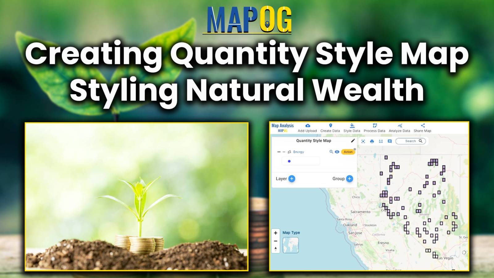
Quantity Style mapping: identifies renewable energy hotspots, highlights land use challenges, and uncovers opportunities for expansion in just one tool.
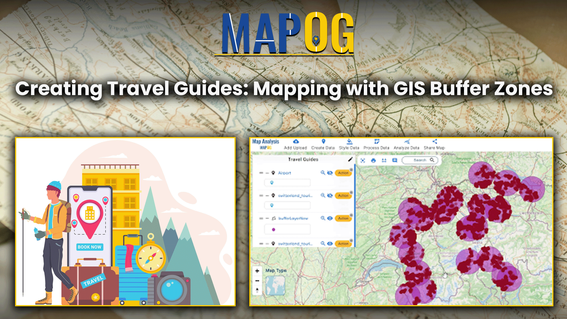
This analysis merges airport and tourist data using GIS, creating travel guides maps for travelers to find nearby attractions from airports.
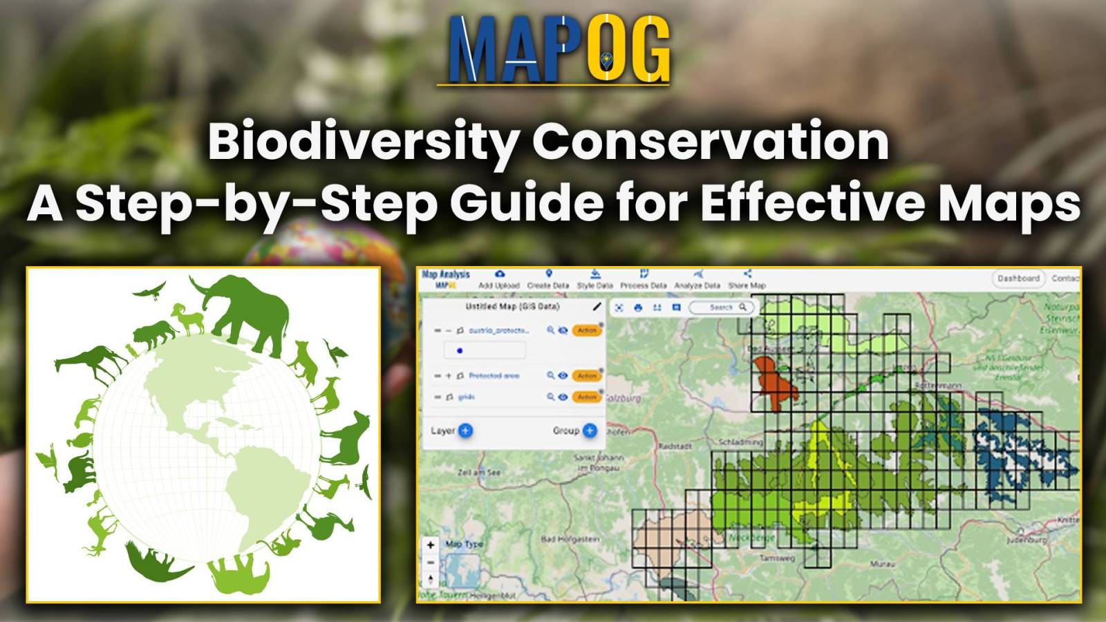
Maximize resources and enhance data accuracy with MAPOG’s step-by-step guide to clip polygons for effective biodiversity maps.
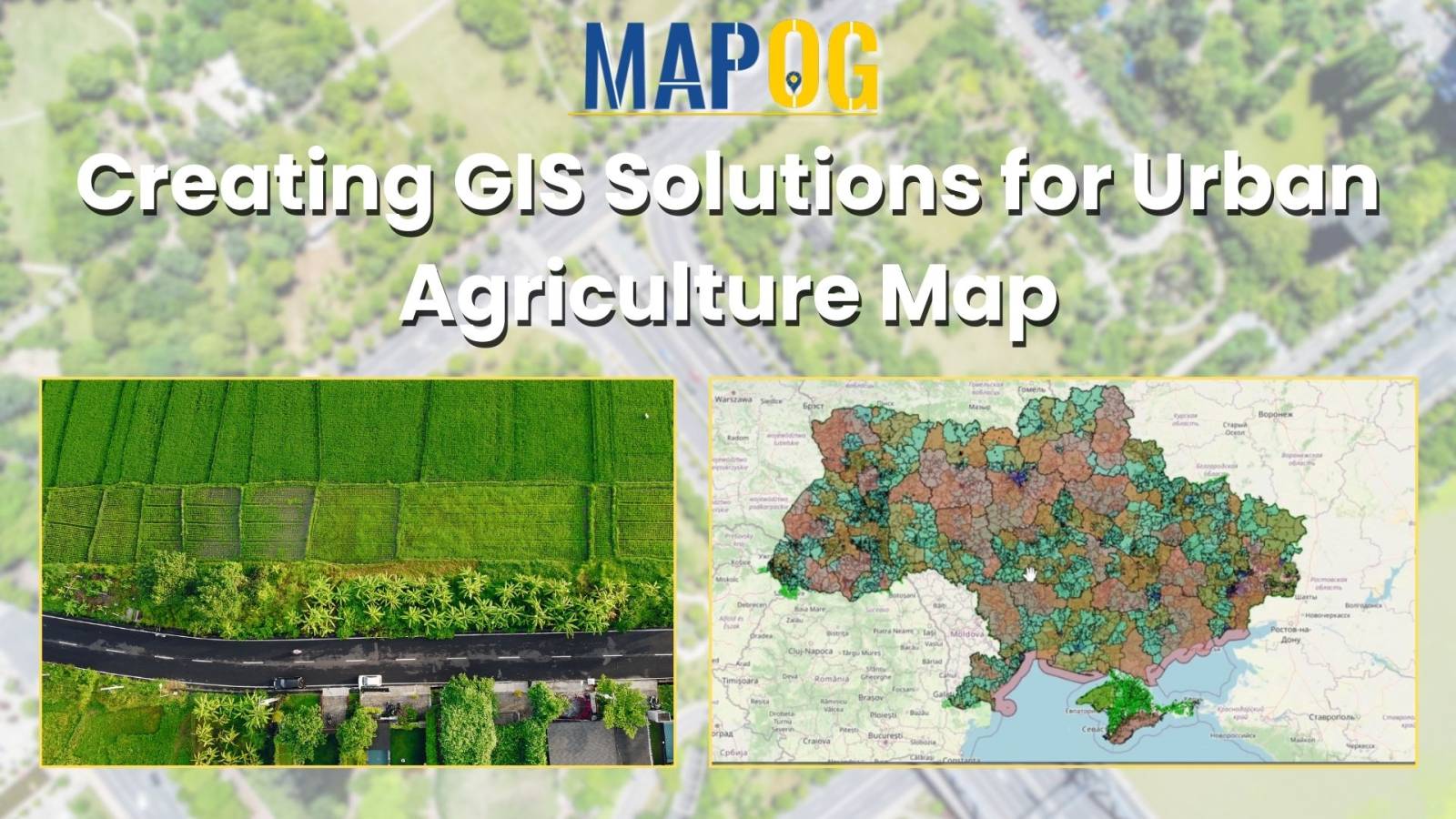
Insights into farmland distribution, urban encroachment risks, agricultural potential, and mitigation strategies for urban agriculture.
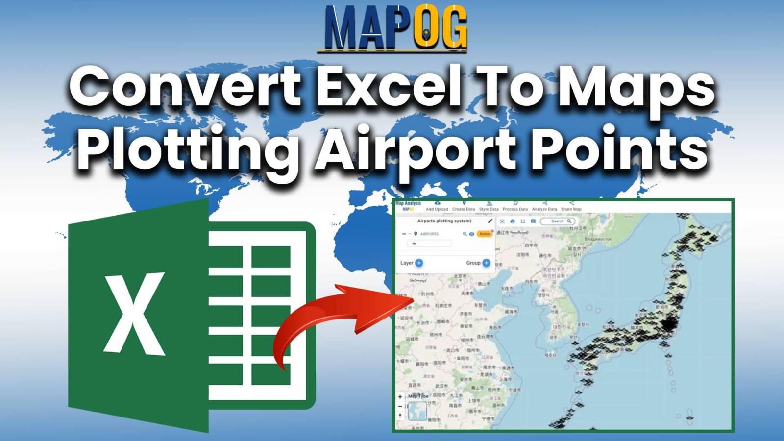
Simplify logistics and navigation with MAPOG’s airport mapping tools. Upload Excel files, enhance visual clarity, and revolutionize air travel planning.
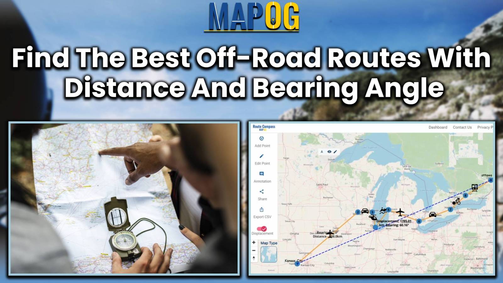
MAPOG Route Compass streamlines construction travel, offering precise route planning and efficient navigation for engineering professionals.