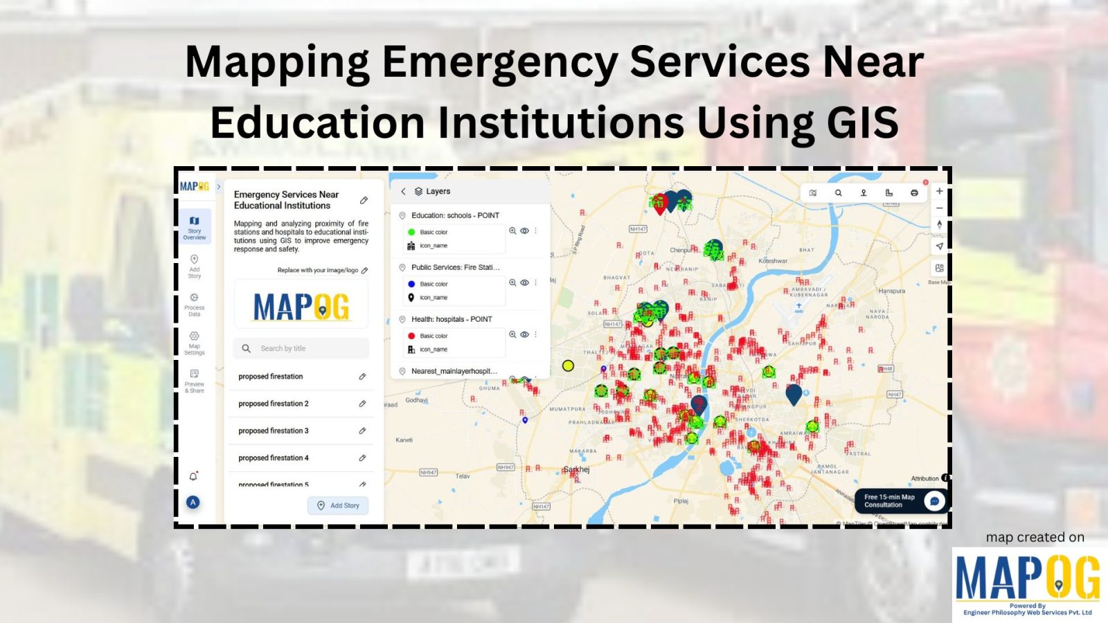
Create Point, Line, Polygon on Map
Learn how to create point, line, and polygon using MAPOG. Generate new spatial datasets and customize maps for diverse mapping needs.
Let yourself loose into a memorable exploration of Analysis of Forest Fire and Map Risk Areas by using the Buffer Tool within MAPOG. Dive into the revelations regarding the insights discovered, the new strategies that emerged, and the overall understanding came about relate to wildfire processes in the past 10 years. Data-driven approaches will be introduced to … Read more
Real estate developers with a holistic approach, market demand, and environmental factors, providing for informed decision-making.
Landfills, where various environmental factors interact to shape microclimates and hydrological patterns, represent complex ecosystems. Effective management and mitigation strategies require a thorough understanding of these landfill areas. Therefore, this article explores the integration of the MAPOG in GIS based Landfill Optimization. If you are interested in creating Urban agriculture map, explore this article-Creating GIS … Read more
Take your hiking experience to new heights with MAPOG’s Route Compass Tool. Explore nature and navigate scenic trails effortlessly.
“Digitizing renewable energy power plants” with MAPOG, in this exploration, we simplify the process of turning intricate data into a straightforward visual guide for a sustainable tomorrow. While our example focuses on the broader global context, these principles can be applied anywhere. Join us as we guide you through the steps, making green energy mapping … Read more
Navigating the quest for an ideal location to build your dream home can be a complex yet exciting endeavor. In this journey, MAPOG emerges as your trusted guide, offering a seamless and intuitive approach to pinpointing the most suitable house construction sites. Create a map to find suitable sites for constructing a new house by … Read more
Welcome to an insightful exploration of education accessibility through comprehensive map analysis using MAPOG. In this journey, we focus on school district coverage, using a Country as an example. Our purpose is to employ Buffer Analysis, as indicated in our topic Create Map – School Map Area Coverage Through Buffer Analysis, to unveil areas with … Read more
Immerse yourself in the future of healthcare safety with ‘Mapping Safety: Create GIS Map.’ Explore the game-changing fusion of MAPOG and the Buffer Tool, strategically crafting buffer zones around solid waste areas. This groundbreaking approach not only enhances safety and mitigates hazards but also redefines risk management in hospital settings. Stay at the forefront of … Read more