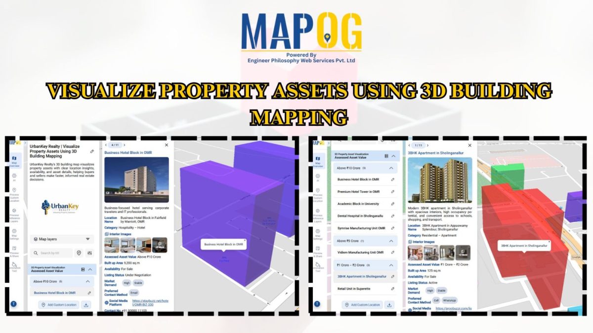
#GeospatialTech

How GIS Helps in Monitoring Climate Change and Its Impact

How GIS is Transforming Climate Change Monitoring and Impact Analysis

GIS (Geographic Information Systems) plays a critical role in tracking, analyzing, and visualizing the climate change and its impact. By integrating satellite imagery, environmental sensors, and spatial data, GIS enables scientists, policymakers, and environmental organizations to understand complex climate patterns and their effects on ecosystems and human communities. It supports long-term monitoring, predictive modeling, and … Read more

GIS in Infrastructure Development and Road Network Analysis

GIS in Infrastructure Development and Road Network Analysis

GIS (Geographic Information Systems) plays a transformative role in the Road Network Analysis development and analysis of infrastructure, particularly in designing and optimizing road networks. By integrating spatial data with planning tools, GIS enables engineers, urban planners, and policymakers to make data-driven decisions. It supports the entire infrastructure lifecycle—from feasibility studies and planning to construction … Read more

Flood Risk Mapping with Interactive Web Maps: A SaaS Platform Approach

Flood Risk Mapping with Interactive Web Maps: SaaS Approach

A SaaS-based flood risk mapping platform leverages interactive web maps to provide risk assessments. Using GIS, AI, and hydrological data, it enables governments, insurers, and communities to visualize flood-prone areas, enhance preparedness, and optimize response strategies. Cloud-based accessibility ensures scalability, data integration, and seamless user collaboration for proactive risk management. Key Concept How Flood Risk … Read more