Story on Map

Interactive Healthcare Map Locate Hospitals, Clinics, Diagnostic Labs & Health Centers

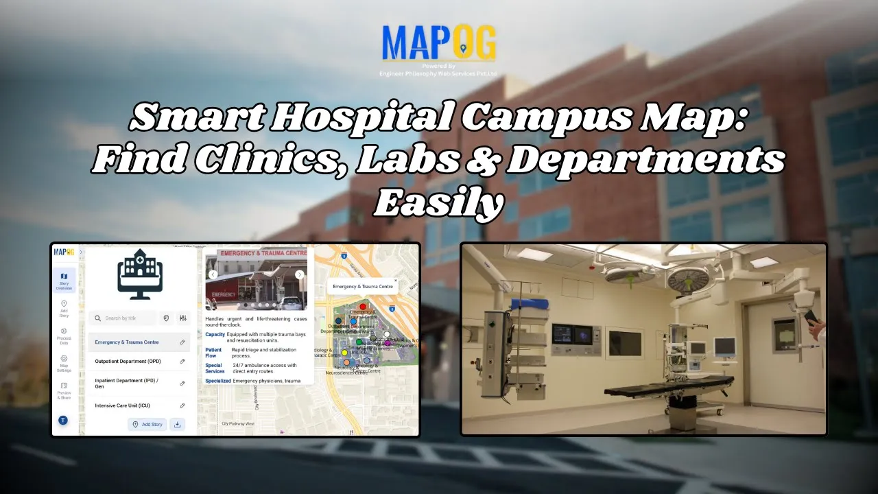
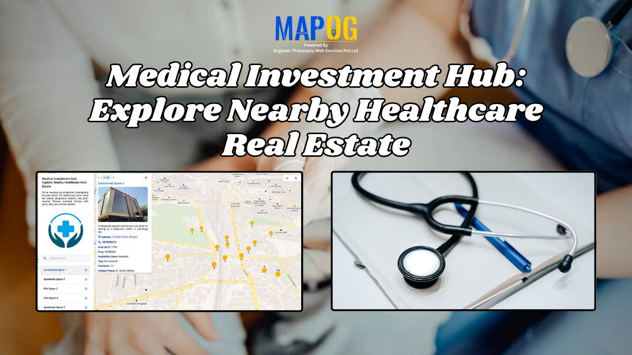
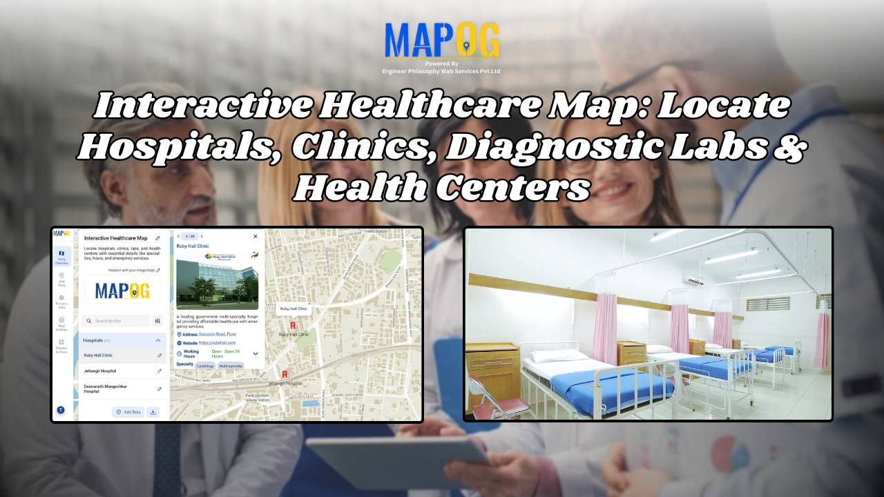
How to Create an Interactive Healthcare Map: Visualize Hospitals, Clinics, and Diagnostic Labs

Healthcare is vital for every community, and using an interactive healthcare map makes it easier to locate the nearest hospital, clinic, or diagnostic lab. With tools like MAPOG, it’s now possible to visualize the entire healthcare network of a city on a single platform. An interactive healthcare map makes it easy to categorize facilities, and … Read more

Smart Hospital Maps: How Interactive Mapping Improves Patient Navigation & Care

Optimizing patient care in a hospital requires a clear view of how different clinical centers, labs, and departments are distributed across the campus. Therefore, a smart hospital campus map improves visibility, efficiency, and decision-making by making navigation simple for patients, staff, and visitors. Using MAPOG, you can create an interactive hospital map that visualizes healthcare … Read more

How to Map a Supply Chain with Warehouses, Distribution Centers & Retail Outlets

How to Map a Supply Chain with Warehouses, Distribution Centers & Retail Outlets

Optimizing logistics requires a clear view of how goods move from warehouses to retail outlets. Mapping your supply chain improves visibility, efficiency, and decision-making. To map a supply chain the best platform is MAPOG, where, you can create an interactive map that visualizes every point in your logistics network. GIS optimizes supply chains by enabling … Read more

Interactive Property Brochure- Showcase Properties with Maps

How to Turn Property Brochures into Interactive Maps for Real Estate Marketing

Interactive Map Experience is redefining real estate marketing by transforming static brochures into dynamic, engaging tools. Instead of only relying on PDFs or plain text, buyers and tenants can instantly see how a property connects to its surroundings—schools, healthcare, transit, and green spaces. These interactive maps don’t just show the building; they showcase the lifestyle … Read more

How to Showcase Your Hotel with an Interactive Property Map for Better Guest Engagement

When travelers look for a luxury stay, undoubtedly, visuals play a powerful role in influencing their decision. This is where you can showcase your hotel with Interactive Property Map to highlight not only your rooms but also the real advantage of your location. Moreover, by designing an engaging map with MAPOG, hotels can transform their … Read more

How GIS Identifies Medical Investment Hubs for Strategic Healthcare Real Estate Growth

Investing in healthcare-focused real estate requires precise Medical Investment Hubs with GIS mapping to identify prime locations near hospitals, clinics, and medical research centers. Likewise, by plotting healthcare hubs, nearby amenities, and transport access, planners and investors can ensure informed decisions, strategic growth, and community well-being using interactive maps with healthcare and property data. Key … Read more

How to Map Destination Wedding Venues with Photos & Details

How to Map Destination Wedding Venues with GIS: Interactive Planning, Travel Insights & Venue Storytelling

How to map Destination weddings venues. It combine travel, culture, and celebration into one unforgettable experience, finding facilities like hospitals, and even explore different styles. In addition, this approach promotes better decision-making, while simultaneously inspiring new ideas and allowing for interactive exploration of venues. Moreover, by integrating GIS tools like MAPOG with venue data, wedding … Read more

Mapping Coastline Marathon with GIS

How to Use GIS for Coastline Marathon Route Mapping and Logistics

Mapping Coastline Marathon organizing a marathon along coastline requires accurate GIS mapping . By plotting hydration points, medical tents, and key milestones, planner, smooth logistics, and a great runner experience without complex crowd-flow simulations, using interactive maps with coastline and checkpoint data. Key Concept: Mapping Coastline Marathon Identifies: Uses of Mapping Coastline Marathon Methodology: Mapping … Read more

On-Map Travel Planning How to Build and Share Interactive Itineraries

On-Map Travel Planning: How to Build and Share Interactive Itineraries Transform Client Experiences

On-Map Travel Planning: How Interactive Itineraries Transform Client Experiences In modern travel , clients no longer want static itineraries—they want to see their journey unfold. Traditional PDFs and spreadsheets may list activities, but they fail to convey geography, movement, or the emotional arc of a trip. This is where on-map travel planning changes the game. … Read more

How to Create Interactive Real Estate Portfolio Maps: Organize, Visualize, and Showcase Projects

In real estate development, success isn’t just built—it’s mapped. Today’s developers are moving beyond static brochures to embrace tools like interactive real estate portfolio map. Hence, these dynamic tools allow developers to present their projects with clarity, connectivity, and context. For example, just as agents use maps to help homebuyers understand surroundings, developers are now … Read more