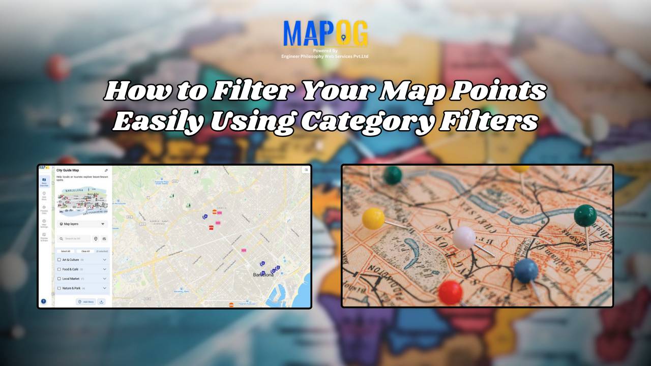
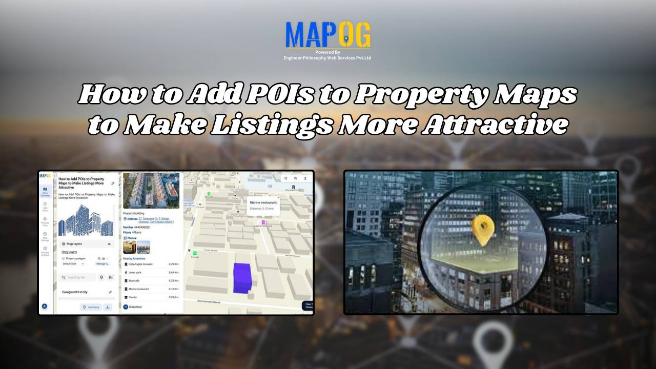
Online Mapping

How GIS Helps in Monitoring Climate Change and Its Impact

How GIS is Transforming Climate Change Monitoring and Impact Analysis

GIS (Geographic Information Systems) plays a critical role in tracking, analyzing, and visualizing the climate change and its impact. By integrating satellite imagery, environmental sensors, and spatial data, GIS enables scientists, policymakers, and environmental organizations to understand complex climate patterns and their effects on ecosystems and human communities. It supports long-term monitoring, predictive modeling, and … Read more

GIS in Infrastructure Development and Road Network Analysis

GIS in Infrastructure Development and Road Network Analysis

GIS (Geographic Information Systems) plays a transformative role in the Road Network Analysis development and analysis of infrastructure, particularly in designing and optimizing road networks. By integrating spatial data with planning tools, GIS enables engineers, urban planners, and policymakers to make data-driven decisions. It supports the entire infrastructure lifecycle—from feasibility studies and planning to construction … Read more

How to Create Interactive Maps Online - Featured Image

Interactive Map Online – A Beginner’s Guide

With tools like Story by MAPOG, anyone can begin their journey in online mapping or build a digital interactive map without technical skills. With tools like MAPOG, anyone—whether you’re a student, traveler, business owner, or researcher—can create beautiful, clickable maps in just a few steps. These maps help you tell stories, plan trips, share information, … Read more