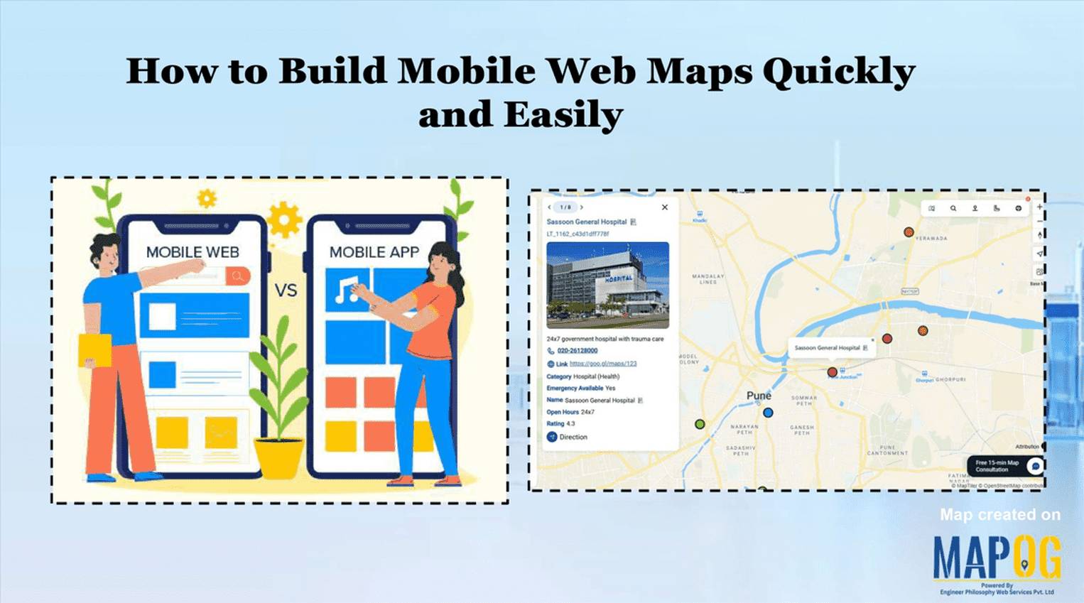
Easy Map Creation

Fire Station Mapping: How GIS Fire Safety Maps Improve Emergency Response & Community Safety

Fire station mapping is an important step as fires spread fast, and when communities lack nearby fire stations, hydrants, or safety infrastructure, the risk of damage rises dramatically. That’s why mapping fire safety infrastructure has become an essential tool for city planners, emergency responders, and local authorities. furthermore using GIS-based interactive tools like MAPOG to … Read more

Mapping Public Amenities to Spot Underserved Areas and Plan New Developments

Public Amenities Mapping with GIS: How Cities Can Improve Schools, Hospitals, Parks & Community Services

Mapping Public Amenities to transform your city into a granted transparent, inclusive, and well-planned urban space with GIS-powered public amenity mapping. This modern approach enables governments, planners, and communities to visualize essential services such as schools, hospitals, parks, libraries, and more on a single interactive map. By identifying underserved areas as much as cities can … Read more

How Mapping Community Water, Energy and Environmental Projects Can Drive Sustainable Development

How Interactive Maps Drive Community Water, Energy, and Environmental Projects

Sustainable development cannot be achieved without community-driven initiatives that focus on water, energy, and environmental needs. Moreover, Mapping Community Water, energy, and environmental projects offers a practical way to visualise data, highlight impact, and ensure transparency. In fact, by creating interactive maps, decision-makers, NGOs, and local communities can track project status, monitor beneficiaries, and share … Read more

How to Map Waste Bins, Collection Points & Recycling Centers to Improve Waste Management and Sustainability

How to Map Waste Bins, Collection Points & Recycling Centers to Improve Waste Management and Sustainability

Waste management is one of the most pressing urban challenges today. However, technology offers us smarter solutions. For example, when you map waste bins, collection points, and recycling centers on an interactive platform, cities can better optimize collection, reduce overflow, and encourage sustainable disposal. Moreover, MAPOG makes it simple to visualize, customize, and share such … Read more

Listing Flats Villas Commercial: How Interactive Maps Transform Real Estate Listings

How to List Flats, Villas & Commercial Properties on One Interactive Map

Listing flats, villas, and commercial spaces in today’s competitive real estate market comes with its own set of challenges. Developers and agents often struggle to present their complete portfolio in an engaging and organised way. Buyers, on the other hand, want to explore properties with context, neighbourhood insights, and trust in the builder—all in one … Read more

Interactive Healthcare Map Locate Hospitals, Clinics, Diagnostic Labs & Health Centers

How to Create an Interactive Healthcare Map: Visualize Hospitals, Clinics, and Diagnostic Labs

Healthcare is vital for every community, and using an interactive healthcare map makes it easier to locate the nearest hospital, clinic, or diagnostic lab. With tools like MAPOG, it’s now possible to visualize the entire healthcare network of a city on a single platform. An interactive healthcare map makes it easy to categorize facilities, and … Read more

Smart Hospital Maps: How Interactive Mapping Improves Patient Navigation & Care

Optimizing patient care in a hospital requires a clear view of how different clinical centers, labs, and departments are distributed across the campus. Therefore, a smart hospital campus map improves visibility, efficiency, and decision-making by making navigation simple for patients, staff, and visitors. Using MAPOG, you can create an interactive hospital map that visualizes healthcare … Read more

How to Map a Supply Chain with Warehouses, Distribution Centers & Retail Outlets

How to Map a Supply Chain with Warehouses, Distribution Centers & Retail Outlets

Optimizing logistics requires a clear view of how goods move from warehouses to retail outlets. Mapping your supply chain improves visibility, efficiency, and decision-making. To map a supply chain the best platform is MAPOG, where, you can create an interactive map that visualizes every point in your logistics network. GIS optimizes supply chains by enabling … Read more

Interactive Property Brochure- Showcase Properties with Maps

How to Turn Property Brochures into Interactive Maps for Real Estate Marketing

Interactive Map Experience is redefining real estate marketing by transforming static brochures into dynamic, engaging tools. Instead of only relying on PDFs or plain text, buyers and tenants can instantly see how a property connects to its surroundings—schools, healthcare, transit, and green spaces. These interactive maps don’t just show the building; they showcase the lifestyle … Read more

How to Showcase Your Hotel with an Interactive Property Map for Better Guest Engagement

When travelers look for a luxury stay, undoubtedly, visuals play a powerful role in influencing their decision. This is where you can showcase your hotel with Interactive Property Map to highlight not only your rooms but also the real advantage of your location. Moreover, by designing an engaging map with MAPOG, hotels can transform their … Read more