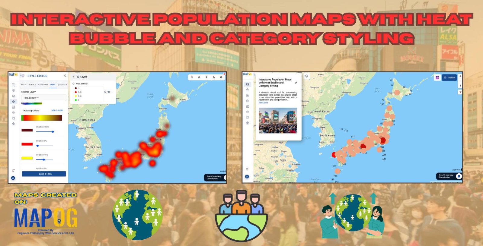
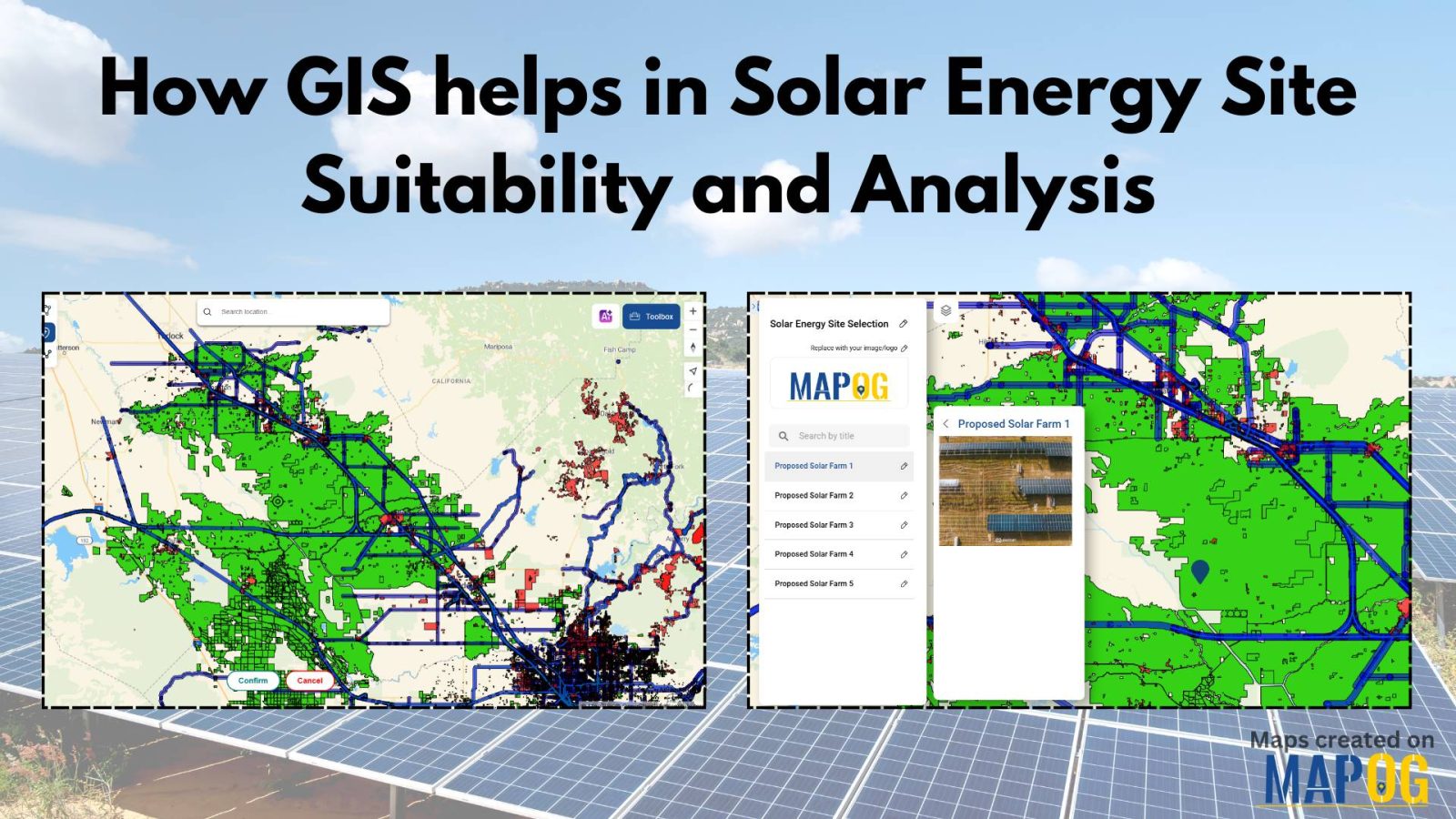
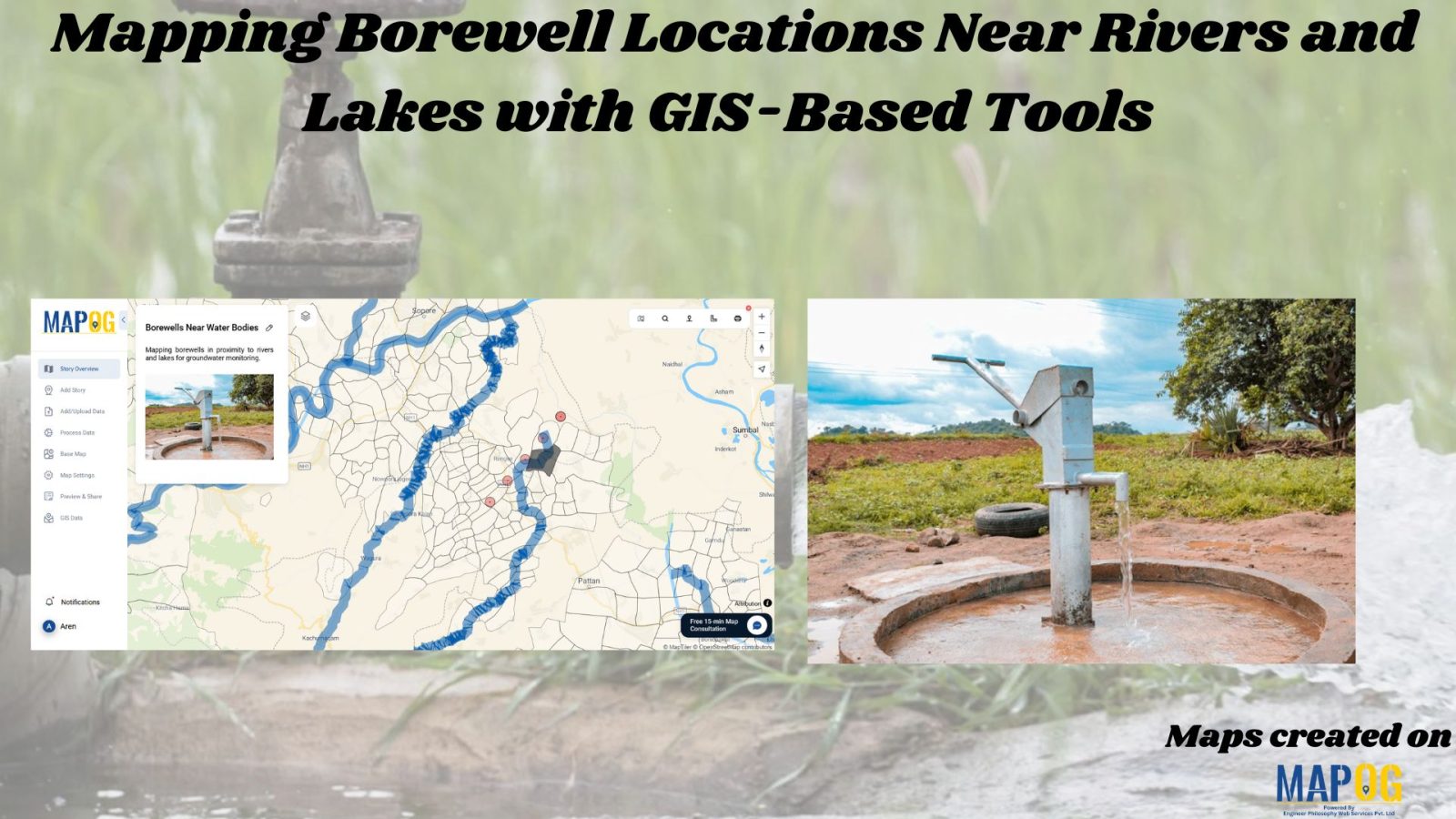
Mapping Hospital-Pharmacy Proximity: A GIS Map Analysis
GIS analysis reveals where pharmacies should be located near hospitals, ensuring timely access to medicine and enhancing public health outcomes.
Understanding and analyzing sports activities in various areas is crucial for making informed decisions about community health, engagement, and infrastructure investments. Mapping Sports Activity: Using Levels for Analysis, By using the level feature and category style in GIS, we can visualize and categorize sports activities on a map effectively. Key Concept of Create Sports Maps … Read more
GIS analysis identifies coverage gaps, places new infrastructure strategically, and optimizes resource allocation for telecom improvements
Delve into the rich legacy of ancient Indian universities with MAPOG’s Map Story feature. Through dynamic mapping technology, we uncover the profound significance of institutions like Nalanda and Taxila. Join us on a captivating journey to explore the vibrant history and enduring impact of these centers of knowledge. KEY CONCEPTS Our goal is to display … Read more
Learn how to map groundwater concentrations with MAPOG MAP ANALYSIS. In this article, we explore the transformative power of heat maps in mapping groundwater concentration. Discover how this innovative approach revolutionizes our understanding of groundwater quality and aids in the protection of vital water resources. KEY CONCEPTS Our goal is to create a simple and … Read more
In the realm of Geographic Information Systems, the ability to visualise spatial data is crucial for understanding patterns, making informed decisions, and communicating information effectively. One fundamental aspect of data visualisation is the representation of specific locations or features on a map using points. Customising these points with distinct icons adds clarity, context, and visual … Read more
Proximity analysis reveals spatial relationships, aiding resource management decisions by identifying patterns, risks, and opportunities efficiently.
Explore the power of MAPOG in creating thematic route maps and bus stop buffer zones, offering key insights for urban planning, transportation optimization, real estate development, and emergency services.
Unlock spatial insights with MAPOG, revealing population distribution, settlement patterns, and strategic opportunities for urban planning, health interventions, real estate, and telecommunications.
In “Green Space Accessibility using Isochrones in MAPOG, we utilize isochrone maps to evaluate and improve access to green spaces. This approach helps identify areas with limited accessibility and guides urban planning efforts to enhance community well-being. Key Concepts By using isochrones in MAPOG, we can analyze and optimize the accessibility of these green spaces, … Read more