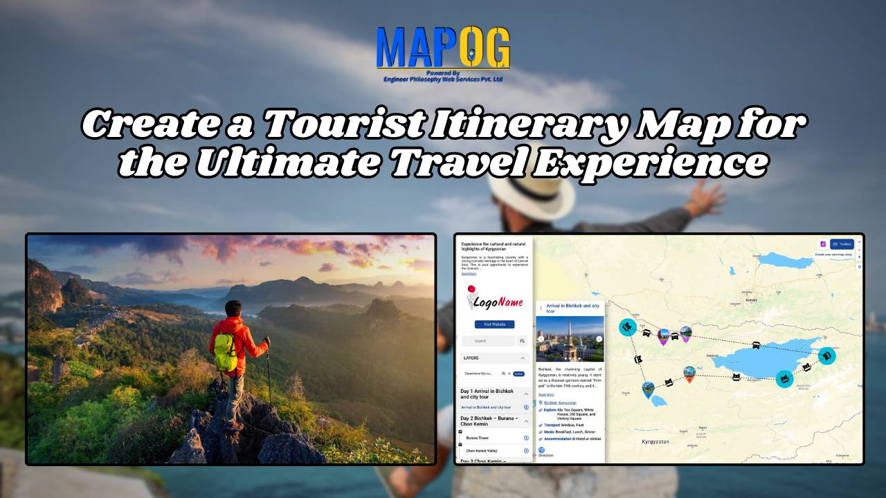
Improving Telecommunications with GIS: A Practical Guide to Mapping Network Coverage
GIS analysis identifies coverage gaps, places new infrastructure strategically, and optimizes resource allocation for telecom improvements
Learn how to map groundwater concentrations with MAPOG MAP ANALYSIS. In this article, we explore the transformative power of heat maps in mapping groundwater concentration. Discover how this innovative approach revolutionizes our understanding of groundwater quality and aids in the protection of vital water resources. KEY CONCEPTS Our goal is to create a simple and … Read more
In the realm of Geographic Information Systems, Excel spreadsheets serve as a common source of data due to their versatility and ease of use. Integrating Excel data into MAPOG can enhance spatial analysis and decision-making processes. This article will walk you through the process of importing Excel data into MAPOG, enabling you to harness the … Read more
Serving as vigilant electronic eyes, CCTV systems are indispensable tools which capture crucial visual evidence in crime investigation. However, not all cameras are equally effective in aiding investigations. Identifying the right cameras, strategically placed in an area, can significantly enhance crime-solving capabilities. By employing MAPOG tools, law enforcement can efficiently identify CCTV cameras that are … Read more
Proximity analysis reveals spatial relationships, aiding resource management decisions by identifying patterns, risks, and opportunities efficiently.
In “Green Space Accessibility using Isochrones in MAPOG, we utilize isochrone maps to evaluate and improve access to green spaces. This approach helps identify areas with limited accessibility and guides urban planning efforts to enhance community well-being. Key Concepts By using isochrones in MAPOG, we can analyze and optimize the accessibility of these green spaces, … Read more
Visualize and analyze spatial data with density mapping using heatmaps. Identify patterns and trends for informed decision-making and planning.
Insights from GIS data: Urban planning, environmental protection, healthcare, real estate benefit, aiding decision-making.
In energy infrastructure management, ensuring the safety and integrity of pipeline networks is very important. The influence of pipelines extends far beyond their physical footprint, encompassing the communities, ecosystems, and infrastructure that lie in their vicinity. Understanding and mitigating the potential risks of pipeline activities necessitate a holistic approach. In this article, we delve into … Read more
In the realm of spatial analysis, understanding the distribution and types of educational institutions is paramount for effective planning and decision-making. With the advent of advanced GIS platforms, such as MAPOG, utilizing tools like proximity analysis has become instrumental in categorizing educational institutions with precision and efficiency. This article delves into the key concept of … Read more