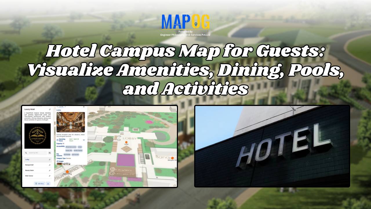
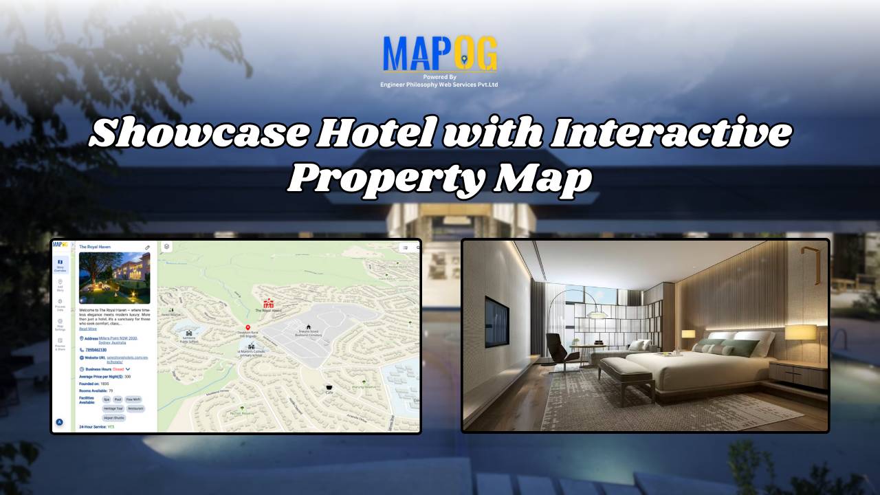
MAP STORY

How GIS on Map Helps Optimize Public Transport Routes and Reduce Traffic

In today’s urban landscape, GIS for public transport optimisation is basically transforming how cities tackle congestion and improve mobility. By integrating spatial data with transit planning altogether, Geographic Information Systems help planners design smarter, more efficient transport routes that reduce traffic, improve accessibility, and enhance commuter satisfaction. Understanding GIS for Public Transport Optimization and Why … Read more

Create a Real Estate Map with Filters for Price, Location, and Property Type

Mapping has become an essential tool in the real estate industry to display property data and attract potential buyers visually. One such powerful and easy-to-use tool is  MAPOG, which allows users to Create real estate Property Map with filters such as price, location, and property type. This article walks you through the methodology step-by-step, explains … Read more

How Real Estate Agents Use Maps to Sell Properties Smarter

How Real Estate Agents Use Maps to Sell Properties Smarter

In real estate, using real estate map tools helps agents present not just the property, but its location benefits too. More agents now use interactive maps to help buyers understand not just the home, but its surroundings—like nearby parks, schools, transit, and conveniences. Embedding maps into property listings makes websites more engaging. When buyers can … Read more

Create a Travel Journal on a Map – Add Photos, Notes & Pins

Create a Travel Journal on a Map – Add Photos, Notes & Pins

Planning your next adventure? Don’t just jot down your stops—Create a Travel Journal on a Map to capture every moment. A Travel Journal Map helps you organize memories by location, add photos and notes, and visually share your journey. With MAPOG, it’s easy to plan your route, add key locations, and share it online with … Read more

Best Alternatives to Google My Maps for Sharing Travel Stories

Best Alternatives to Google My Maps for Sharing Travel Stories

If you’re on the lookout for the best alternatives to Google My Maps, you’re not alone. Travelers, bloggers, and content creators are increasingly seeking more flexible, interactive, and storytelling-driven platforms to share their travel memories. While Google My Maps offers basic map-making features, it often falls short in terms of personalization, multi-user collaboration, and storytelling … Read more

Performing Retail Site Selection with Convex Hull Analysis

Performing Retail Site Selection with Convex Hull Analysis

Choosing the right retail location goes beyond guessing where people shop. Instead it’s about recognizing spatial clusters, identifying market gaps, and optimizing coverage. With this in mind, MAPOG, retailers can make data-driven decisions by interpreting customer and store distributions visually. Coupled with heat bubble styling, grid-based analysis, or retail site selection , MAPOG enables smarter … Read more

Mapping Waste Disposal Sites with GIS for Clean Cities

In fast-growing cities, mapping waste disposal sites with GIS is becoming essential to public health and sustainability. As waste volumes rise, understanding where and how it’s managed is key to building cleaner, more efficient cities. This project uses MAPOG, a cloud-based spatial mapping platform, to visualize key waste disposal sites—ranging from major landfills to Refuse … Read more

Mapping Hotel Branches for Better Hospitality Management

Effectively managing several hotel locations is crucial for providing consistent service and upholding brand standards in the dynamic hospitality sector. By making it possible to visualise and analyse hotel branch data on interactive maps, Geographic Information Systems (GIS) provide a contemporary solution. Using intelligent GIS tools like MAPOG to map hotel branches improves decision-making, streamlines … Read more

Free GIS Mapping Tools for Students and Researchers

Free GIS Mapping Tools for Students and Researchers

In today’s logistics-driven world, Geographic Information Systems (GIS) play a pivotal role in analyzing spatial data for informed decision-making. Fortunately, MAPOG offers Free GIS Mapping Tools that empower students, researchers, and planners to explore and visualize real-world location-based patterns. With tools such as Buffer Zones, Clip and Isochrones, users can easily identify optimal sites for … Read more

How to Highlight and Manage Your Franchise Reach Using Interactive Maps

Want to show franchise stores on a map and manage them easily? If you run a franchise spread across India, you already know how tough it gets to keep track of store locations, managers, services, and updates. That’s where interactive maps step in—not just as a tool to display your presence, but as a powerful … Read more