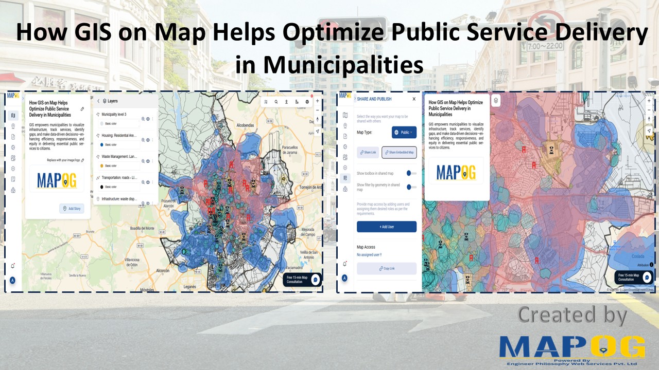
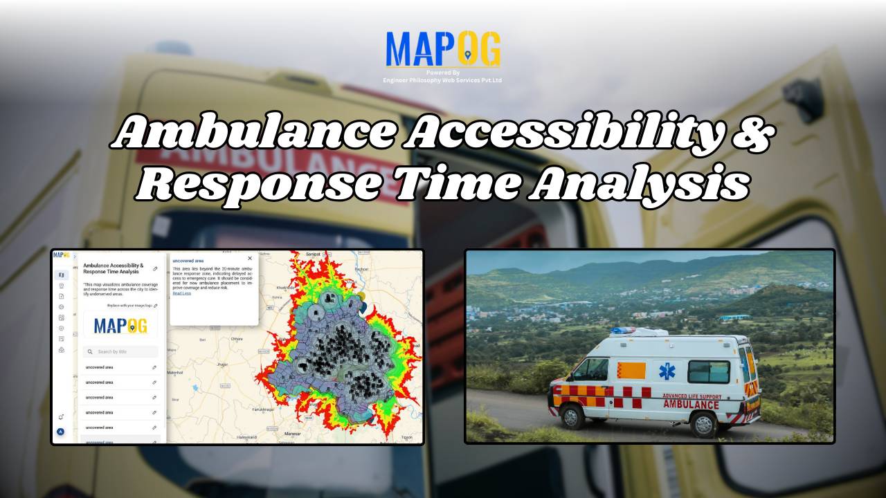
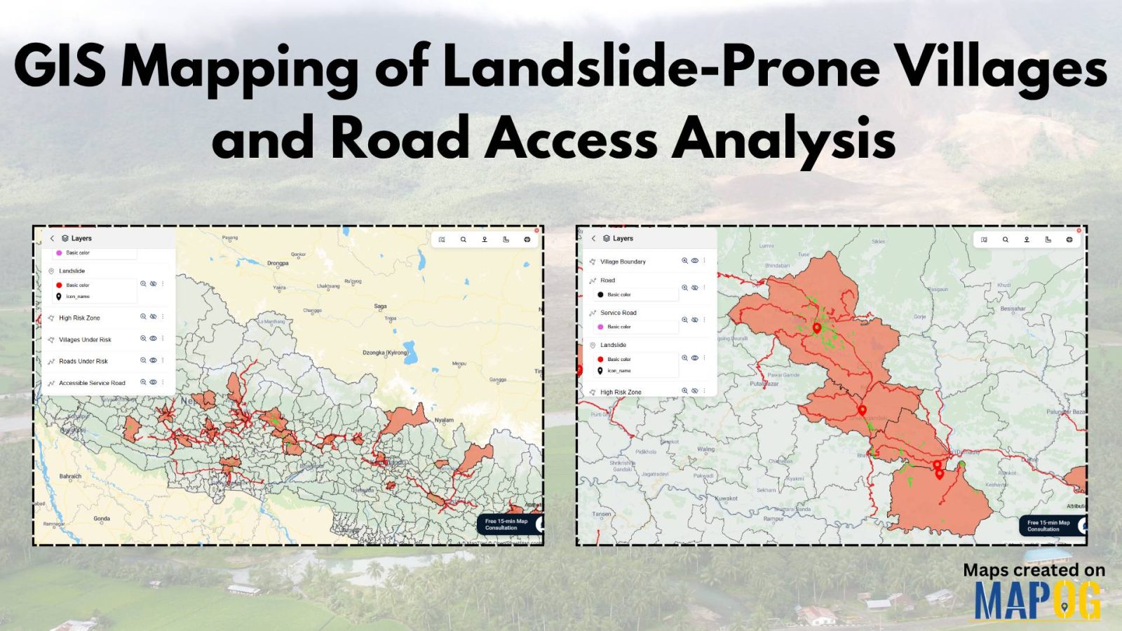
Creating Travel Guides: Mapping with GIS Buffer Zones
This analysis merges airport and tourist data using GIS, creating travel guides maps for travelers to find nearby attractions from airports.
Data tables serve as the backbone of Geographic Information Systems (GIS), housing crucial information about spatial features. In the realm of GIS, understanding and effectively manipulating these tables are essential for comprehensive data management and analysis. Enter MAPOG, a powerful platform that revolutionizes data table exploration and utilization. Explore the application of MAPOG in various … Read more
Insights into farmland distribution, urban encroachment risks, agricultural potential, and mitigation strategies for urban agriculture.
In today’s era of rapid urbanization and the push for sustainable transportation, the accessibility of charging stations for electric vehicles (EVs) has emerged as a critical consideration. In this article, we delve into the importance of evaluating the accessibility of charging stations, employing the powerful methodology of MAPOG MAP Analysis. By harnessing this innovative approach, … Read more
In the realm of ‘Petrol Pump Availability: Empowering Access’, MAPOG stands as a powerful tool, offering insights that can redefine our understanding of spatial dynamics. In a world constantly moving, access to petrol pumps is paramount. At MAPOG, we’re dedicated to providing a comprehensive solution for visualizing and analyzing Petrol Pump Accessibility: A Spatial Analysis. … Read more
Discover how to efficiently merge polygons in GIS. Learn the essential steps and techniques to combine geographic features
Transform road networks through digitalization with MAPOG Map Analysis Tool. Enhance efficiency and strategic planning.
Real estate developers with a holistic approach, market demand, and environmental factors, providing for informed decision-making.
Landfills, where various environmental factors interact to shape microclimates and hydrological patterns, represent complex ecosystems. Effective management and mitigation strategies require a thorough understanding of these landfill areas. Therefore, this article explores the integration of the MAPOG in GIS based Landfill Optimization. If you are interested in creating Urban agriculture map, explore this article-Creating GIS … Read more
Navigating the quest for an ideal location to build your dream home can be a complex yet exciting endeavor. In this journey, MAPOG emerges as your trusted guide, offering a seamless and intuitive approach to pinpointing the most suitable house construction sites. Create a map to find suitable sites for constructing a new house by … Read more