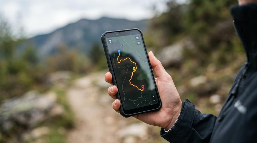
For trekking tour operators, a map is not just a marketing asset. It is where route planning, trip communication, safety information, and traveler confidence come together. MAPOG gives you a no-code way to build interactive maps that help you publish routes, explain itineraries, and share trail information in a format your clients and staff can actually use.
MAPOG is built for businesses that need map-based experiences, including adventure and trekking companies, tour operators, hotels, resorts, and tourism boards. If you need to show a multi-day trek, publish a branded itinerary, brief guides on route changes, or embed a shareable map on your website, we help you do that without custom development or GIS-heavy workflows.
MAPOG adventure map software for trekking tour operators
MAPOG helps trekking operators turn routes, places, and trip details into interactive maps that work for both customer-facing trips and internal operations. You can create a map, add route information, attach images, videos, links, and notes, then share it publicly, embed it on your website, or keep it private for staff and partners.
That matters when your team is managing more than a simple start-and-finish trail line. A trekking trip often includes trailheads, camps, pickup points, lodging, permit notes, safety instructions, alternate routes, and local contact information. MAPOG brings those details into one map-based experience so your travelers spend less time searching through PDFs, email threads, and scattered links.
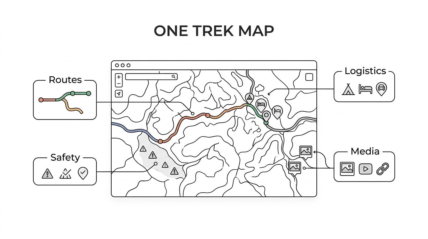
“MAPOG gives trekking operators one shareable map for routes, safety notes, images, videos, links, and trip details.”
Because MAPOG is designed for travel and tourism teams, you do not need programming knowledge to get started. That makes it easier to launch new itineraries quickly, update seasonal routes, and keep your published trip information aligned with what your guides and operations team are using.
Publish trekking routes, trip plans, and trail safety information in one map
When you sell guided hikes, treks, or remote adventure travel, your clients want to see more than a route line. They want to understand the journey. MAPOG lets you build adventure maps that show daily stages, major waypoints, accommodations, transfer points, rest stops, scenic highlights, and important trail notes in one place.
MAPOG also supports the safety side of trip communication. The U.S. National Park Service advises hikers to carry navigation essentials such as a map and GPS system and to share a trip plan before departure. Our platform helps you package route guidance, designated trail reminders, meeting points, and pre-departure trip details in a format that is easier for travelers to review before they head into the field.
“MAPOG helps you package trail maps, safety routes, and trip plans in one interactive format that is easy to share before departure.”
A strong adventure map can support both booking decisions and trip readiness. When travelers can explore the route visually and understand how the trip unfolds, expectations become clearer before they arrive.
Here are some of the details trekking operators often publish with MAPOG:
- Routes: Day-by-day trail segments, alternate paths, summit attempts, transfer legs, and return routes.
- Safety information: Designated trail guidance, briefing notes, emergency contacts, check-in points, and route-specific cautions.
- Trip logistics: Meeting locations, accommodations, camps, meal stops, permit notes, gear reminders, and transport connections.
- Rich media: Photos, videos, links, and map notes that help travelers understand terrain, highlights, and key decisions along the route.
MAPOG gives you a practical way to combine itinerary publishing with trail communication, so your map becomes useful before the trip, during operations, and after a route update needs to go live.
Embed branded adventure maps on your trekking website and control access by role
Many trekking companies need one version of a map for marketing and another for operations. MAPOG supports both. You can build a public-facing adventure map for trip pages and create private or restricted-access map views for internal teams, guides, transport partners, or local coordinators.
MAPOG also makes publishing easier for lean teams. You can create a map, customize the appearance, copy the embed code, and place it on a webpage. For your business, that means faster trip page updates, stronger visual storytelling, and less reliance on a developer every time a route changes or a new departure is launched.
“MAPOG lets your team create a map, customize it, and paste an embed code into your website without programming.”
Role-based access matters when not every route note should be public. You may want travelers to see the itinerary and highlights, while guide teams need operational notes, backup routes, supplier contacts, or field instructions. MAPOG gives you that flexibility while keeping your mapping workflow in one system instead of splitting it across consumer map tools, internal documents, and web content.
Mobile-friendly route planning and field communication for guides and travelers
Adventure travel does not happen at a desk, so your maps need to work well on phones and tablets. MAPOG is mobile-friendly across devices, which helps your staff and travelers access route information on the move, whether they are reviewing a trek itinerary in advance or checking key locations during operations.
MAPOG also supports route planning, map analysis, GIS data download, and mobile data collection. That gives trekking operators a more operationally useful map setup, especially when routes need to be reviewed by office staff, field guides, and partners using different levels of detail. If your team already works with trail or GIS data, MAPOG helps turn that information into something more usable for trip delivery and customer communication.
“MAPOG combines route planning, GIS data download, mobile data collection, and mobile-friendly maps for trekking operations.”
Just as important, MAPOG supports preparation rather than replacing standard hiking safety practices. Hikers are still advised to carry maps and GPS and to review routes before leaving cell service. Our platform helps you distribute clearer trip plans, route expectations, and trail information ahead of time so travelers and staff are working from the same source.
When MAPOG is the right fit for trekking operators and adventure travel teams
MAPOG is a strong fit when your business needs more than a static route image or a simple pin map. We are especially relevant when your maps need to support sales, pre-trip communication, and field coordination at the same time.
MAPOG is likely the right choice for your team if you need to:
- Publish sellable trekking itineraries: Show routes, highlights, accommodations, and travel logistics in a format that supports trip pages and client conversations.
- Share trail safety and route updates: Communicate designated trails, safety notes, alternate routes, and planning details in one place.
- Manage public and private map access: Keep customer maps polished while giving staff and partners the operational detail they need.
- Avoid custom development: Launch interactive, embeddable maps without requiring technical or programming knowledge.
If you only need a one-time static trail image, MAPOG may be more than you need. If you need living adventure maps that can be updated, shared, embedded, and used across teams, it becomes a much stronger fit.
Start building a MAPOG adventure map for your next trekking itinerary
Your routes already carry the story of your business. MAPOG helps you present that story with more clarity for travelers and more control for your team. You can show the journey, publish the logistics, support safety communication, and keep your trek information current without turning every update into a web project.
If you are ready to improve how you publish trekking routes and trip plans, start with MAPOG and build an adventure map that works for your website, your guides, and your travelers.