
Interactive visualization has become a crucial component of modern real estate marketing, from understanding flat layouts and building structures to investigating facilities and nearby places, 3D buildings are becoming popular. Real estate companies may present projects more clearly, increase consumer engagement, and streamline property exploration by converting traditional maps into immersive visual experiences.
With MAPOG, creating interactive 3D building maps becomes simple and accessible. Using polygon structure, customizable templates, and advanced visualization tools, businesses can build detailed 3D representations of residential societies, without requiring complex GIS expertise.
Key Concepts Behind Create 3D Buildings
Traditional maps often display locations as flat markers, which can make it difficult for users to fully understand the actual environment or structure of a place. In the real estate business, showcasing residential societies, apartments, villas, and nearby facilities in a visually detailed way, allows buyers to better visualize the project before visiting the site. In addition, urban planners and infrastructure teams can also use 3D visualization to present city layouts, zoning plans, and development projects more effectively.
Creating 3D buildings utilizes polygon structure to visually elevate maps, enabling viewers to identify nearby facilities easily. Layered visualization enhances storytelling and spatial analysis and is beneficial for marketing.
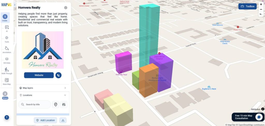
Step-By-Step Guide To Create 3D Buildings
Step 1: Add 3D Buildings in a New Map Setup
To begin, open MAPOG and go to the Create & Publish section. After that, click on the Create New Map, and choose the template option.
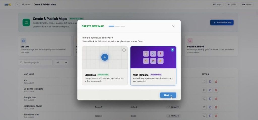
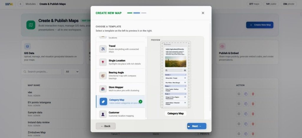
Choose the Category Map template.
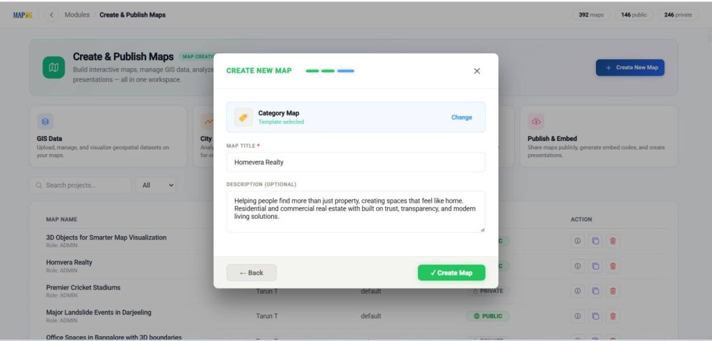
After adding the title and description, create the map and open the workspace.
Next, go to Map Settings & upload your logo for branding.
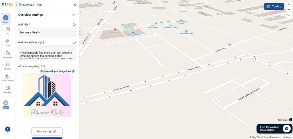
Step 2: Create 3D Structures of Buildings
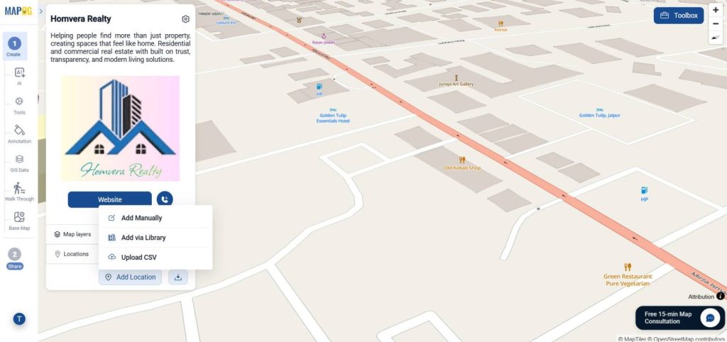
First, click on Add location, then select Add Manually.
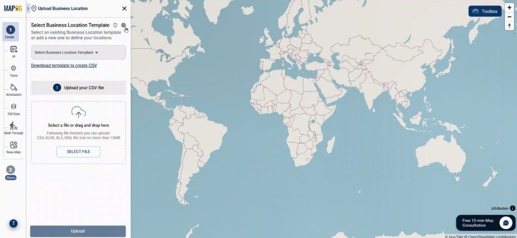
Click on Select Business Location Template settings option to create a reusable template. This feature in MAPOG is extremely useful because the same structure can later be reused across different maps.
Click the new type to begin. Inside the template setup, add the title, choose a color, and set geometry as Polygon as buildings require area.
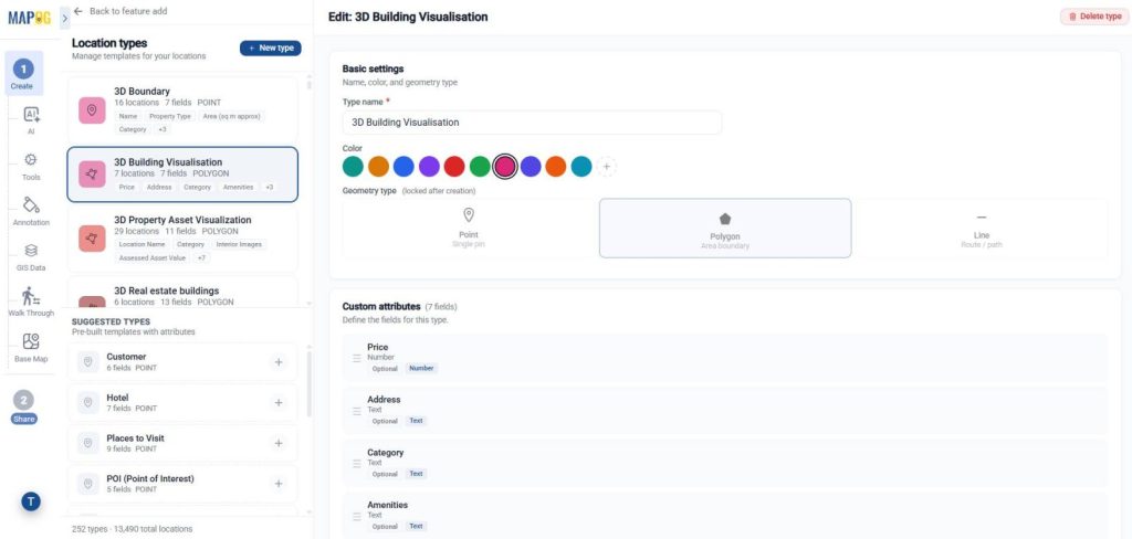
After that, assign attributes like Area (sq meters), Price, Category etc. Select the field type as text, number, select etc. Then, click on the create type to save the template.
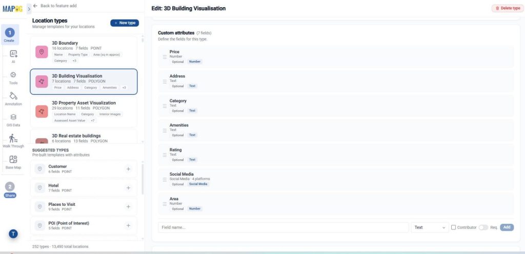
Afterward, return to the previous window, Select the business location template, you just created. Add a title, a short description, upload an image of the property, and write the attributes. Add social media links for easier access.
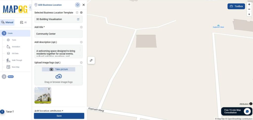
Now click on the Polygon tool on the map. You can Search your location or just add manually.
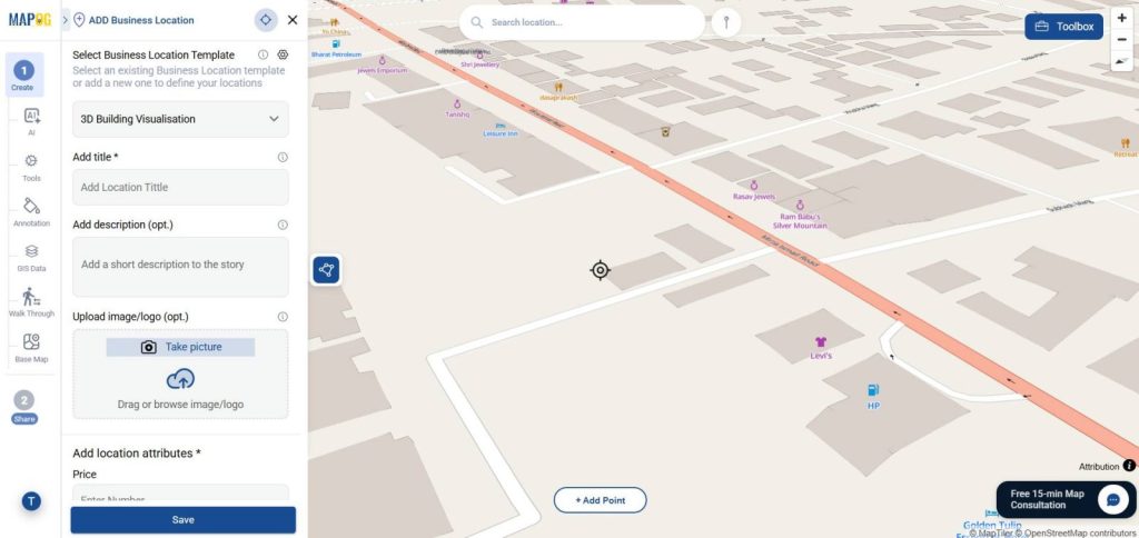
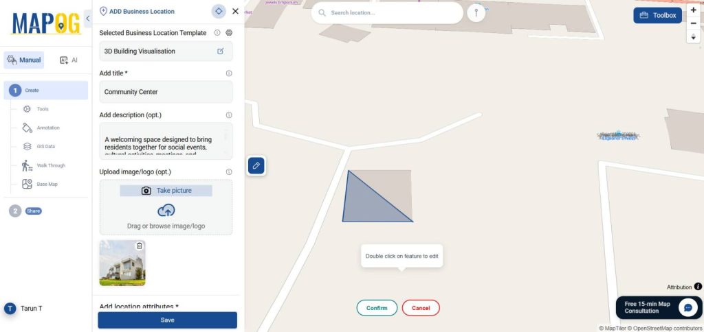
Move your cursor to one corner of the building and click to add a point. Repeat the same process by tracing the complete building boundary. Once finished, click on Confirm.
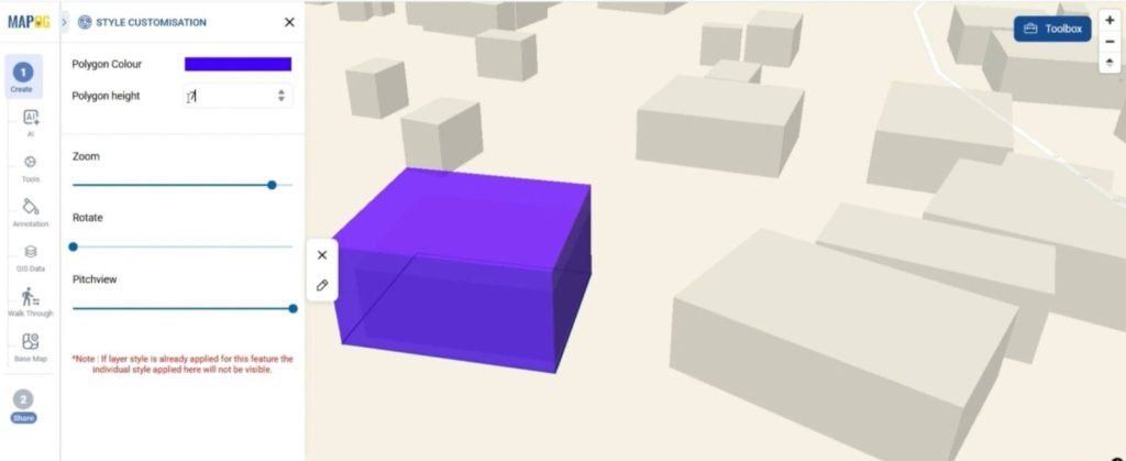
Next, click on the Pencil icon to customize the polygon. The Style Customization window will appear. Choose the colour of your choice, add the height of the building to give it a 3D structure. Add zoom, rotate & pitchview for better visualization. Review everything & click submit.
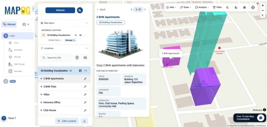
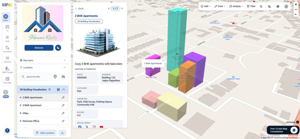
By following similar steps, you can add multiple 3D structures such as 3BHK flats, community centers, and other amenities, to create a complete interactive 3D map of your real estate project.
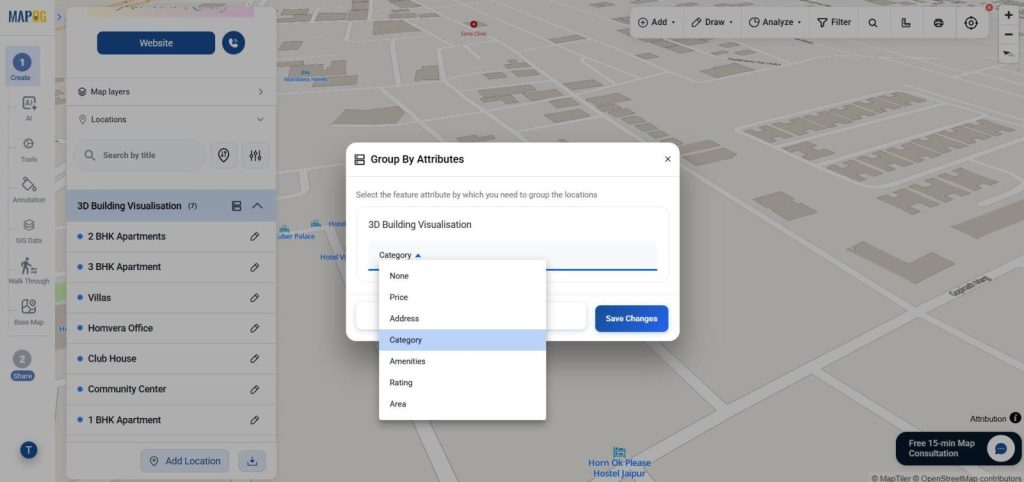
By using group by attribute features you can categorise project based on property types or price status.
Step 3: Share and collaborate on 3D Building Maps
Finally, open the Preview & Share section. Keep the map private for internal collaboration or make it public, for wider access.
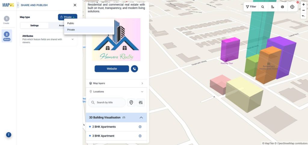
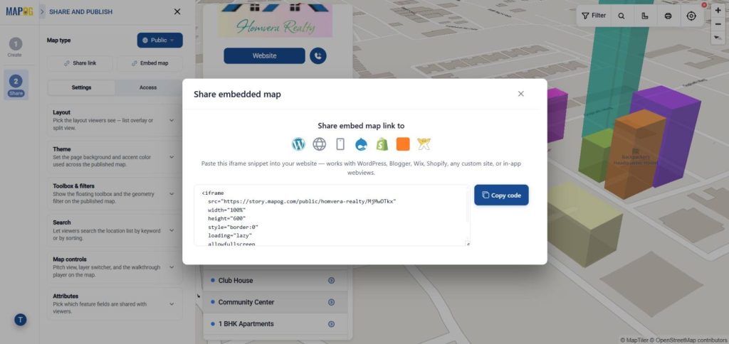
Share links and embed links are also available, allowing maps to be added directly to websites or presentations.
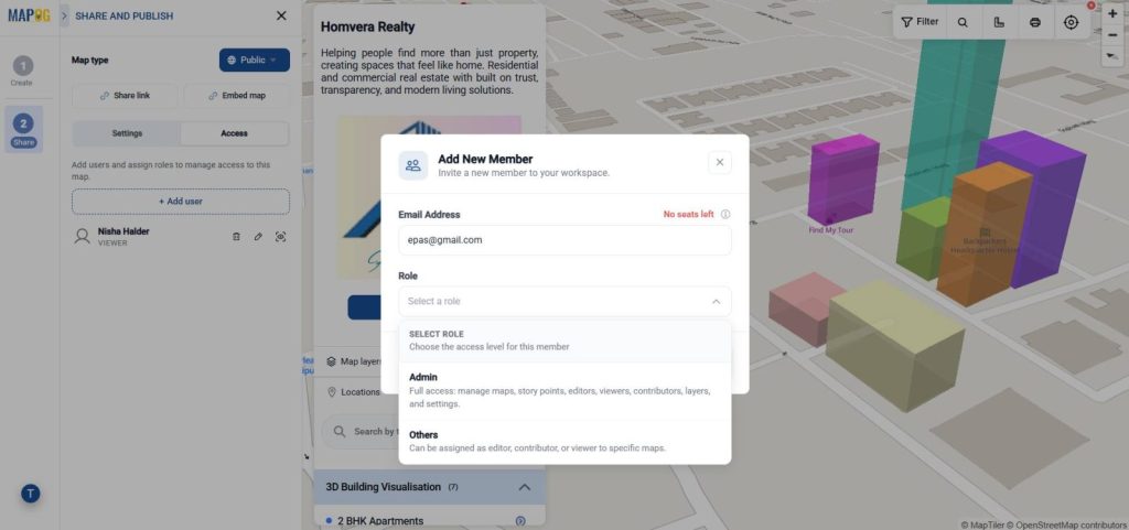
In addition, you can add team members with role-based permissions, so collaborative editing becomes more secure and organized.
Benefits of adding 3D Building Maps for Real Estate Industry
In the digital-first real estate industry, presentation plays a major role in attracting potential buyers and investors. Therefore, 3D building maps help companies create visually impressive project showcases that can be used across websites, sales presentations, advertisements, and virtual campaigns. Instead of relying only on images and floor plans, businesses can provide an interactive experience that keeps audiences engaged for longer durations. This not only strengthens brand credibility but also helps real estate companies stand out in a highly competitive market.
Conclusion
In conclusion, the presentation and visualisation of real estate projects are being revolutionised by interactive 3D maps. Businesses can now offer immersive and data-rich experiences that help customers to better comprehend project layouts, amenities, and surrounding infrastructure instead of depending on flat visuals and static property listings.
Moreover, MAPOG makes spatial visualization easier while enhancing project presentation, client engagement, and decision-making, whether you are displaying residential societies, villas, apartments, commercial complexes, or major infrastructure projects.