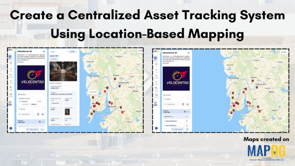
Asset tracking is often fragmented, with limited visibility and scattered data, making real-time monitoring and decision-making difficult. A centralized asset tracking system which is location-based solves this by bringing all assets into one visual interface. With MAPOG, combining location data with status updates and task-driven inputs enables real-time visibility, faster issue detection, and informed decisions across the asset network.
Key concept of map
A location-based centralized asset tracking system map displays all assets on a single interface using coordinates. It shows key status indicators with detailed, on-click information, while task-based updates and filters provide real-time visibility for quick, informed decisions.
Step-By-Step process of making map
Step 1: Create location type in map
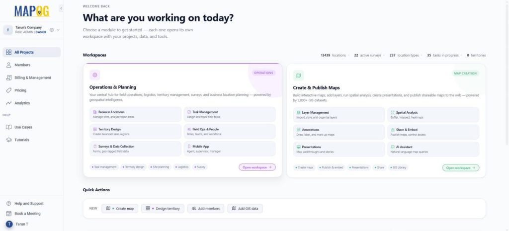
Go to MAPOG, In Operations & Planning section on the dashboard.
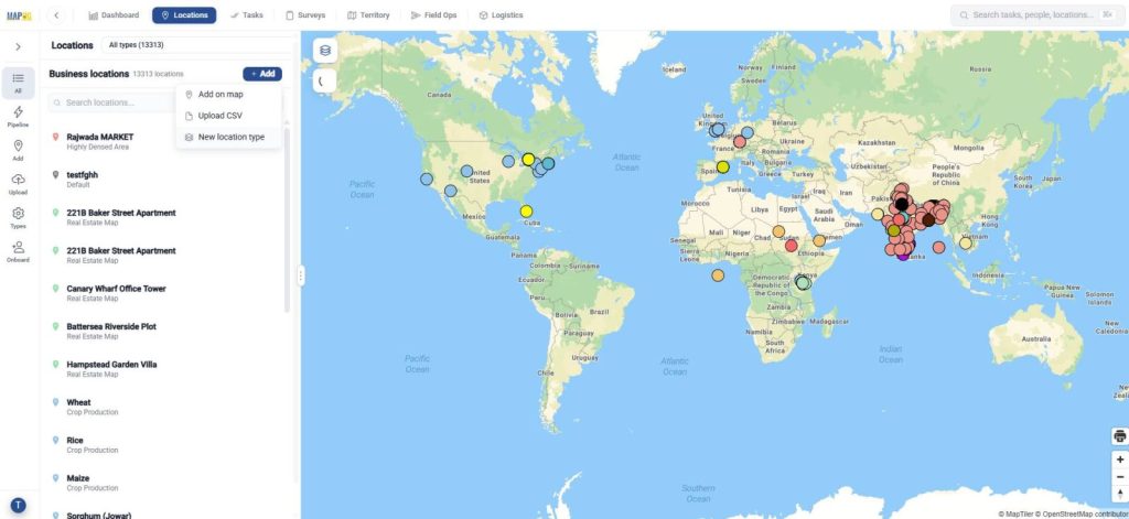
Go to locations for creating a custom location template to accommodate the attributes that each asset should display and click ‘New location type’.
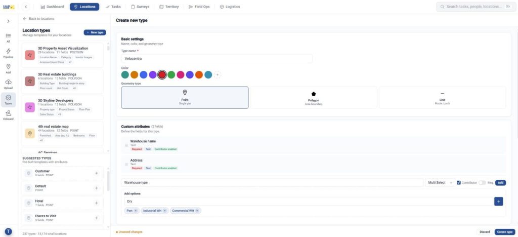
Further, add a title, color, and set geometry as a point. Then include attributes like warehouse name, type using select or multi-select fields. Enable contributors so users can view in the contributor app.
Step 2: Add locations
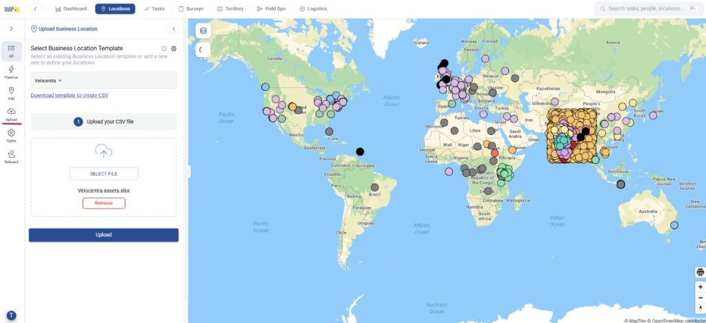
Now, click on upload, to upload all details from the spreadsheet to the map. Then, select your custom location template from dropdown, browse excel file and upload.
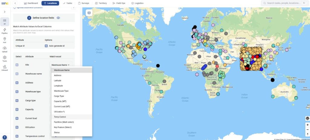
Next, define location fields, assign each point an auto-generated unique ID to track locations and prevent duplicates. Then map each attribute to its corresponding Excel column for easy data upload.
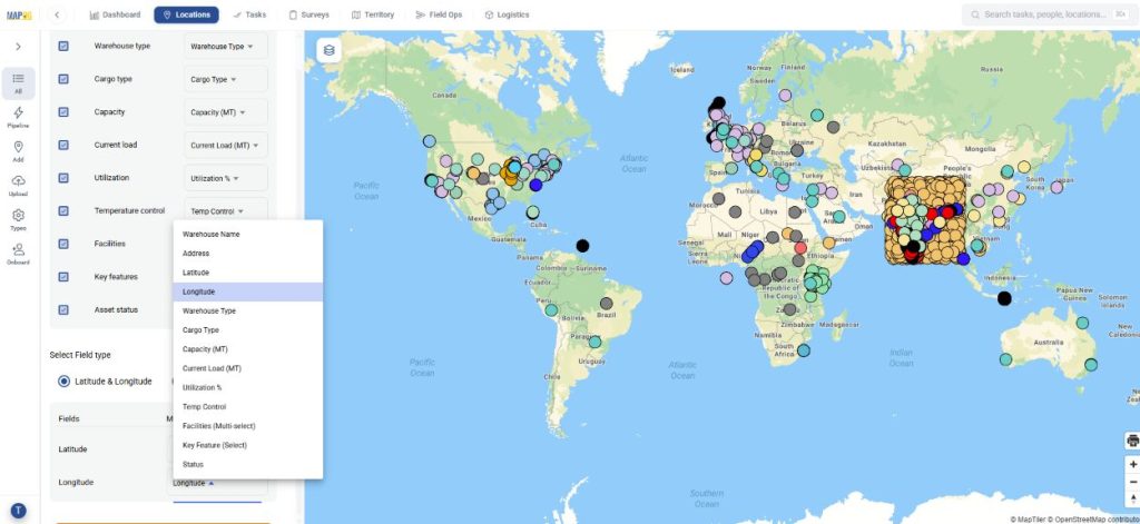
Finally, select the field type and match your Latitude & Longitude column and submit. Your points will be auto-plotted on the map.
Step 3: Edit business location details
You can edit details for each point. Go to your uploaded business location by searching it.
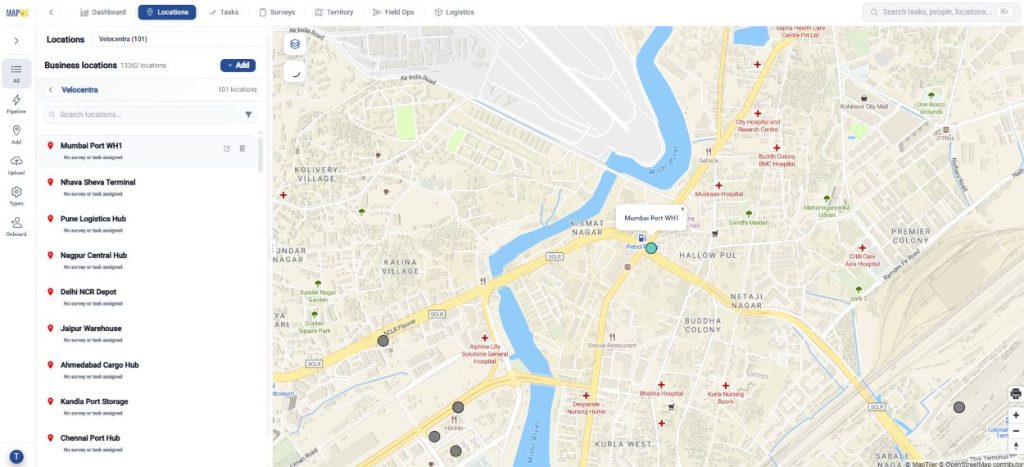
Then, click on edit.
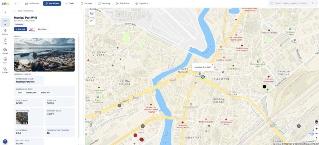
Add area photos and other required details and save.
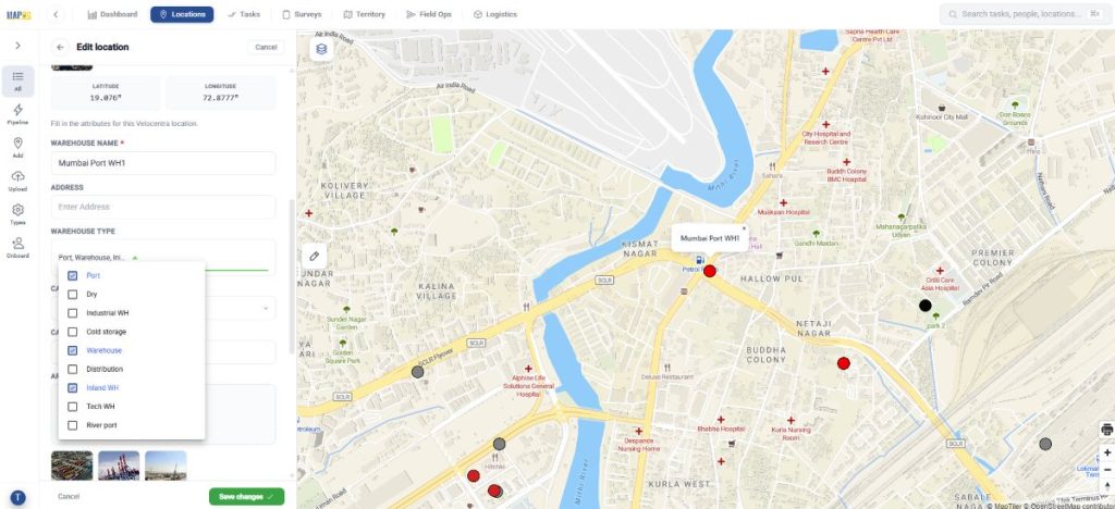
Step 4: Create completion form
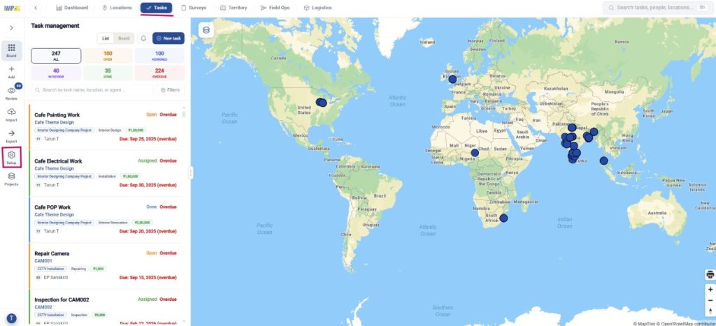
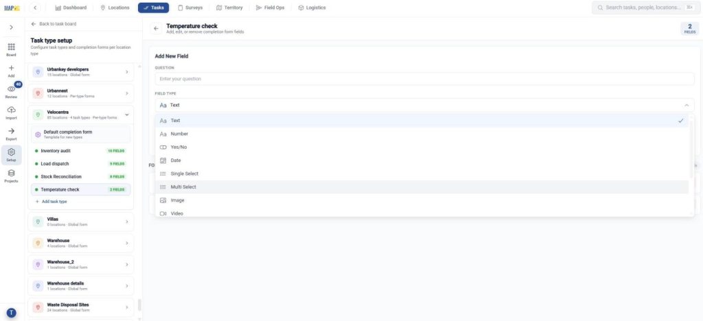
Additionally, under tasks, click task type setup and locate your location template.
Now, to create a completion form for your template for supervising work, create task types and make completion forms for each task type, add questions with responses such as text, select, multiselect and image for verifying work done.
Step 5: Add task
Now, in locations, find your location type and click on desired asset location to assign tasks in order to keep track of the assets.
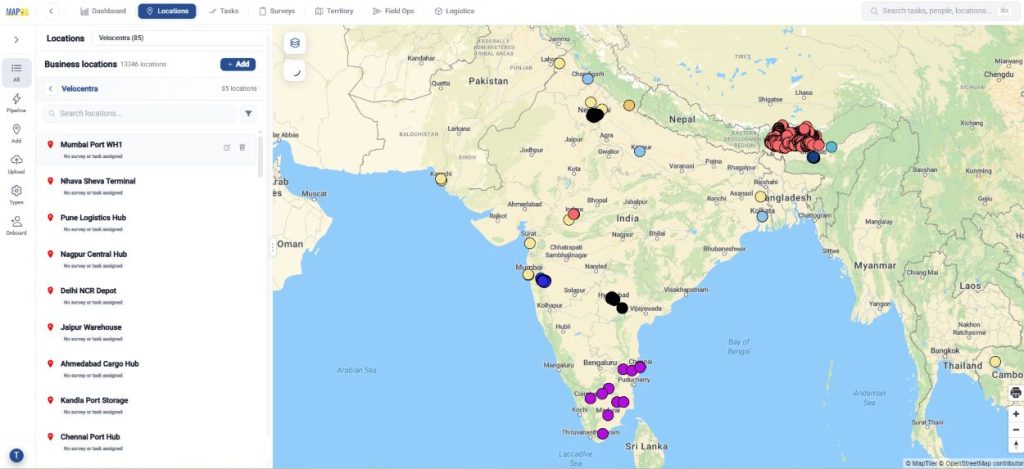
In the location, select Add task.
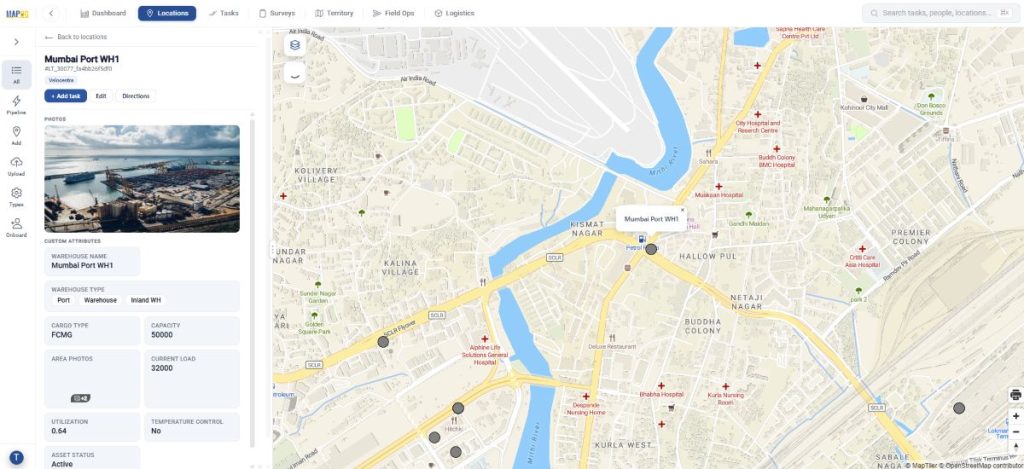
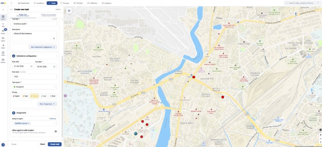
To create new task:
- Firstly, select task type
- Further, add task details like title and description
- Schedule and configure i.e. assign due date, value, task status and priority
- Finally, assign members
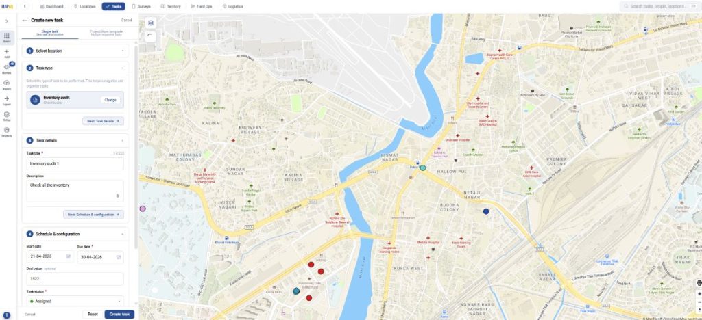
To assign a new member, click add new in assignment and add email id and member role and invite. Then select from the dropdown.
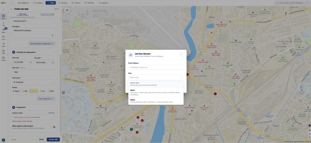
Finally, click create task.
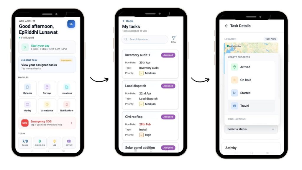
Step 6: User interface
The assigned users can see tasks in the MAPOG Contributor app. They can view and filter them. Afterwards, they can update the status of work as started or on-hold, add comments.
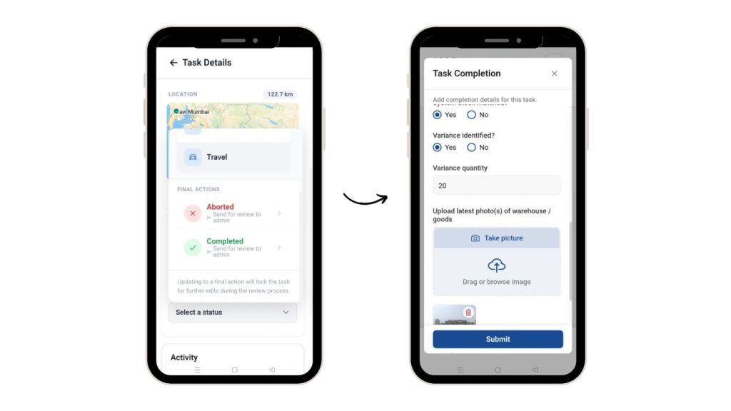
Finally, they can select completed status and fill the task completion form, along with images and submit for review.
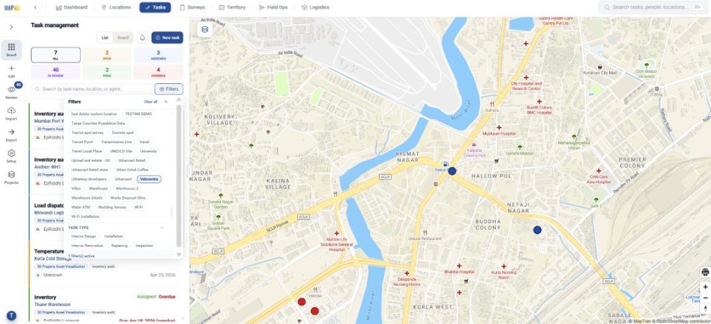
Step 7: Task management in map
In the task management section, you can filter tasks and view by location, type, etc.
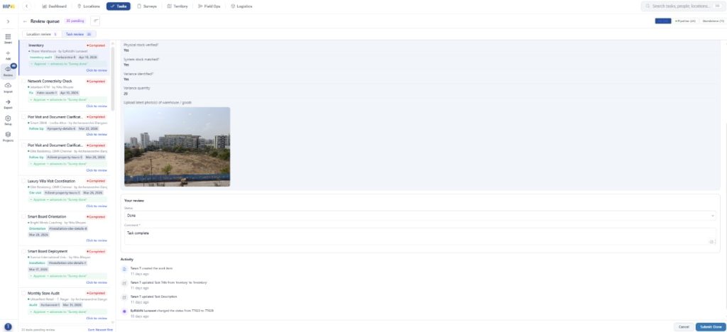
Further, review the submitted tasks in task review, select status and comment.
Step 8: Create a new map for your assets
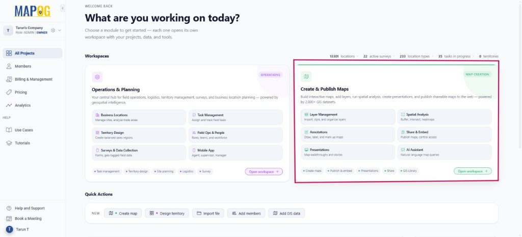
Go to MAPOG dashboard, click ‘Create & Publish Maps’.
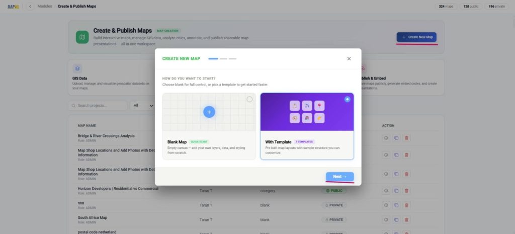
Next, click create new map, with template and press next.
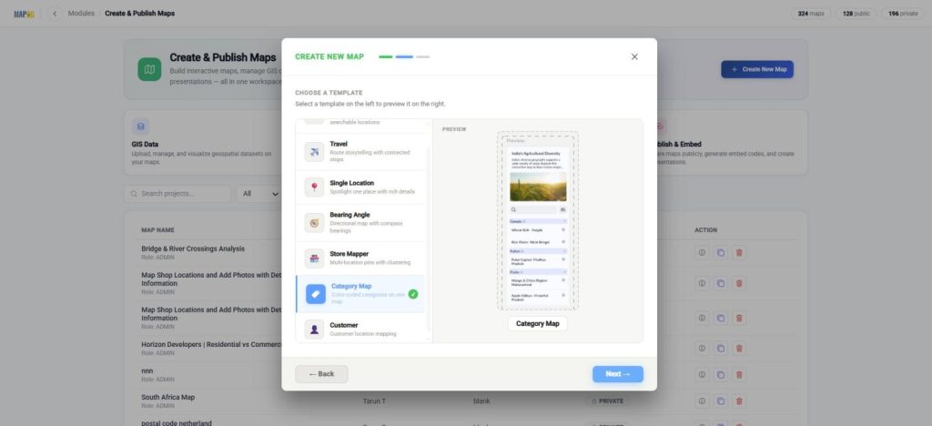
Select Category template and next.
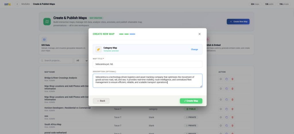
Finally, add title and description and create map.
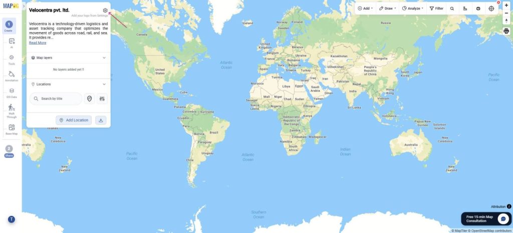
To add company logo, Go to map settings.
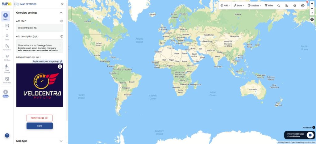
Using upload option, add company logo and save
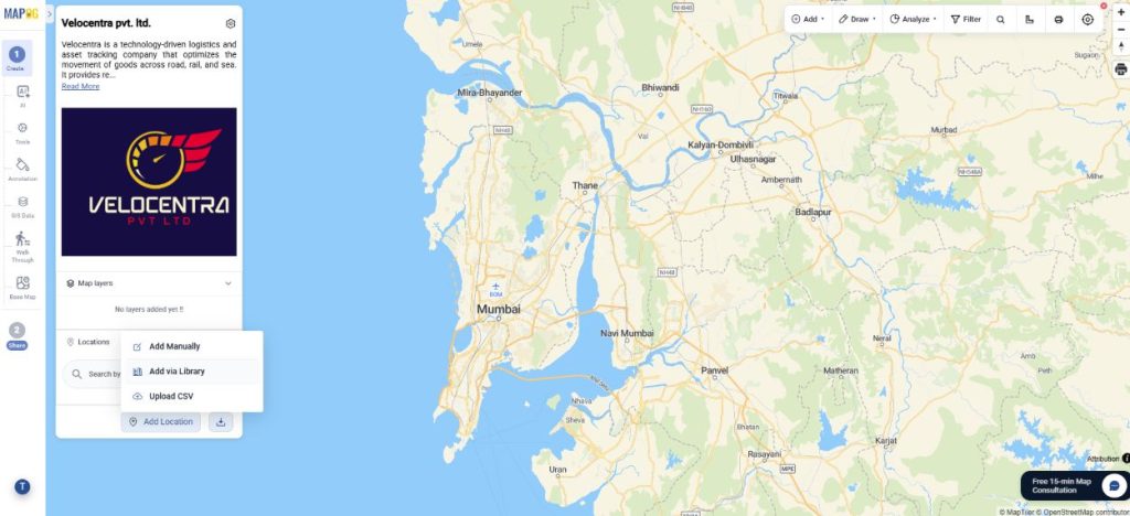
Step 9: Add business locations to map
Now, click add location and add via library to add your uploaded locations on the map.
Navigate your custom location template from dropdown and click on it.
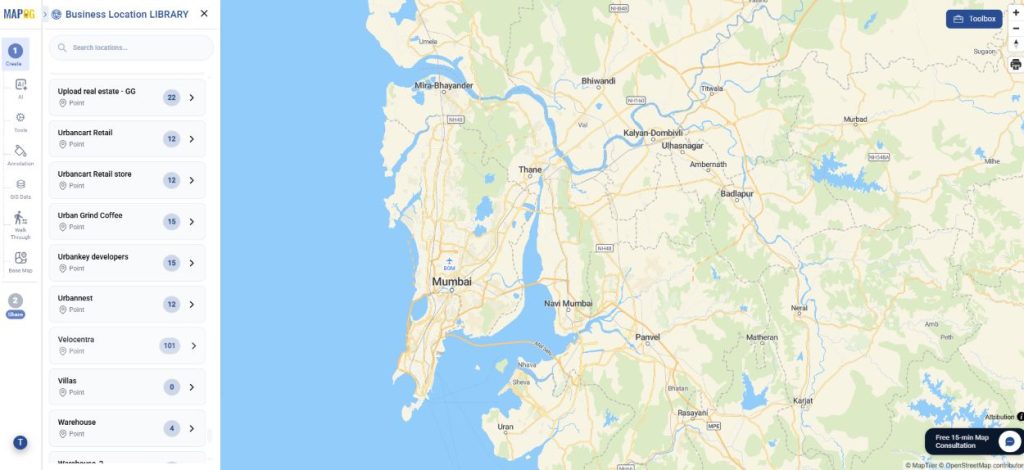
Further, select all locations and click add business locations.
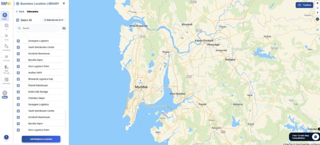
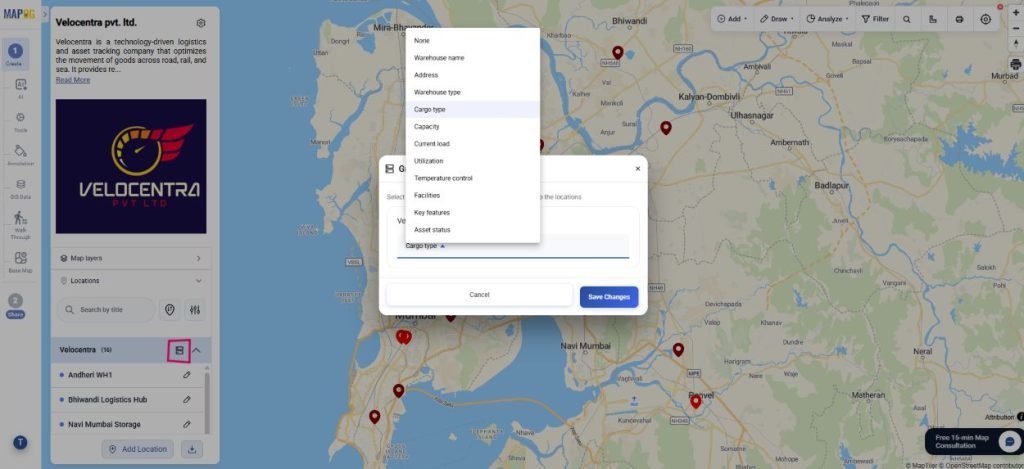
Step 10: Group By, Filter and sort
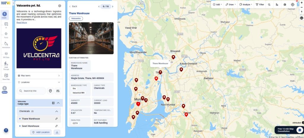
Use “Group by Attributes” to organize locations. Select an attribute (e.g., cargo type) to cluster data into groups like chemical or agricultural.
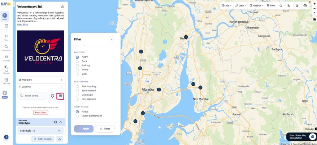
Using the Filter option, view locations selectively based on requirements. Go to Filter and you will view the assets of your choice on the map.
Finally, use ‘Sort by’ and view locations by live distance or by certain location. Type any location and assets are visible, along with their distance from location.
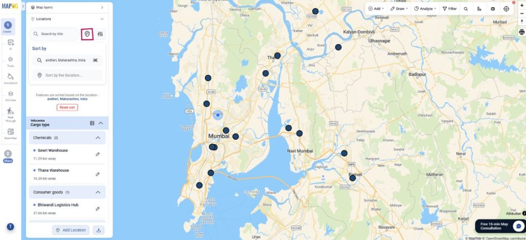
Step 11: Add style layer
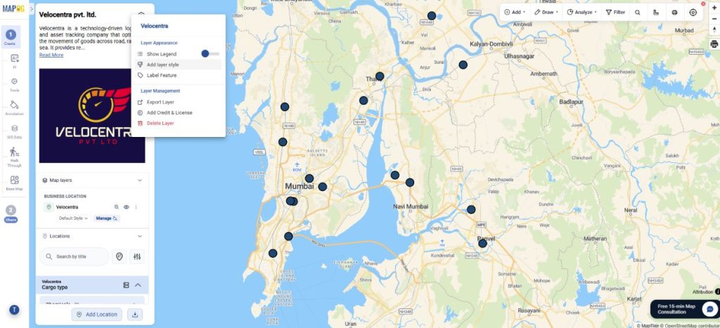
Go to add layer style to style your points.
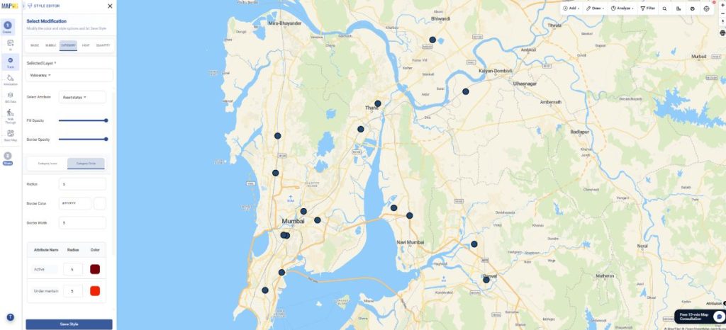
Further, in category style, you can choose suitable attributes, assign a different colour or icon to each and save.
Step 12: Preview & Share
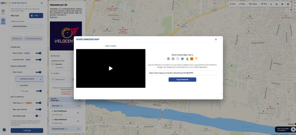
Finally, in preview & share, you can choose map type as private or public.
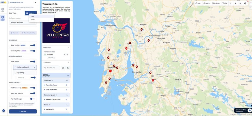
To share the map, you can share map link or embed map link to share it across platforms. Optionally, add users to the map for collaboration purposes.
Industrial Benefits
Centralizing asset data on a location-based map enables faster decisions, improved efficiency, and proactive issue management. It optimizes resources and enhances coordination across sites, benefiting logistics, manufacturing, warehousing, and other asset-heavy industries.
Conclusion
A centralized, location-based asset tracking system provides real-time visibility, streamlines updates, and uses spatial mapping to simplify operations. It improves efficiency, reduces risk, and enables faster decision-making across industries.