#CleanEnergy

Using Maps to Locate Electric Vehicle Charging Stations Easily

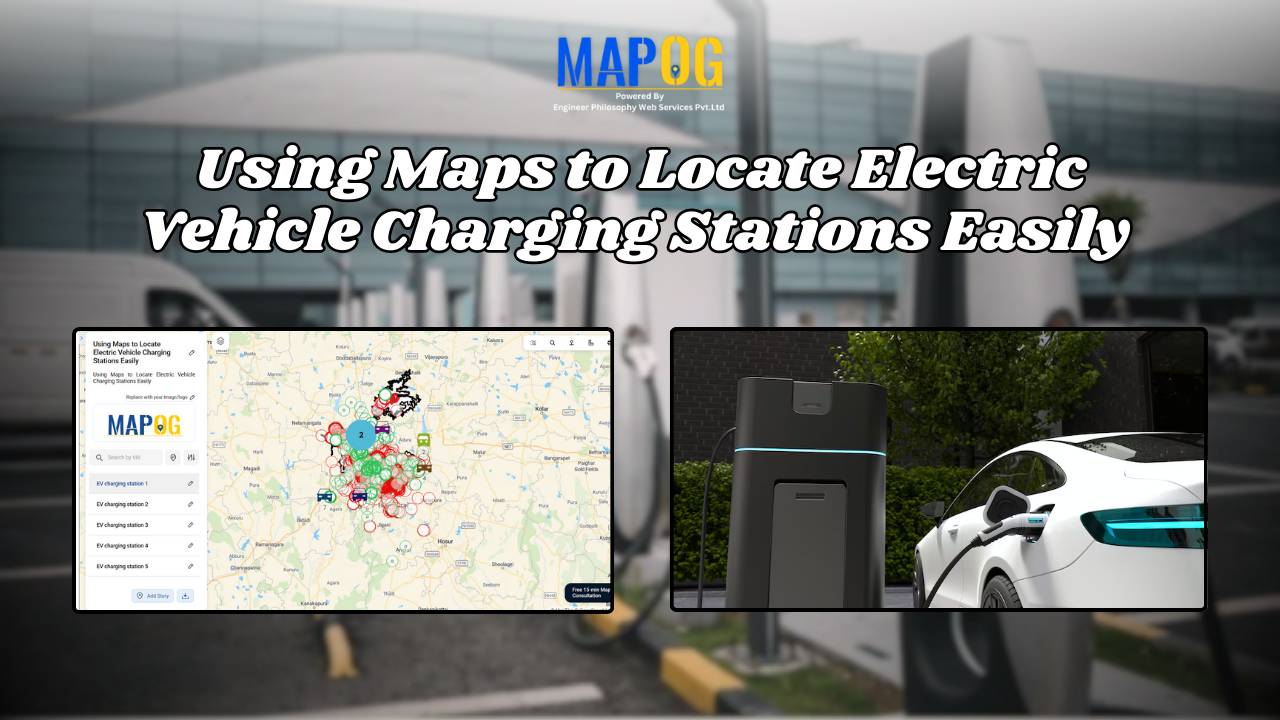
How to Map Electric Vehicle Charging Stations Using GIS for Smarter Route Planning

As electric vehicles (EVs) become more common on our roads, ensuring easy access to charging infrastructure is essential for a seamless driving experience. Drivers often face challenges in locating nearby charging stations, especially in unfamiliar areas or during long trips. Limited visibility and poor planning can lead to range anxiety and inconvenience. With  MAPOG, mapping … Read more

How to Use GIS Mapping for Solar Development A Step-by-Step Guide to Smart Site Selection

How to Use GIS Mapping for Solar Development: A Step-by-Step Guide to Smart Site Selection

Planning utility-scale Solar Site Suitability Mapping projects with MAPOG involves overlaying layers like GHI, land parcels, flood zones, and transmission lines. Spatial filters quickly eliminate unsuitable areas, helping prioritize sites that are both high in solar potential and accessible to the grid streamlining smart, data-driven solar development. Key Concept: Solar Site Suitability Mapping While many … Read more